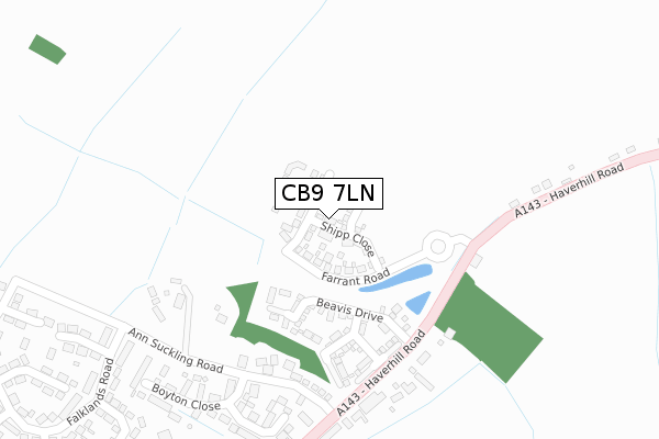
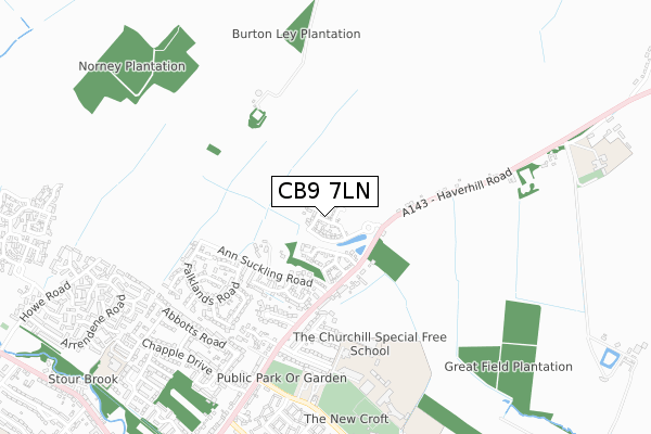
CB9 7LN is located in the Haverhill North electoral ward, within the local authority district of West Suffolk and the English Parliamentary constituency of West Suffolk. The Sub Integrated Care Board (ICB) Location is NHS Suffolk and North East Essex ICB - 07K and the police force is Suffolk. This postcode has been in use since August 2018.


GetTheData
Source: OS Open Zoomstack (Ordnance Survey)
Licence: Open Government Licence (requires attribution)
Attribution: Contains OS data © Crown copyright and database right 2024
Source: Open Postcode Geo
Licence: Open Government Licence (requires attribution)
Attribution: Contains OS data © Crown copyright and database right 2024; Contains Royal Mail data © Royal Mail copyright and database right 2024; Source: Office for National Statistics licensed under the Open Government Licence v.3.0
| Easting | 567700 |
| Northing | 246778 |
| Latitude | 52.093946 |
| Longitude | 0.446659 |
GetTheData
Source: Open Postcode Geo
Licence: Open Government Licence
| Country | England |
| Postcode District | CB9 |
| ➜ CB9 open data dashboard ➜ See where CB9 is on a map ➜ Where is Haverhill? | |
GetTheData
Source: Land Registry Price Paid Data
Licence: Open Government Licence
| Ward | Haverhill North |
| Constituency | West Suffolk |
GetTheData
Source: ONS Postcode Database
Licence: Open Government Licence
31, SHIPP CLOSE, LITTLE WRATTING, HAVERHILL, CB9 7LN 2020 18 DEC £308,000 |
29, SHIPP CLOSE, LITTLE WRATTING, HAVERHILL, CB9 7LN 2020 18 DEC £313,000 |
36, SHIPP CLOSE, LITTLE WRATTING, HAVERHILL, CB9 7LN 2020 29 OCT £312,000 |
11, SHIPP CLOSE, LITTLE WRATTING, HAVERHILL, CB9 7LN 2020 30 JUN £303,000 |
1, SHIPP CLOSE, LITTLE WRATTING, HAVERHILL, CB9 7LN 2020 31 MAR £310,000 |
GetTheData
Source: HM Land Registry Price Paid Data
Licence: Contains HM Land Registry data © Crown copyright and database right 2024. This data is licensed under the Open Government Licence v3.0.
| June 2022 | Violence and sexual offences | On or near Haverhill Road | 208m |
| June 2022 | Criminal damage and arson | On or near Ann Suckling Road | 323m |
| June 2022 | Burglary | On or near Ann Suckling Road | 323m |
| ➜ Get more crime data in our Crime section | |||
GetTheData
Source: data.police.uk
Licence: Open Government Licence
| The Fox (Haverhill Road) | Little Wratting | 189m |
| The Fox (Haverhill Road) | Little Wratting | 203m |
| Ann Suckling Road (Wratting Road) | Haverhill | 281m |
| Ann Suckling Road (Wratting Road) | Haverhill | 296m |
| Samuel Ward School (On Site) | Haverhill | 626m |
GetTheData
Source: NaPTAN
Licence: Open Government Licence
GetTheData
Source: ONS Postcode Database
Licence: Open Government Licence


➜ Get more ratings from the Food Standards Agency
GetTheData
Source: Food Standards Agency
Licence: FSA terms & conditions
| Last Collection | |||
|---|---|---|---|
| Location | Mon-Fri | Sat | Distance |
| Ann Suckling Lane | 17:45 | 11:45 | 263m |
| Wratting Road | 17:45 | 11:30 | 729m |
| Chaplains Close | 17:45 | 11:45 | 843m |
GetTheData
Source: Dracos
Licence: Creative Commons Attribution-ShareAlike
| Facility | Distance |
|---|---|
| Samuel Ward Academy Chalkstone Way, Haverhill Grass Pitches, Sports Hall, Studio, Artificial Grass Pitch | 509m |
| The New Croft Chalkstone Way, Haverhill Grass Pitches, Artificial Grass Pitch | 828m |
| Westfield Primary Academy Chalkstone Way, Haverhill Grass Pitches | 911m |
GetTheData
Source: Active Places
Licence: Open Government Licence
| School | Phase of Education | Distance |
|---|---|---|
| Samuel Ward Academy Chalkstone Way, Haverhill, CB9 0LD | Secondary | 509m |
| Westfield Primary Academy Chalkstone Way, Haverhill, CB9 0BW | Primary | 950m |
| New Cangle Community Primary School Chapple Drive, Haverhill, CB9 0DU | Primary | 998m |
GetTheData
Source: Edubase
Licence: Open Government Licence
The below table lists the International Territorial Level (ITL) codes (formerly Nomenclature of Territorial Units for Statistics (NUTS) codes) and Local Administrative Units (LAU) codes for CB9 7LN:
| ITL 1 Code | Name |
|---|---|
| TLH | East |
| ITL 2 Code | Name |
| TLH1 | East Anglia |
| ITL 3 Code | Name |
| TLH14 | Suffolk CC |
| LAU 1 Code | Name |
| E07000245 | West Suffolk |
GetTheData
Source: ONS Postcode Directory
Licence: Open Government Licence
The below table lists the Census Output Area (OA), Lower Layer Super Output Area (LSOA), and Middle Layer Super Output Area (MSOA) for CB9 7LN:
| Code | Name | |
|---|---|---|
| OA | E00153721 | |
| LSOA | E01030151 | St Edmundsbury 011C |
| MSOA | E02006283 | St Edmundsbury 011 |
GetTheData
Source: ONS Postcode Directory
Licence: Open Government Licence
| CB9 7TA | Boyton Woods | 246m |
| CB9 7UD | Haverhill Road | 254m |
| CB9 0DZ | Boyton Close | 316m |
| CB9 0DF | Hill Crescent | 395m |
| CB9 0AB | Bladon Way | 402m |
| CB9 0AD | Blenheim Close | 455m |
| CB9 0EE | Rowell Close | 462m |
| CB9 0EB | Cross Close | 474m |
| CB9 0EH | Copellis Close | 516m |
| CB9 0EQ | Goldings Close | 526m |
GetTheData
Source: Open Postcode Geo; Land Registry Price Paid Data
Licence: Open Government Licence