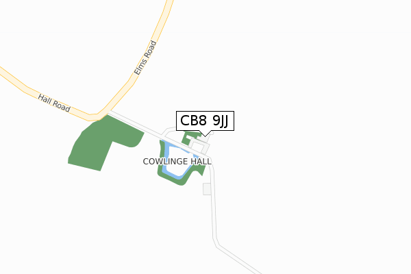
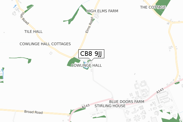
CB8 9JJ is located in the Withersfield electoral ward, within the local authority district of West Suffolk and the English Parliamentary constituency of West Suffolk. The Sub Integrated Care Board (ICB) Location is NHS Suffolk and North East Essex ICB - 07K and the police force is Suffolk. This postcode has been in use since October 2017.


GetTheData
Source: OS Open Zoomstack (Ordnance Survey)
Licence: Open Government Licence (requires attribution)
Attribution: Contains OS data © Crown copyright and database right 2024
Source: Open Postcode Geo
Licence: Open Government Licence (requires attribution)
Attribution: Contains OS data © Crown copyright and database right 2024; Contains Royal Mail data © Royal Mail copyright and database right 2024; Source: Office for National Statistics licensed under the Open Government Licence v.3.0
| Easting | 571351 |
| Northing | 252478 |
| Latitude | 52.144027 |
| Longitude | 0.502769 |
GetTheData
Source: Open Postcode Geo
Licence: Open Government Licence
| Country | England |
| Postcode District | CB8 |
| ➜ CB8 open data dashboard ➜ See where CB8 is on a map | |
GetTheData
Source: Land Registry Price Paid Data
Licence: Open Government Licence
| Ward | Withersfield |
| Constituency | West Suffolk |
GetTheData
Source: ONS Postcode Database
Licence: Open Government Licence
| Highpoint (A143) | Stradishall | 888m |
| Highpoint (A143) | Stradishall | 894m |
| Post Office | Stradishall | 1,211m |
| Post Office | Stradishall | 1,223m |
GetTheData
Source: NaPTAN
Licence: Open Government Licence
GetTheData
Source: ONS Postcode Database
Licence: Open Government Licence


➜ Get more ratings from the Food Standards Agency
GetTheData
Source: Food Standards Agency
Licence: FSA terms & conditions
| Last Collection | |||
|---|---|---|---|
| Location | Mon-Fri | Sat | Distance |
| Stradishall Cafe | 16:00 | 08:45 | 1,139m |
| High Point Prison | 16:00 | 08:45 | 1,273m |
| Erritts Hill | 16:00 | 08:45 | 1,544m |
GetTheData
Source: Dracos
Licence: Creative Commons Attribution-ShareAlike
| Facility | Distance |
|---|---|
| Hmp Highpoint South Highpoint, Stradishall, Newmarket Artificial Grass Pitch | 1.1km |
| Barnardiston Hall Preparatory School Barnardiston, Haverhill Grass Pitches, Sports Hall, Artificial Grass Pitch | 2.2km |
| Great Thurlow Recreation Ground Wratting Road, Thurlow, Haverhill Grass Pitches, Outdoor Tennis Courts | 4.2km |
GetTheData
Source: Active Places
Licence: Open Government Licence
| School | Phase of Education | Distance |
|---|---|---|
| Barnardiston Hall Preparatory School Barnardiston, Haverhill, CB9 7TG | Not applicable | 2.2km |
| Thurlow Voluntary Controlled Primary School The Street, Little Thurlow, Haverhill, CB9 7HY | Primary | 3.8km |
| Wickhambrook Primary Academy Wickhambrook, Newmarket, CB8 8XN | Primary | 4.2km |
GetTheData
Source: Edubase
Licence: Open Government Licence
The below table lists the International Territorial Level (ITL) codes (formerly Nomenclature of Territorial Units for Statistics (NUTS) codes) and Local Administrative Units (LAU) codes for CB8 9JJ:
| ITL 1 Code | Name |
|---|---|
| TLH | East |
| ITL 2 Code | Name |
| TLH1 | East Anglia |
| ITL 3 Code | Name |
| TLH14 | Suffolk CC |
| LAU 1 Code | Name |
| E07000245 | West Suffolk |
GetTheData
Source: ONS Postcode Directory
Licence: Open Government Licence
The below table lists the Census Output Area (OA), Lower Layer Super Output Area (LSOA), and Middle Layer Super Output Area (MSOA) for CB8 9JJ:
| Code | Name | |
|---|---|---|
| OA | E00153716 | |
| LSOA | E01030151 | St Edmundsbury 011C |
| MSOA | E02006283 | St Edmundsbury 011 |
GetTheData
Source: ONS Postcode Directory
Licence: Open Government Licence
| CB8 9YF | Hundon Close | 635m |
| CB9 7JW | 787m | |
| CB8 9YA | Chestnut Road | 1080m |
| CB8 9XZ | Hawthorne Way | 1129m |
| CB8 9YE | Ash Walk | 1143m |
| CB8 8PU | Hawbush Road | 1164m |
| CB8 9XX | Bury Road | 1174m |
| CB8 9YB | Poplar Walk | 1200m |
| CB8 9HX | Hobbles Green | 1209m |
| CB8 9HR | 1210m |
GetTheData
Source: Open Postcode Geo; Land Registry Price Paid Data
Licence: Open Government Licence