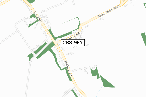
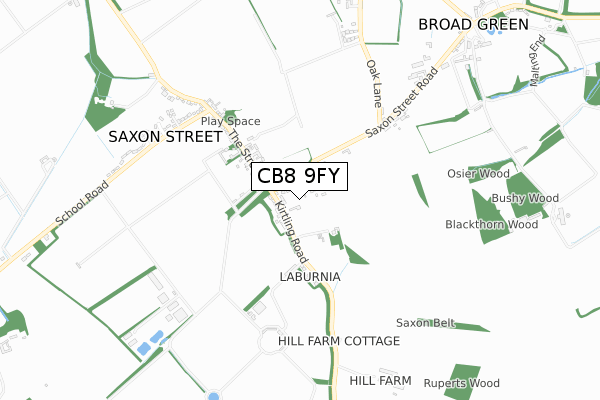
CB8 9FY is located in the Woodditton electoral ward, within the local authority district of East Cambridgeshire and the English Parliamentary constituency of South East Cambridgeshire. The Sub Integrated Care Board (ICB) Location is NHS Cambridgeshire and Peterborough ICB - 06H and the police force is Cambridgeshire. This postcode has been in use since October 2019.


GetTheData
Source: OS Open Zoomstack (Ordnance Survey)
Licence: Open Government Licence (requires attribution)
Attribution: Contains OS data © Crown copyright and database right 2024
Source: Open Postcode Geo
Licence: Open Government Licence (requires attribution)
Attribution: Contains OS data © Crown copyright and database right 2024; Contains Royal Mail data © Royal Mail copyright and database right 2024; Source: Office for National Statistics licensed under the Open Government Licence v.3.0
| Easting | 568130 |
| Northing | 259228 |
| Latitude | 52.205646 |
| Longitude | 0.459085 |
GetTheData
Source: Open Postcode Geo
Licence: Open Government Licence
| Country | England |
| Postcode District | CB8 |
| ➜ CB8 open data dashboard ➜ See where CB8 is on a map ➜ Where is Saxon Street? | |
GetTheData
Source: Land Registry Price Paid Data
Licence: Open Government Licence
| Ward | Woodditton |
| Constituency | South East Cambridgeshire |
GetTheData
Source: ONS Postcode Database
Licence: Open Government Licence
| May 2022 | Violence and sexual offences | On or near Cheveley Road | 73m |
| July 2021 | Criminal damage and arson | On or near Cheveley Road | 73m |
| March 2021 | Public order | On or near Cheveley Road | 73m |
| ➜ Get more crime data in our Crime section | |||
GetTheData
Source: data.police.uk
Licence: Open Government Licence
| Cheveley Road (Kirtling Road) | Saxon Street | 115m |
| Cheveley Road (Kirtling Road) | Saxon Street | 122m |
| Holy Trinity Church (The Street) | Saxon Street | 492m |
| Holy Trinity Church (The Street) | Saxon Street | 492m |
| School Road | Saxon Street | 669m |
| Newmarket Station | 5.1km |
GetTheData
Source: NaPTAN
Licence: Open Government Licence
GetTheData
Source: ONS Postcode Database
Licence: Open Government Licence


➜ Get more ratings from the Food Standards Agency
GetTheData
Source: Food Standards Agency
Licence: FSA terms & conditions
| Last Collection | |||
|---|---|---|---|
| Location | Mon-Fri | Sat | Distance |
| The Street | 16:45 | 10:30 | 170m |
| School Road | 16:45 | 10:30 | 662m |
| Broad Green | 16:15 | 09:00 | 1,052m |
GetTheData
Source: Dracos
Licence: Creative Commons Attribution-ShareAlike
| Facility | Distance |
|---|---|
| Kirtling Cricket Club The Street, Kirtling Grass Pitches | 2.8km |
| The Ellesmere Centre Ley Road, Stetchworth Sports Hall, Grass Pitches, Squash Courts, Artificial Grass Pitch | 4km |
| Newmarket Town Football Club Cricket Field Road, Newmarket Grass Pitches, Artificial Grass Pitch | 4.9km |
GetTheData
Source: Active Places
Licence: Open Government Licence
| School | Phase of Education | Distance |
|---|---|---|
| Cheveley CofE Primary School Park Road, Cheveley, Newmarket, CB8 9DF | Primary | 1.9km |
| Kettlefields Primary School Stetchworth Road, Dullingham, Newmarket, CB8 9UH | Primary | 4.5km |
| Ditton Lodge Primary School St Johns Avenue, Newmarket, CB8 8BL | Primary | 4.9km |
GetTheData
Source: Edubase
Licence: Open Government Licence
The below table lists the International Territorial Level (ITL) codes (formerly Nomenclature of Territorial Units for Statistics (NUTS) codes) and Local Administrative Units (LAU) codes for CB8 9FY:
| ITL 1 Code | Name |
|---|---|
| TLH | East |
| ITL 2 Code | Name |
| TLH1 | East Anglia |
| ITL 3 Code | Name |
| TLH12 | Cambridgeshire CC |
| LAU 1 Code | Name |
| E07000009 | East Cambridgeshire |
GetTheData
Source: ONS Postcode Directory
Licence: Open Government Licence
The below table lists the Census Output Area (OA), Lower Layer Super Output Area (LSOA), and Middle Layer Super Output Area (MSOA) for CB8 9FY:
| Code | Name | |
|---|---|---|
| OA | E00090917 | |
| LSOA | E01018023 | East Cambridgeshire 011C |
| MSOA | E02006825 | East Cambridgeshire 011 |
GetTheData
Source: ONS Postcode Directory
Licence: Open Government Licence
| CB8 9RN | Cheveley Road | 73m |
| CB8 9RW | Cheveley Road | 93m |
| CB8 9RP | Kirtling Road | 108m |
| CB8 9RR | Kirtling Road | 277m |
| CB8 9RS | The Street | 376m |
| CB8 9RA | Oak Lane | 512m |
| CB8 9HQ | Newmarket Road | 607m |
| CB8 9RU | The Street | 665m |
| CB8 9RX | School Road | 692m |
| CB8 9RB | Saxon Street Road | 716m |
GetTheData
Source: Open Postcode Geo; Land Registry Price Paid Data
Licence: Open Government Licence