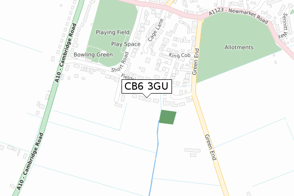
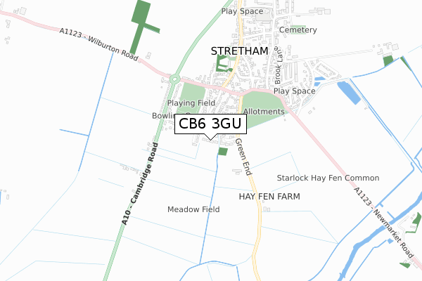
CB6 3GU is located in the Stretham electoral ward, within the local authority district of East Cambridgeshire and the English Parliamentary constituency of South East Cambridgeshire. The Sub Integrated Care Board (ICB) Location is NHS Cambridgeshire and Peterborough ICB - 06H and the police force is Cambridgeshire. This postcode has been in use since August 2019.


GetTheData
Source: OS Open Zoomstack (Ordnance Survey)
Licence: Open Government Licence (requires attribution)
Attribution: Contains OS data © Crown copyright and database right 2024
Source: Open Postcode Geo
Licence: Open Government Licence (requires attribution)
Attribution: Contains OS data © Crown copyright and database right 2024; Contains Royal Mail data © Royal Mail copyright and database right 2024; Source: Office for National Statistics licensed under the Open Government Licence v.3.0
| Easting | 551061 |
| Northing | 274105 |
| Latitude | 52.344234 |
| Longitude | 0.216158 |
GetTheData
Source: Open Postcode Geo
Licence: Open Government Licence
| Country | England |
| Postcode District | CB6 |
| ➜ CB6 open data dashboard ➜ See where CB6 is on a map ➜ Where is Stretham? | |
GetTheData
Source: Land Registry Price Paid Data
Licence: Open Government Licence
| Ward | Stretham |
| Constituency | South East Cambridgeshire |
GetTheData
Source: ONS Postcode Database
Licence: Open Government Licence
4, OLD ORCHARD LANE, STRETHAM, ELY, CB6 3GU 2020 25 NOV £535,000 |
GetTheData
Source: HM Land Registry Price Paid Data
Licence: Contains HM Land Registry data © Crown copyright and database right 2024. This data is licensed under the Open Government Licence v3.0.
| June 2022 | Violence and sexual offences | On or near Cage Lane | 233m |
| June 2022 | Vehicle crime | On or near Sports/Recreation Area | 261m |
| May 2022 | Criminal damage and arson | On or near King Cob | 185m |
| ➜ Get more crime data in our Crime section | |||
GetTheData
Source: data.police.uk
Licence: Open Government Licence
| Cambridge Road | Stretham | 330m |
| Short Road (Wilburton Road) | Stretham | 353m |
| Cambridge Road | Stretham | 360m |
| Short Road (Wilburton Road) | Stretham | 368m |
| Chapel Street (High Street) | Stretham | 492m |
GetTheData
Source: NaPTAN
Licence: Open Government Licence
GetTheData
Source: ONS Postcode Database
Licence: Open Government Licence


➜ Get more ratings from the Food Standards Agency
GetTheData
Source: Food Standards Agency
Licence: FSA terms & conditions
| Last Collection | |||
|---|---|---|---|
| Location | Mon-Fri | Sat | Distance |
| Green End | 16:15 | 10:00 | 142m |
| Wilburton Road | 16:15 | 10:00 | 357m |
| Newmarket Road | 16:15 | 09:30 | 431m |
GetTheData
Source: Dracos
Licence: Creative Commons Attribution-ShareAlike
| Facility | Distance |
|---|---|
| Stretham Recreation Ground Short Road, Stretham Grass Pitches | 252m |
| Stretham Community Primary School Wood Lane, Stretham, Ely Grass Pitches | 831m |
| Wilburton Recreation Ground Station Road, Wilburton, Ely Grass Pitches | 2.5km |
GetTheData
Source: Active Places
Licence: Open Government Licence
| School | Phase of Education | Distance |
|---|---|---|
| Stretham Community Primary School Wood Lane, Stretham, Ely, CB6 3JN | Primary | 848m |
| The Harbour School Station Road, Wilburton, Ely, CB6 3RR | Not applicable | 2.6km |
| Wilburton CofE Primary School Carpond Lane, Wilburton, Ely, CB6 3RJ | Primary | 2.9km |
GetTheData
Source: Edubase
Licence: Open Government Licence
The below table lists the International Territorial Level (ITL) codes (formerly Nomenclature of Territorial Units for Statistics (NUTS) codes) and Local Administrative Units (LAU) codes for CB6 3GU:
| ITL 1 Code | Name |
|---|---|
| TLH | East |
| ITL 2 Code | Name |
| TLH1 | East Anglia |
| ITL 3 Code | Name |
| TLH12 | Cambridgeshire CC |
| LAU 1 Code | Name |
| E07000009 | East Cambridgeshire |
GetTheData
Source: ONS Postcode Directory
Licence: Open Government Licence
The below table lists the Census Output Area (OA), Lower Layer Super Output Area (LSOA), and Middle Layer Super Output Area (MSOA) for CB6 3GU:
| Code | Name | |
|---|---|---|
| OA | E00091068 | |
| LSOA | E01018054 | East Cambridgeshire 005F |
| MSOA | E02003736 | East Cambridgeshire 005 |
GetTheData
Source: ONS Postcode Directory
Licence: Open Government Licence
| CB6 3LT | Fieldside | 70m |
| CB6 3LZ | Starlock Close | 82m |
| CB6 3NB | The Grove | 112m |
| CB6 3LS | Short Road | 136m |
| CB6 3NA | King Cob | 183m |
| CB6 3LE | Green End | 183m |
| CB6 3LB | Cage Lane | 212m |
| CB6 3NG | Andrews Close | 225m |
| CB6 3LP | Cambridge Road | 331m |
| CB6 3LL | Wilburton Road | 345m |
GetTheData
Source: Open Postcode Geo; Land Registry Price Paid Data
Licence: Open Government Licence