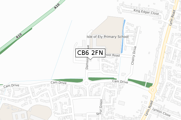
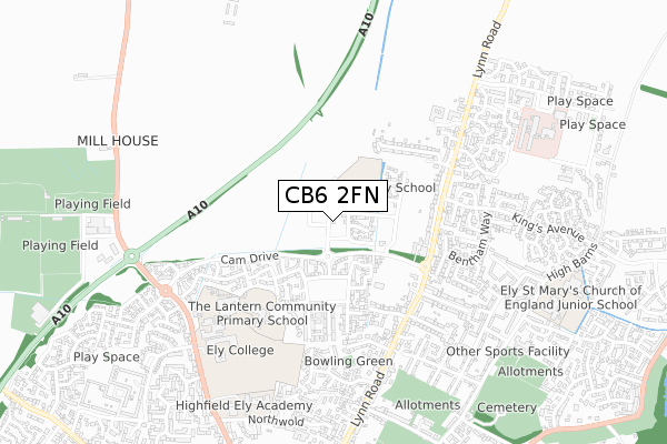
CB6 2FN is located in the Ely North electoral ward, within the local authority district of East Cambridgeshire and the English Parliamentary constituency of South East Cambridgeshire. The Sub Integrated Care Board (ICB) Location is NHS Cambridgeshire and Peterborough ICB - 06H and the police force is Cambridgeshire. This postcode has been in use since February 2019.


GetTheData
Source: OS Open Zoomstack (Ordnance Survey)
Licence: Open Government Licence (requires attribution)
Attribution: Contains OS data © Crown copyright and database right 2024
Source: Open Postcode Geo
Licence: Open Government Licence (requires attribution)
Attribution: Contains OS data © Crown copyright and database right 2024; Contains Royal Mail data © Royal Mail copyright and database right 2024; Source: Office for National Statistics licensed under the Open Government Licence v.3.0
| Easting | 554108 |
| Northing | 281551 |
| Latitude | 52.410276 |
| Longitude | 0.264269 |
GetTheData
Source: Open Postcode Geo
Licence: Open Government Licence
| Country | England |
| Postcode District | CB6 |
| ➜ CB6 open data dashboard ➜ See where CB6 is on a map ➜ Where is Ely? | |
GetTheData
Source: Land Registry Price Paid Data
Licence: Open Government Licence
| Ward | Ely North |
| Constituency | South East Cambridgeshire |
GetTheData
Source: ONS Postcode Database
Licence: Open Government Licence
| September 2023 | Anti-social behaviour | On or near Bentham Way | 429m |
| August 2023 | Anti-social behaviour | On or near Bentham Way | 429m |
| February 2023 | Violence and sexual offences | On or near Bentham Way | 429m |
| ➜ Get more crime data in our Crime section | |||
GetTheData
Source: data.police.uk
Licence: Open Government Licence
| Stour Green (Cam Drive) | Ely | 126m |
| Stour Green (Cam Drive) | Ely | 132m |
| Cam Drive (Lynn Road) | Ely | 382m |
| Cam Drive (Lynn Road) | Ely | 390m |
| King's Avenue (Lynn Road) | Ely | 423m |
| Ely Station | 2.1km |
GetTheData
Source: NaPTAN
Licence: Open Government Licence
| Percentage of properties with Next Generation Access | 100.0% |
| Percentage of properties with Superfast Broadband | 100.0% |
| Percentage of properties with Ultrafast Broadband | 100.0% |
| Percentage of properties with Full Fibre Broadband | 100.0% |
Superfast Broadband is between 30Mbps and 300Mbps
Ultrafast Broadband is > 300Mbps
| Percentage of properties unable to receive 2Mbps | 0.0% |
| Percentage of properties unable to receive 5Mbps | 0.0% |
| Percentage of properties unable to receive 10Mbps | 0.0% |
| Percentage of properties unable to receive 30Mbps | 0.0% |
GetTheData
Source: Ofcom
Licence: Ofcom Terms of Use (requires attribution)
GetTheData
Source: ONS Postcode Database
Licence: Open Government Licence


➜ Get more ratings from the Food Standards Agency
GetTheData
Source: Food Standards Agency
Licence: FSA terms & conditions
| Last Collection | |||
|---|---|---|---|
| Location | Mon-Fri | Sat | Distance |
| Kings Avenue | 17:30 | 12:00 | 432m |
| Lynton Drive | 17:30 | 12:00 | 455m |
| Cam Drive | 17:30 | 12:00 | 469m |
GetTheData
Source: Dracos
Licence: Creative Commons Attribution-ShareAlike
| Facility | Distance |
|---|---|
| Ely College Downham Road, Ely Artificial Grass Pitch, Sports Hall, Health and Fitness Gym, Grass Pitches | 617m |
| The Hive Leisure Centre Downham Road, Ely Swimming Pool, Health and Fitness Gym, Studio, Sports Hall, Artificial Grass Pitch | 888m |
| The Paradise Centre Newnham Street, Ely Sports Hall, Health and Fitness Gym, Grass Pitches, Studio, Squash Courts | 916m |
GetTheData
Source: Active Places
Licence: Open Government Licence
| School | Phase of Education | Distance |
|---|---|---|
| Isle of Ely Primary School School Road, Ely, CB6 2FG | Primary | 113m |
| Lantern Community Primary School Nene Road, Ely, CB6 2WL | Primary | 444m |
| Ely College Downham Road, Ely, CB6 2SH | Secondary | 617m |
GetTheData
Source: Edubase
Licence: Open Government Licence
The below table lists the International Territorial Level (ITL) codes (formerly Nomenclature of Territorial Units for Statistics (NUTS) codes) and Local Administrative Units (LAU) codes for CB6 2FN:
| ITL 1 Code | Name |
|---|---|
| TLH | East |
| ITL 2 Code | Name |
| TLH1 | East Anglia |
| ITL 3 Code | Name |
| TLH12 | Cambridgeshire CC |
| LAU 1 Code | Name |
| E07000009 | East Cambridgeshire |
GetTheData
Source: ONS Postcode Directory
Licence: Open Government Licence
The below table lists the Census Output Area (OA), Lower Layer Super Output Area (LSOA), and Middle Layer Super Output Area (MSOA) for CB6 2FN:
| Code | Name | |
|---|---|---|
| OA | E00173716 | |
| LSOA | E01033426 | East Cambridgeshire 003F |
| MSOA | E02003734 | East Cambridgeshire 003 |
GetTheData
Source: ONS Postcode Directory
Licence: Open Government Licence
| CB6 2WY | Wensum Way | 187m |
| CB6 2WR | Stour Green | 196m |
| CB6 2WZ | Wensum Way | 227m |
| CB6 2XA | Welland Place | 240m |
| CB6 2WX | Stour Green | 311m |
| CB6 2WE | Welland Place | 313m |
| CB6 2XJ | Stour Green | 359m |
| CB6 2WS | Chelmer Way | 365m |
| CB6 1DR | Buckingham Drive | 369m |
| CB6 2WL | Nene Road | 372m |
GetTheData
Source: Open Postcode Geo; Land Registry Price Paid Data
Licence: Open Government Licence