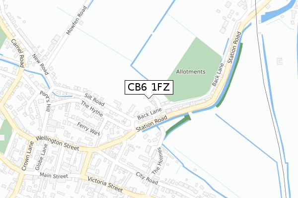
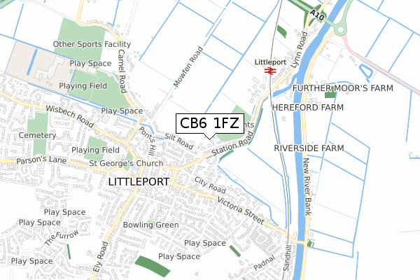
CB6 1FZ is located in the Littleport electoral ward, within the local authority district of East Cambridgeshire and the English Parliamentary constituency of North East Cambridgeshire. The Sub Integrated Care Board (ICB) Location is NHS Cambridgeshire and Peterborough ICB - 06H and the police force is Cambridgeshire. This postcode has been in use since October 2018.


GetTheData
Source: OS Open Zoomstack (Ordnance Survey)
Licence: Open Government Licence (requires attribution)
Attribution: Contains OS data © Crown copyright and database right 2024
Source: Open Postcode Geo
Licence: Open Government Licence (requires attribution)
Attribution: Contains OS data © Crown copyright and database right 2024; Contains Royal Mail data © Royal Mail copyright and database right 2024; Source: Office for National Statistics licensed under the Open Government Licence v.3.0
| Easting | 557110 |
| Northing | 287062 |
| Latitude | 52.458927 |
| Longitude | 0.310953 |
GetTheData
Source: Open Postcode Geo
Licence: Open Government Licence
| Country | England |
| Postcode District | CB6 |
| ➜ CB6 open data dashboard ➜ See where CB6 is on a map ➜ Where is Littleport? | |
GetTheData
Source: Land Registry Price Paid Data
Licence: Open Government Licence
| Ward | Littleport |
| Constituency | North East Cambridgeshire |
GetTheData
Source: ONS Postcode Database
Licence: Open Government Licence
| January 2024 | Anti-social behaviour | On or near White Hart Lane | 239m |
| January 2024 | Violence and sexual offences | On or near Parking Area | 400m |
| January 2024 | Anti-social behaviour | On or near Parking Area | 400m |
| ➜ Get more crime data in our Crime section | |||
GetTheData
Source: data.police.uk
Licence: Open Government Licence
| Granby Street (Wellington Street) | Littleport | 276m |
| Granby Street (Wellington Street) | Littleport | 276m |
| Thoroughfare Way | Littleport | 301m |
| Thoroughfare Way | Littleport | 303m |
| White Hart Lane (Victoria Street) | Littleport | 324m |
| Littleport Station | 0.5km |
GetTheData
Source: NaPTAN
Licence: Open Government Licence
➜ Broadband speed and availability dashboard for CB6 1FZ
| Percentage of properties with Next Generation Access | 100.0% |
| Percentage of properties with Superfast Broadband | 100.0% |
| Percentage of properties with Ultrafast Broadband | 0.0% |
| Percentage of properties with Full Fibre Broadband | 0.0% |
Superfast Broadband is between 30Mbps and 300Mbps
Ultrafast Broadband is > 300Mbps
| Median download speed | 40.0Mbps |
| Average download speed | 47.0Mbps |
| Maximum download speed | 80.00Mbps |
| Median upload speed | 10.0Mbps |
| Average upload speed | 11.1Mbps |
| Maximum upload speed | 20.00Mbps |
| Percentage of properties unable to receive 2Mbps | 0.0% |
| Percentage of properties unable to receive 5Mbps | 0.0% |
| Percentage of properties unable to receive 10Mbps | 0.0% |
| Percentage of properties unable to receive 30Mbps | 0.0% |
➜ Broadband speed and availability dashboard for CB6 1FZ
GetTheData
Source: Ofcom
Licence: Ofcom Terms of Use (requires attribution)
GetTheData
Source: ONS Postcode Database
Licence: Open Government Licence


➜ Get more ratings from the Food Standards Agency
GetTheData
Source: Food Standards Agency
Licence: FSA terms & conditions
| Last Collection | |||
|---|---|---|---|
| Location | Mon-Fri | Sat | Distance |
| Anchor Court | 17:00 | 09:30 | 432m |
| Littleport Post Office | 17:00 | 11:00 | 463m |
| Camel Road | 17:00 | 09:00 | 470m |
GetTheData
Source: Dracos
Licence: Creative Commons Attribution-ShareAlike
| Facility | Distance |
|---|---|
| Littleport Leisure Camel Road, Littleport, Ely Grass Pitches, Sports Hall, Studio | 730m |
| Littleport Leisure Centre (Closed) Camel Road, Littleport, Ely Sports Hall, Health and Fitness Gym, Golf, Squash Courts | 808m |
| Millfield Primary School Grange Lane, Littleport, Ely Grass Pitches | 1.5km |
GetTheData
Source: Active Places
Licence: Open Government Licence
| School | Phase of Education | Distance |
|---|---|---|
| Highfield Littleport Academy Elmside, Ely, CB6 1LJ | Not applicable | 1.1km |
| Vista Academy Littleport Camel Road, Ely, CB6 1EW | Secondary | 1.2km |
| Littleport Community Primary School Parsons Lane, Littleport, Ely, CB6 1JT | Primary | 1.3km |
GetTheData
Source: Edubase
Licence: Open Government Licence
The below table lists the International Territorial Level (ITL) codes (formerly Nomenclature of Territorial Units for Statistics (NUTS) codes) and Local Administrative Units (LAU) codes for CB6 1FZ:
| ITL 1 Code | Name |
|---|---|
| TLH | East |
| ITL 2 Code | Name |
| TLH1 | East Anglia |
| ITL 3 Code | Name |
| TLH12 | Cambridgeshire CC |
| LAU 1 Code | Name |
| E07000009 | East Cambridgeshire |
GetTheData
Source: ONS Postcode Directory
Licence: Open Government Licence
The below table lists the Census Output Area (OA), Lower Layer Super Output Area (LSOA), and Middle Layer Super Output Area (MSOA) for CB6 1FZ:
| Code | Name | |
|---|---|---|
| OA | E00091019 | |
| LSOA | E01018044 | East Cambridgeshire 001C |
| MSOA | E02003732 | East Cambridgeshire 001 |
GetTheData
Source: ONS Postcode Directory
Licence: Open Government Licence
| CB6 1QD | Silt Road | 179m |
| CB6 1QE | Station Road | 193m |
| CB6 1NH | The Holmes | 210m |
| CB6 1QA | The Hythe | 221m |
| CB6 1QJ | Ferry Way | 221m |
| CB6 1QF | Station Road | 223m |
| CB6 1NB | White Hart Lane | 226m |
| CB6 1PA | Cedar Court | 284m |
| CB6 1LU | Victoria Street | 292m |
| CB6 1NG | City Road | 292m |
GetTheData
Source: Open Postcode Geo; Land Registry Price Paid Data
Licence: Open Government Licence