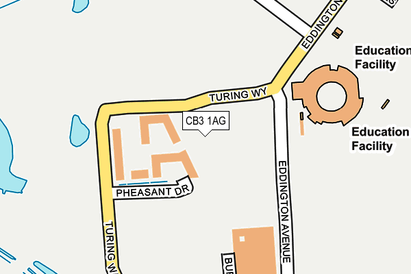
CB3 1AG is located in the Castle electoral ward, within the local authority district of Cambridge and the English Parliamentary constituency of Cambridge. The Sub Integrated Care Board (ICB) Location is NHS Cambridgeshire and Peterborough ICB - 06H and the police force is Cambridgeshire. This postcode has been in use since June 2017.


GetTheData
Source: OS OpenMap – Local (Ordnance Survey)
Source: OS VectorMap District (Ordnance Survey)
Licence: Open Government Licence (requires attribution)
| Easting | 542621 |
| Northing | 259946 |
| Latitude | 52.219281 |
| Longitude | 0.086371 |
GetTheData
Source: Open Postcode Geo
Licence: Open Government Licence
| Country | England |
| Postcode District | CB3 |
| ➜ CB3 open data dashboard ➜ See where CB3 is on a map ➜ Where is Cambridge? | |
GetTheData
Source: Land Registry Price Paid Data
Licence: Open Government Licence
| Ward | Castle |
| Constituency | Cambridge |
GetTheData
Source: ONS Postcode Database
Licence: Open Government Licence
| June 2022 | Bicycle theft | On or near Park/Open Space | 495m |
| May 2022 | Violence and sexual offences | On or near Park/Open Space | 495m |
| March 2022 | Bicycle theft | On or near Park/Open Space | 495m |
| ➜ Get more crime data in our Crime section | |||
GetTheData
Source: data.police.uk
Licence: Open Government Licence
| Madingley Rd Park-and-ride (Madingley Road) | Cambridge | 525m |
| Madingley Rd Park-and-ride (Madingley Road) | Cambridge | 532m |
| Madingley Rd Park-and-ride (Madingley Road) | Cambridge | 552m |
| Thornton Road (Huntingdon Road) | Cambridge | 593m |
| Thornton Road (Huntingdon Road) | Cambridge | 609m |
| Cambridge Station | 4.5km |
GetTheData
Source: NaPTAN
Licence: Open Government Licence
➜ Broadband speed and availability dashboard for CB3 1AG
| Percentage of properties with Next Generation Access | 100.0% |
| Percentage of properties with Superfast Broadband | 100.0% |
| Percentage of properties with Ultrafast Broadband | 100.0% |
| Percentage of properties with Full Fibre Broadband | 100.0% |
Superfast Broadband is between 30Mbps and 300Mbps
Ultrafast Broadband is > 300Mbps
| Median download speed | 100.0Mbps |
| Average download speed | 100.0Mbps |
| Maximum download speed | 100.00Mbps |
Ofcom does not currently provide upload speed data for CB3 1AG. This is because there are less than four broadband connections in this postcode.
| Percentage of properties unable to receive 2Mbps | 0.0% |
| Percentage of properties unable to receive 5Mbps | 0.0% |
| Percentage of properties unable to receive 10Mbps | 0.0% |
| Percentage of properties unable to receive 30Mbps | 0.0% |
➜ Broadband speed and availability dashboard for CB3 1AG
GetTheData
Source: Ofcom
Licence: Ofcom Terms of Use (requires attribution)
GetTheData
Source: ONS Postcode Database
Licence: Open Government Licence


➜ Get more ratings from the Food Standards Agency
GetTheData
Source: Food Standards Agency
Licence: FSA terms & conditions
| Last Collection | |||
|---|---|---|---|
| Location | Mon-Fri | Sat | Distance |
| Landsdowne Road | 17:30 | 12:30 | 632m |
| Girton Corner | 18:45 | 12:30 | 701m |
| Howes Place | 19:00 | 12:45 | 724m |
GetTheData
Source: Dracos
Licence: Creative Commons Attribution-ShareAlike
| Facility | Distance |
|---|---|
| Eddington Playing Field Eddington Avenue, Eddington Avenue, Cambridge Grass Pitches | 379m |
| Girton College Cambridge Swimming Pool, Grass Pitches, Squash Courts | 1km |
| Trinity Hall Sports Ground Storeys Way, Cambridge Grass Pitches | 1.2km |
GetTheData
Source: Active Places
Licence: Open Government Licence
| School | Phase of Education | Distance |
|---|---|---|
| University of Cambridge Primary School Eddington Avenue, Cambridge, CB3 0QZ | Primary | 570m |
| Mayfield Primary School Warwick Road, Cambridge, CB4 3HN | Primary | 1.6km |
| St John's College School 73 Grange Road, Cambridge, CB3 9AB | Not applicable | 1.7km |
GetTheData
Source: Edubase
Licence: Open Government Licence
The below table lists the International Territorial Level (ITL) codes (formerly Nomenclature of Territorial Units for Statistics (NUTS) codes) and Local Administrative Units (LAU) codes for CB3 1AG:
| ITL 1 Code | Name |
|---|---|
| TLH | East |
| ITL 2 Code | Name |
| TLH1 | East Anglia |
| ITL 3 Code | Name |
| TLH12 | Cambridgeshire CC |
| LAU 1 Code | Name |
| E07000008 | Cambridge |
GetTheData
Source: ONS Postcode Directory
Licence: Open Government Licence
The below table lists the Census Output Area (OA), Lower Layer Super Output Area (LSOA), and Middle Layer Super Output Area (MSOA) for CB3 1AG:
| Code | Name | |
|---|---|---|
| OA | E00090578 | |
| LSOA | E01017956 | Cambridge 005B |
| MSOA | E02003723 | Cambridge 005 |
GetTheData
Source: ONS Postcode Directory
Licence: Open Government Licence
| CB3 0EU | Lansdowne Road | 555m |
| CB3 0LG | Huntingdon Road | 581m |
| CB3 0EY | Conduit Head Road | 603m |
| CB3 0DW | Bradrushe Fields | 629m |
| CB3 0EX | Madingley Road | 635m |
| CB3 0LX | Huntingdon Road | 656m |
| CB3 0DL | Huntingdon Road | 657m |
| CB3 0LY | Bunkers Hill | 667m |
| CB3 0LQ | Huntingdon Road | 669m |
| CB3 0GU | Burlton Road | 683m |
GetTheData
Source: Open Postcode Geo; Land Registry Price Paid Data
Licence: Open Government Licence