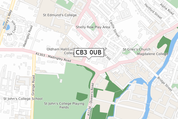
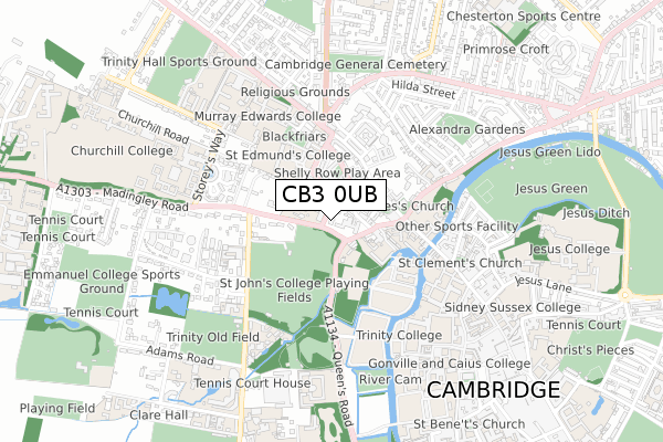
CB3 0UB is located in the Castle electoral ward, within the local authority district of Cambridge and the English Parliamentary constituency of Cambridge. The Sub Integrated Care Board (ICB) Location is NHS Cambridgeshire and Peterborough ICB - 06H and the police force is Cambridgeshire. This postcode has been in use since October 2017.


GetTheData
Source: OS Open Zoomstack (Ordnance Survey)
Licence: Open Government Licence (requires attribution)
Attribution: Contains OS data © Crown copyright and database right 2024
Source: Open Postcode Geo
Licence: Open Government Licence (requires attribution)
Attribution: Contains OS data © Crown copyright and database right 2024; Contains Royal Mail data © Royal Mail copyright and database right 2024; Source: Office for National Statistics licensed under the Open Government Licence v.3.0
| Easting | 544333 |
| Northing | 259045 |
| Latitude | 52.210741 |
| Longitude | 0.111030 |
GetTheData
Source: Open Postcode Geo
Licence: Open Government Licence
| Country | England |
| Postcode District | CB3 |
| ➜ CB3 open data dashboard ➜ See where CB3 is on a map ➜ Where is Cambridge? | |
GetTheData
Source: Land Registry Price Paid Data
Licence: Open Government Licence
| Ward | Castle |
| Constituency | Cambridge |
GetTheData
Source: ONS Postcode Database
Licence: Open Government Licence
| June 2022 | Other theft | On or near Lady Margaret Road | 38m |
| June 2022 | Violence and sexual offences | On or near Further/Higher Educational Building | 54m |
| June 2022 | Other theft | On or near Albion Row | 129m |
| ➜ Get more crime data in our Crime section | |||
GetTheData
Source: data.police.uk
Licence: Open Government Licence
| St John's Coll Pathway (Queen's Road) | Cambridge | 120m |
| Castle Street (Northampton Street) | Cambridge | 186m |
| Castle Street (Northampton Street) | Cambridge | 210m |
| St Peter's Street (Castle Street) | Cambridge | 232m |
| St John's Coll Pathway (Queens Road) | Cambridge | 243m |
| Cambridge Station | 2.6km |
GetTheData
Source: NaPTAN
Licence: Open Government Licence
GetTheData
Source: ONS Postcode Database
Licence: Open Government Licence


➜ Get more ratings from the Food Standards Agency
GetTheData
Source: Food Standards Agency
Licence: FSA terms & conditions
| Last Collection | |||
|---|---|---|---|
| Location | Mon-Fri | Sat | Distance |
| Northampton Street | 18:45 | 13:00 | 90m |
| Shelly Row | 18:45 | 13:00 | 196m |
| County Courts | 18:45 | 12:45 | 219m |
GetTheData
Source: Dracos
Licence: Creative Commons Attribution-ShareAlike
| Facility | Distance |
|---|---|
| St Johns College Sports Ground Grange Road, Cambridge Grass Pitches, Artificial Grass Pitch, Outdoor Tennis Courts | 303m |
| The Glassworks Health Club Thompsons Lane, Cambridge Health and Fitness Gym, Studio | 483m |
| Fitzwilliam College Storeys Way, Cambridge Health and Fitness Gym, Squash Courts | 570m |
GetTheData
Source: Active Places
Licence: Open Government Licence
| School | Phase of Education | Distance |
|---|---|---|
| St John's College School 73 Grange Road, Cambridge, CB3 9AB | Not applicable | 371m |
| Park Street CofE Primary School Lower Park Street, Cambridge, CB5 8AR | Primary | 612m |
| University of Cambridge Vice Chancellor's Office, University Offices, The Old Schools, Cambridge, CB2 1TN | Not applicable | 715m |
GetTheData
Source: Edubase
Licence: Open Government Licence
The below table lists the International Territorial Level (ITL) codes (formerly Nomenclature of Territorial Units for Statistics (NUTS) codes) and Local Administrative Units (LAU) codes for CB3 0UB:
| ITL 1 Code | Name |
|---|---|
| TLH | East |
| ITL 2 Code | Name |
| TLH1 | East Anglia |
| ITL 3 Code | Name |
| TLH12 | Cambridgeshire CC |
| LAU 1 Code | Name |
| E07000008 | Cambridge |
GetTheData
Source: ONS Postcode Directory
Licence: Open Government Licence
The below table lists the Census Output Area (OA), Lower Layer Super Output Area (LSOA), and Middle Layer Super Output Area (MSOA) for CB3 0UB:
| Code | Name | |
|---|---|---|
| OA | E00090574 | |
| LSOA | E01017958 | Cambridge 005D |
| MSOA | E02003723 | Cambridge 005 |
GetTheData
Source: ONS Postcode Directory
Licence: Open Government Licence
| CB3 0BJ | Lady Margaret Road | 66m |
| CB3 0BQ | Haymarket Road | 80m |
| CB3 0BH | Albion Row | 123m |
| CB3 0AL | Honey Hill Mews | 129m |
| CB3 0AE | Pound Hill | 134m |
| CB3 0BG | Honey Hill | 154m |
| CB3 0BE | The Terrace | 161m |
| CB3 0BY | Albion Row | 166m |
| CB3 0BD | St Peters Street | 171m |
| CB3 0BP | Shelly Row | 196m |
GetTheData
Source: Open Postcode Geo; Land Registry Price Paid Data
Licence: Open Government Licence