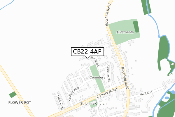
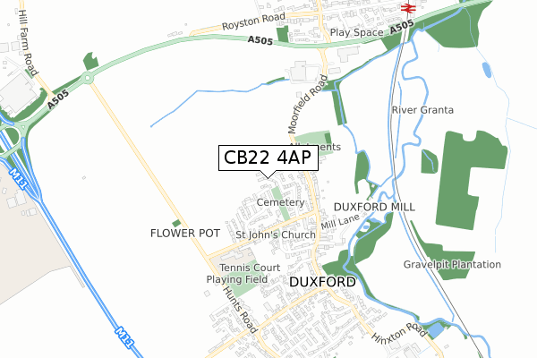
CB22 4AP is located in the Duxford electoral ward, within the local authority district of South Cambridgeshire and the English Parliamentary constituency of South Cambridgeshire. The Sub Integrated Care Board (ICB) Location is NHS Cambridgeshire and Peterborough ICB - 06H and the police force is Cambridgeshire. This postcode has been in use since June 2018.


GetTheData
Source: OS Open Zoomstack (Ordnance Survey)
Licence: Open Government Licence (requires attribution)
Attribution: Contains OS data © Crown copyright and database right 2025
Source: Open Postcode Geo
Licence: Open Government Licence (requires attribution)
Attribution: Contains OS data © Crown copyright and database right 2025; Contains Royal Mail data © Royal Mail copyright and database right 2025; Source: Office for National Statistics licensed under the Open Government Licence v.3.0
| Easting | 547775 |
| Northing | 246446 |
| Latitude | 52.096637 |
| Longitude | 0.155892 |
GetTheData
Source: Open Postcode Geo
Licence: Open Government Licence
| Country | England |
| Postcode District | CB22 |
➜ See where CB22 is on a map ➜ Where is Duxford? | |
GetTheData
Source: Land Registry Price Paid Data
Licence: Open Government Licence
| Ward | Duxford |
| Constituency | South Cambridgeshire |
GetTheData
Source: ONS Postcode Database
Licence: Open Government Licence
2024 5 DEC £710,000 |
2022 19 APR £965,000 |
18, BEDELL ROAD, DUXFORD, CAMBRIDGE, CB22 4AP 2019 20 DEC £649,950 |
3, BEDELL ROAD, DUXFORD, CAMBRIDGE, CB22 4AP 2018 20 DEC £419,950 |
2018 20 DEC £850,000 |
2018 20 DEC £572,950 |
16, BEDELL ROAD, DUXFORD, CAMBRIDGE, CB22 4AP 2018 21 SEP £730,000 |
11, BEDELL ROAD, DUXFORD, CAMBRIDGE, CB22 4AP 2018 29 JUN £585,000 |
9, BEDELL ROAD, DUXFORD, CAMBRIDGE, CB22 4AP 2018 29 JUN £565,000 |
7, BEDELL ROAD, DUXFORD, CAMBRIDGE, CB22 4AP 2018 28 JUN £595,000 |
GetTheData
Source: HM Land Registry Price Paid Data
Licence: Contains HM Land Registry data © Crown copyright and database right 2025. This data is licensed under the Open Government Licence v3.0.
| The Firs (Moorfield Road) | Duxford | 169m |
| The Firs (Moorfield Road) | Duxford | 177m |
| St John's Street (Moorfield Road) | Duxford | 284m |
| St John's Street (Moorfield Road) | Duxford | 291m |
| Playing Field (Hunts Road) | Duxford | 489m |
| Whittlesford Parkway Station | 1km |
| Great Chesterford Station | 4.8km |
GetTheData
Source: NaPTAN
Licence: Open Government Licence
| Percentage of properties with Next Generation Access | 100.0% |
| Percentage of properties with Superfast Broadband | 100.0% |
| Percentage of properties with Ultrafast Broadband | 100.0% |
| Percentage of properties with Full Fibre Broadband | 100.0% |
Superfast Broadband is between 30Mbps and 300Mbps
Ultrafast Broadband is > 300Mbps
| Percentage of properties unable to receive 2Mbps | 0.0% |
| Percentage of properties unable to receive 5Mbps | 0.0% |
| Percentage of properties unable to receive 10Mbps | 0.0% |
| Percentage of properties unable to receive 30Mbps | 0.0% |
GetTheData
Source: Ofcom
Licence: Ofcom Terms of Use (requires attribution)
GetTheData
Source: ONS Postcode Database
Licence: Open Government Licence


➜ Get more ratings from the Food Standards Agency
GetTheData
Source: Food Standards Agency
Licence: FSA terms & conditions
| Last Collection | |||
|---|---|---|---|
| Location | Mon-Fri | Sat | Distance |
| Laceys Way | 16:00 | 10:30 | 177m |
| Morefield Road | 17:00 | 10:45 | 279m |
| Duxford Post Office | 17:00 | 10:45 | 581m |
GetTheData
Source: Dracos
Licence: Creative Commons Attribution-ShareAlike
The below table lists the International Territorial Level (ITL) codes (formerly Nomenclature of Territorial Units for Statistics (NUTS) codes) and Local Administrative Units (LAU) codes for CB22 4AP:
| ITL 1 Code | Name |
|---|---|
| TLH | East |
| ITL 2 Code | Name |
| TLH1 | East Anglia |
| ITL 3 Code | Name |
| TLH12 | Cambridgeshire CC |
| LAU 1 Code | Name |
| E07000012 | South Cambridgeshire |
GetTheData
Source: ONS Postcode Directory
Licence: Open Government Licence
The below table lists the Census Output Area (OA), Lower Layer Super Output Area (LSOA), and Middle Layer Super Output Area (MSOA) for CB22 4AP:
| Code | Name | |
|---|---|---|
| OA | E00092004 | |
| LSOA | E01018239 | South Cambridgeshire 017B |
| MSOA | E02003791 | South Cambridgeshire 017 |
GetTheData
Source: ONS Postcode Directory
Licence: Open Government Licence
| CB22 4PJ | The Old Nursery | 79m |
| CB22 4PY | The Firs | 118m |
| CB22 4SE | Laceys Way | 163m |
| CB22 4RB | Greenacres | 165m |
| CB22 4PP | Moorfield Road | 175m |
| CB22 4SG | The Rustons | 199m |
| CB22 4PS | Moorfield Road | 219m |
| CB22 4RA | St Johns Street | 239m |
| CB22 4FA | Bankes Mead | 263m |
| CB22 4RD | Elms Close | 303m |
GetTheData
Source: Open Postcode Geo; Land Registry Price Paid Data
Licence: Open Government Licence