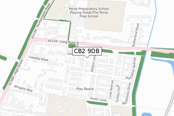
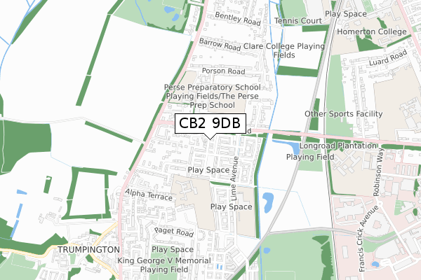
CB2 9DB is located in the Trumpington electoral ward, within the local authority district of Cambridge and the English Parliamentary constituency of Cambridge. The Sub Integrated Care Board (ICB) Location is NHS Cambridgeshire and Peterborough ICB - 06H and the police force is Cambridgeshire. This postcode has been in use since August 2017.


GetTheData
Source: OS Open Zoomstack (Ordnance Survey)
Licence: Open Government Licence (requires attribution)
Attribution: Contains OS data © Crown copyright and database right 2024
Source: Open Postcode Geo
Licence: Open Government Licence (requires attribution)
Attribution: Contains OS data © Crown copyright and database right 2024; Contains Royal Mail data © Royal Mail copyright and database right 2024; Source: Office for National Statistics licensed under the Open Government Licence v.3.0
| Easting | 545103 |
| Northing | 255602 |
| Latitude | 52.179605 |
| Longitude | 0.120818 |
GetTheData
Source: Open Postcode Geo
Licence: Open Government Licence
| Country | England |
| Postcode District | CB2 |
| ➜ CB2 open data dashboard ➜ See where CB2 is on a map ➜ Where is Cambridge? | |
GetTheData
Source: Land Registry Price Paid Data
Licence: Open Government Licence
| Ward | Trumpington |
| Constituency | Cambridge |
GetTheData
Source: ONS Postcode Database
Licence: Open Government Licence
2021 5 AUG £1,425,000 |
5, BROOK END CLOSE, TRUMPINGTON, CAMBRIDGE, CB2 9DB 2019 25 OCT £1,100,000 |
1, BROOK END CLOSE, TRUMPINGTON, CAMBRIDGE, CB2 9DB 2019 5 AUG £1,150,000 |
7, BROOK END CLOSE, TRUMPINGTON, CAMBRIDGE, CB2 9DB 2019 25 JUL £1,110,000 |
2019 8 APR £1,200,000 |
14, BROOK END CLOSE, TRUMPINGTON, CAMBRIDGE, CB2 9DB 2018 28 SEP £764,000 |
6, BROOK END CLOSE, TRUMPINGTON, CAMBRIDGE, CB2 9DB 2017 17 AUG £795,000 |
GetTheData
Source: HM Land Registry Price Paid Data
Licence: Contains HM Land Registry data © Crown copyright and database right 2024. This data is licensed under the Open Government Licence v3.0.
| October 2023 | Anti-social behaviour | On or near Gazeley Road | 264m |
| August 2023 | Criminal damage and arson | On or near Gazeley Road | 264m |
| July 2023 | Other theft | On or near Gazeley Road | 264m |
| ➜ Get more crime data in our Crime section | |||
GetTheData
Source: data.police.uk
Licence: Open Government Licence
| Trumpington Road (Long Road) | Trumpington | 151m |
| Trumpington Road (Long Road) | Trumpington | 211m |
| Rutherford Road (Long Road) | Trumpington | 331m |
| Gazeley Road (High Street) | Trumpington | 346m |
| Rutherford Road (Long Road) | Trumpington | 364m |
| Cambridge Station | 2km |
| Shelford (Cambs) Station | 3.7km |
GetTheData
Source: NaPTAN
Licence: Open Government Licence
| Percentage of properties with Next Generation Access | 100.0% |
| Percentage of properties with Superfast Broadband | 100.0% |
| Percentage of properties with Ultrafast Broadband | 100.0% |
| Percentage of properties with Full Fibre Broadband | 100.0% |
Superfast Broadband is between 30Mbps and 300Mbps
Ultrafast Broadband is > 300Mbps
| Percentage of properties unable to receive 2Mbps | 0.0% |
| Percentage of properties unable to receive 5Mbps | 0.0% |
| Percentage of properties unable to receive 10Mbps | 0.0% |
| Percentage of properties unable to receive 30Mbps | 0.0% |
GetTheData
Source: Ofcom
Licence: Ofcom Terms of Use (requires attribution)
GetTheData
Source: ONS Postcode Database
Licence: Open Government Licence


➜ Get more ratings from the Food Standards Agency
GetTheData
Source: Food Standards Agency
Licence: FSA terms & conditions
| Last Collection | |||
|---|---|---|---|
| Location | Mon-Fri | Sat | Distance |
| Gilmerton Court | 18:30 | 12:15 | 249m |
| Rutherford Road | 18:30 | 13:00 | 377m |
| Barrow Road | 18:00 | 12:15 | 596m |
GetTheData
Source: Dracos
Licence: Creative Commons Attribution-ShareAlike
| Facility | Distance |
|---|---|
| The Perse Preparatory School Trumpington Road, Cambridge Sports Hall, Grass Pitches | 303m |
| Fawcett Primary School Alpha Terrace, Trumpington, Cambridge Grass Pitches, Sports Hall, Swimming Pool | 322m |
| Trumpington Community College Playing Field Long Road, Long Road, Trumpington, Cambridge Grass Pitches | 363m |
GetTheData
Source: Active Places
Licence: Open Government Licence
| School | Phase of Education | Distance |
|---|---|---|
| Trumpington Community College Lime Avenue, Cambridge, CB2 9FD | Secondary | 125m |
| Fawcett Primary School Alpha Terrace, Trumpington, Cambridge, CB2 9FS | Primary | 323m |
| Long Road Sixth Form College Long Road, Cambridge, CB2 8PX | 16 plus | 829m |
GetTheData
Source: Edubase
Licence: Open Government Licence
The below table lists the International Territorial Level (ITL) codes (formerly Nomenclature of Territorial Units for Statistics (NUTS) codes) and Local Administrative Units (LAU) codes for CB2 9DB:
| ITL 1 Code | Name |
|---|---|
| TLH | East |
| ITL 2 Code | Name |
| TLH1 | East Anglia |
| ITL 3 Code | Name |
| TLH12 | Cambridgeshire CC |
| LAU 1 Code | Name |
| E07000008 | Cambridge |
GetTheData
Source: ONS Postcode Directory
Licence: Open Government Licence
The below table lists the Census Output Area (OA), Lower Layer Super Output Area (LSOA), and Middle Layer Super Output Area (MSOA) for CB2 9DB:
| Code | Name | |
|---|---|---|
| OA | E00090814 | |
| LSOA | E01018002 | Cambridge 012A |
| MSOA | E02003730 | Cambridge 012 |
GetTheData
Source: ONS Postcode Directory
Licence: Open Government Licence
| CB2 9DH | Willers Lane | 62m |
| CB2 9BY | Huntsman Road | 75m |
| CB2 9DD | Northrop Road | 117m |
| CB2 8HE | Long Road | 125m |
| CB2 9BX | Clay Farm Drive | 151m |
| CB2 8HF | Long Road | 153m |
| CB2 9DE | Lime Avenue | 175m |
| CB2 9DJ | Seekings Close | 192m |
| CB2 9HB | Gazeley Road | 222m |
| CB2 9DL | Plantation Avenue | 262m |
GetTheData
Source: Open Postcode Geo; Land Registry Price Paid Data
Licence: Open Government Licence