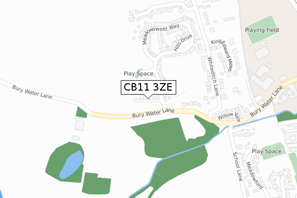
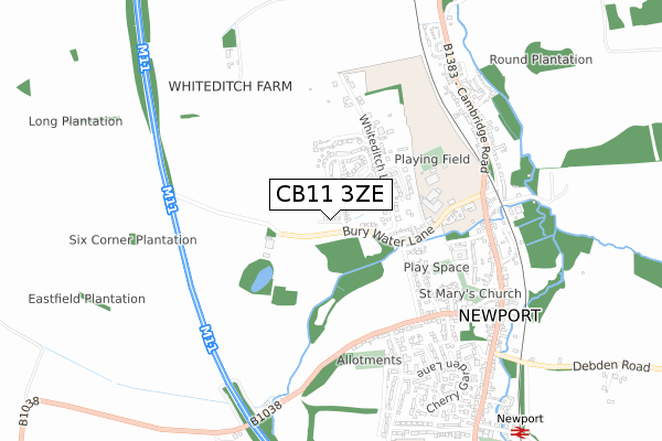
CB11 3ZE is located in the Newport electoral ward, within the local authority district of Uttlesford and the English Parliamentary constituency of Saffron Walden. The Sub Integrated Care Board (ICB) Location is NHS Hertfordshire and West Essex ICB - 07H and the police force is Essex. This postcode has been in use since February 2018.


GetTheData
Source: OS Open Zoomstack (Ordnance Survey)
Licence: Open Government Licence (requires attribution)
Attribution: Contains OS data © Crown copyright and database right 2024
Source: Open Postcode Geo
Licence: Open Government Licence (requires attribution)
Attribution: Contains OS data © Crown copyright and database right 2024; Contains Royal Mail data © Royal Mail copyright and database right 2024; Source: Office for National Statistics licensed under the Open Government Licence v.3.0
| Easting | 551528 |
| Northing | 234383 |
| Latitude | 51.987247 |
| Longitude | 0.205291 |
GetTheData
Source: Open Postcode Geo
Licence: Open Government Licence
| Country | England |
| Postcode District | CB11 |
| ➜ CB11 open data dashboard ➜ See where CB11 is on a map ➜ Where is Newport? | |
GetTheData
Source: Land Registry Price Paid Data
Licence: Open Government Licence
| Ward | Newport |
| Constituency | Saffron Walden |
GetTheData
Source: ONS Postcode Database
Licence: Open Government Licence
2, WATERSIDE PLACE, NEWPORT, SAFFRON WALDEN, CB11 3ZE 2018 31 OCT £889,950 |
6, WATERSIDE PLACE, NEWPORT, SAFFRON WALDEN, CB11 3ZE 2018 28 MAR £779,950 |
4, WATERSIDE PLACE, NEWPORT, SAFFRON WALDEN, CB11 3ZE 2018 28 FEB £692,450 |
GetTheData
Source: HM Land Registry Price Paid Data
Licence: Contains HM Land Registry data © Crown copyright and database right 2024. This data is licensed under the Open Government Licence v3.0.
| June 2022 | Public order | On or near Willow Vale | 273m |
| April 2022 | Public order | On or near Willow Vale | 273m |
| March 2022 | Other theft | On or near Willow Vale | 273m |
| ➜ Get more crime data in our Crime section | |||
GetTheData
Source: data.police.uk
Licence: Open Government Licence
| School Lane | Newport | 292m |
| Jf Academy (Bury Water Lane) | Newport | 411m |
| Frambury Lane (Wicken Road) | Newport | 459m |
| Frambury Lane (Wicken Road) | Newport | 465m |
| Gaces Acre (Belmont Hill) | Newport | 587m |
| Newport (Essex) Station | 1.1km |
| Audley End Station | 1.9km |
GetTheData
Source: NaPTAN
Licence: Open Government Licence
| Percentage of properties with Next Generation Access | 100.0% |
| Percentage of properties with Superfast Broadband | 100.0% |
| Percentage of properties with Ultrafast Broadband | 100.0% |
| Percentage of properties with Full Fibre Broadband | 100.0% |
Superfast Broadband is between 30Mbps and 300Mbps
Ultrafast Broadband is > 300Mbps
| Percentage of properties unable to receive 2Mbps | 0.0% |
| Percentage of properties unable to receive 5Mbps | 0.0% |
| Percentage of properties unable to receive 10Mbps | 0.0% |
| Percentage of properties unable to receive 30Mbps | 0.0% |
GetTheData
Source: Ofcom
Licence: Ofcom Terms of Use (requires attribution)
GetTheData
Source: ONS Postcode Database
Licence: Open Government Licence


➜ Get more ratings from the Food Standards Agency
GetTheData
Source: Food Standards Agency
Licence: FSA terms & conditions
| Last Collection | |||
|---|---|---|---|
| Location | Mon-Fri | Sat | Distance |
| Wicken Road | 16:30 | 10:00 | 518m |
| Bridge End | 17:30 | 10:00 | 648m |
| Newport Post Office | 17:15 | 10:00 | 696m |
GetTheData
Source: Dracos
Licence: Creative Commons Attribution-ShareAlike
| Facility | Distance |
|---|---|
| Anglian Leisure Joyce Frankland Cambridge Road, Newport, Saffron Walden Artificial Grass Pitch, Health and Fitness Gym, Grass Pitches, Sports Hall | 487m |
| Diana Sell Memorial Playground Meadowford, Newport Outdoor Tennis Courts | 541m |
| Get Up N Go (Closed) Cambridge Road, Newport, Saffron Walden Health and Fitness Gym | 750m |
GetTheData
Source: Active Places
Licence: Open Government Licence
| School | Phase of Education | Distance |
|---|---|---|
| Joyce Frankland Academy, Newport Bury Water Lane, Newport, Saffron Walden, CB11 3TR | Secondary | 487m |
| Newport Primary School Frambury Lane, Newport, CB11 3PU | Primary | 905m |
| Katherine Semar Junior School Ross Close, Saffron Walden, CB11 4DU | Primary | 3.7km |
GetTheData
Source: Edubase
Licence: Open Government Licence
The below table lists the International Territorial Level (ITL) codes (formerly Nomenclature of Territorial Units for Statistics (NUTS) codes) and Local Administrative Units (LAU) codes for CB11 3ZE:
| ITL 1 Code | Name |
|---|---|
| TLH | East |
| ITL 2 Code | Name |
| TLH3 | Essex |
| ITL 3 Code | Name |
| TLH35 | West Essex |
| LAU 1 Code | Name |
| E07000077 | Uttlesford |
GetTheData
Source: ONS Postcode Directory
Licence: Open Government Licence
The below table lists the Census Output Area (OA), Lower Layer Super Output Area (LSOA), and Middle Layer Super Output Area (MSOA) for CB11 3ZE:
| Code | Name | |
|---|---|---|
| OA | E00112157 | |
| LSOA | E01022073 | Uttlesford 003D |
| MSOA | E02004593 | Uttlesford 003 |
GetTheData
Source: ONS Postcode Directory
Licence: Open Government Licence
| CB11 3UB | Parsonage Cottages | 148m |
| CB11 3UA | Bury Water Lane | 198m |
| CB11 3DD | Willow Vale | 262m |
| CB11 3TZ | Bury Water Lane | 334m |
| CB11 3UW | Tenterfields | 335m |
| CB11 3UD | Whiteditch Lane | 341m |
| CB11 3QL | Meadowford | 425m |
| CB11 3QH | Wicken Road | 474m |
| CB11 3RR | School Lane | 483m |
| CB11 3QF | Wicken Road | 521m |
GetTheData
Source: Open Postcode Geo; Land Registry Price Paid Data
Licence: Open Government Licence