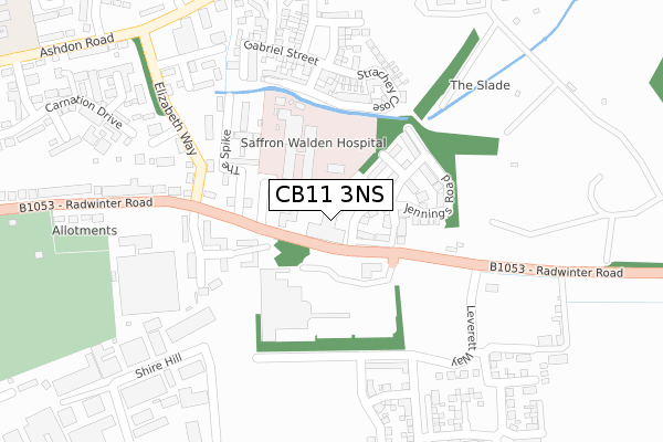
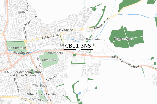
CB11 3NS is located in the Saffron Walden Castle electoral ward, within the local authority district of Uttlesford and the English Parliamentary constituency of Saffron Walden. The Sub Integrated Care Board (ICB) Location is NHS Hertfordshire and West Essex ICB - 07H and the police force is Essex. This postcode has been in use since August 2019.


GetTheData
Source: OS Open Zoomstack (Ordnance Survey)
Licence: Open Government Licence (requires attribution)
Attribution: Contains OS data © Crown copyright and database right 2024
Source: Open Postcode Geo
Licence: Open Government Licence (requires attribution)
Attribution: Contains OS data © Crown copyright and database right 2024; Contains Royal Mail data © Royal Mail copyright and database right 2024; Source: Office for National Statistics licensed under the Open Government Licence v.3.0
| Easting | 555135 |
| Northing | 238486 |
| Latitude | 52.023114 |
| Longitude | 0.259634 |
GetTheData
Source: Open Postcode Geo
Licence: Open Government Licence
| Country | England |
| Postcode District | CB11 |
| ➜ CB11 open data dashboard ➜ See where CB11 is on a map ➜ Where is Saffron Walden? | |
GetTheData
Source: Land Registry Price Paid Data
Licence: Open Government Licence
| Ward | Saffron Walden Castle |
| Constituency | Saffron Walden |
GetTheData
Source: ONS Postcode Database
Licence: Open Government Licence
| June 2022 | Other theft | On or near Ferguson Close | 106m |
| June 2022 | Violence and sexual offences | On or near The Spike | 163m |
| June 2022 | Violence and sexual offences | On or near The Spike | 163m |
| ➜ Get more crime data in our Crime section | |||
GetTheData
Source: data.police.uk
Licence: Open Government Licence
| Tesco Store (Radwinter Road) | Saffron Walden | 50m |
| Tesco Store (Radwinter Road) | Saffron Walden | 97m |
| Tesco (Radwinter Road) | Saffron Walden | 112m |
| Hospital (Access To Hospital) | Saffron Walden | 115m |
| The Spike (Radwinter Road) | Saffron Walden | 180m |
| Audley End Station | 4.2km |
| Newport (Essex) Station | 5.7km |
| Great Chesterford Station | 6.1km |
GetTheData
Source: NaPTAN
Licence: Open Government Licence
GetTheData
Source: ONS Postcode Database
Licence: Open Government Licence


➜ Get more ratings from the Food Standards Agency
GetTheData
Source: Food Standards Agency
Licence: FSA terms & conditions
| Last Collection | |||
|---|---|---|---|
| Location | Mon-Fri | Sat | Distance |
| Tesco Stores | 17:45 | 11:00 | 157m |
| Elizabeth Way | 17:30 | 12:00 | 265m |
| Whiteshot Road | 17:45 | 12:00 | 453m |
GetTheData
Source: Dracos
Licence: Creative Commons Attribution-ShareAlike
| Facility | Distance |
|---|---|
| Just Gym Shire Hill, Saffron Walden Health and Fitness Gym | 327m |
| Just Gym (Closed) Shire Hill, Saffron Walden Health and Fitness Gym | 422m |
| Pickles Gym Ltd (Closed) Shire Hill, Saffron Walden Health and Fitness Gym | 493m |
GetTheData
Source: Active Places
Licence: Open Government Licence
| School | Phase of Education | Distance |
|---|---|---|
| R A Butler Infant School South Road, Saffron Walden, CB11 3DG | Primary | 1.1km |
| R A Butler Junior School South Road, Saffron Walden, CB11 3DG | Primary | 1.1km |
| St Thomas More Catholic Primary School, Saffron Walden South Road, Saffron Walden, CB11 3DW | Primary | 1.1km |
GetTheData
Source: Edubase
Licence: Open Government Licence
The below table lists the International Territorial Level (ITL) codes (formerly Nomenclature of Territorial Units for Statistics (NUTS) codes) and Local Administrative Units (LAU) codes for CB11 3NS:
| ITL 1 Code | Name |
|---|---|
| TLH | East |
| ITL 2 Code | Name |
| TLH3 | Essex |
| ITL 3 Code | Name |
| TLH35 | West Essex |
| LAU 1 Code | Name |
| E07000077 | Uttlesford |
GetTheData
Source: ONS Postcode Directory
Licence: Open Government Licence
The below table lists the Census Output Area (OA), Lower Layer Super Output Area (LSOA), and Middle Layer Super Output Area (MSOA) for CB11 3NS:
| Code | Name | |
|---|---|---|
| OA | E00112180 | |
| LSOA | E01022079 | Uttlesford 002D |
| MSOA | E02004592 | Uttlesford 002 |
GetTheData
Source: ONS Postcode Directory
Licence: Open Government Licence
| CB11 3JW | Horn Book | 162m |
| CB11 3GA | Radwinter Road | 170m |
| CB11 3JF | Radwinter Road | 185m |
| CB10 2GN | Strachey Close | 212m |
| CB11 3JN | Horn Book | 221m |
| CB10 2EW | The Sycamores | 223m |
| CB10 2NN | Lavender Field | 224m |
| CB11 3HY | Radwinter Road | 235m |
| CB10 2NJ | Rochester Court | 250m |
| CB10 2JZ | Radwinter Road | 264m |
GetTheData
Source: Open Postcode Geo; Land Registry Price Paid Data
Licence: Open Government Licence