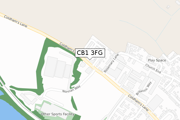
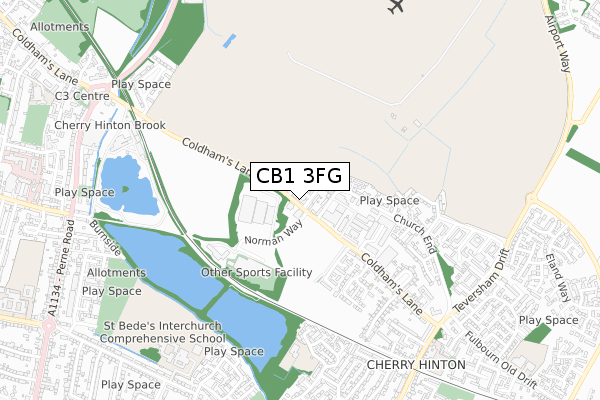
CB1 3FG is located in the Cherry Hinton electoral ward, within the local authority district of Cambridge and the English Parliamentary constituency of Cambridge. The Sub Integrated Care Board (ICB) Location is NHS Cambridgeshire and Peterborough ICB - 06H and the police force is Cambridgeshire. This postcode has been in use since June 2019.


GetTheData
Source: OS Open Zoomstack (Ordnance Survey)
Licence: Open Government Licence (requires attribution)
Attribution: Contains OS data © Crown copyright and database right 2024
Source: Open Postcode Geo
Licence: Open Government Licence (requires attribution)
Attribution: Contains OS data © Crown copyright and database right 2024; Contains Royal Mail data © Royal Mail copyright and database right 2024; Source: Office for National Statistics licensed under the Open Government Licence v.3.0
| Easting | 548408 |
| Northing | 257566 |
| Latitude | 52.196372 |
| Longitude | 0.169977 |
GetTheData
Source: Open Postcode Geo
Licence: Open Government Licence
| Country | England |
| Postcode District | CB1 |
| ➜ CB1 open data dashboard ➜ See where CB1 is on a map ➜ Where is Cambridge? | |
GetTheData
Source: Land Registry Price Paid Data
Licence: Open Government Licence
| Ward | Cherry Hinton |
| Constituency | Cambridge |
GetTheData
Source: ONS Postcode Database
Licence: Open Government Licence
| November 2023 | Burglary | On or near March Lane | 452m |
| November 2022 | Violence and sexual offences | On or near March Lane | 452m |
| October 2022 | Violence and sexual offences | On or near March Lane | 452m |
| ➜ Get more crime data in our Crime section | |||
GetTheData
Source: data.police.uk
Licence: Open Government Licence
| Hatherdene Close (Coldham's Lane) | Cherry Hinton | 27m |
| Hatherdene Close (Coldham's Lane) | Cherry Hinton | 47m |
| Kathleen Elliot Way (Coldham's Lane) | Cherry Hinton | 210m |
| Kathleen Elliot Way (Coldham's Lane) | Cherry Hinton | 243m |
| Queen's Meadow (Coldham's Lane) | Cherry Hinton | 445m |
| Cambridge Station | 2.2km |
GetTheData
Source: NaPTAN
Licence: Open Government Licence
| Percentage of properties with Next Generation Access | 100.0% |
| Percentage of properties with Superfast Broadband | 100.0% |
| Percentage of properties with Ultrafast Broadband | 100.0% |
| Percentage of properties with Full Fibre Broadband | 100.0% |
Superfast Broadband is between 30Mbps and 300Mbps
Ultrafast Broadband is > 300Mbps
| Percentage of properties unable to receive 2Mbps | 0.0% |
| Percentage of properties unable to receive 5Mbps | 0.0% |
| Percentage of properties unable to receive 10Mbps | 0.0% |
| Percentage of properties unable to receive 30Mbps | 0.0% |
GetTheData
Source: Ofcom
Licence: Ofcom Terms of Use (requires attribution)
GetTheData
Source: ONS Postcode Database
Licence: Open Government Licence


➜ Get more ratings from the Food Standards Agency
GetTheData
Source: Food Standards Agency
Licence: FSA terms & conditions
| Last Collection | |||
|---|---|---|---|
| Location | Mon-Fri | Sat | Distance |
| Coldhams Lane | 18:15 | 12:15 | 511m |
| Church End | 18:15 | 12:15 | 584m |
| Nuttings Road | 18:45 | 12:30 | 737m |
GetTheData
Source: Dracos
Licence: Creative Commons Attribution-ShareAlike
| Facility | Distance |
|---|---|
| David Lloyd (Cambridge) Coldhams Business Park, Norman Way, Cambridge Sports Hall, Swimming Pool, Health and Fitness Gym, Indoor Tennis Centre, Squash Courts, Studio, Outdoor Tennis Courts | 346m |
| St Bedes Inter Church School Birdwood Road, Cambridge Sports Hall, Grass Pitches, Studio, Health and Fitness Gym, Outdoor Tennis Courts | 827m |
| Cherry Hinton Village Leisure Centre Colville Road, Cambridge Sports Hall, Health and Fitness Gym | 1.1km |
GetTheData
Source: Active Places
Licence: Open Government Licence
| School | Phase of Education | Distance |
|---|---|---|
| The Spinney Primary School Hayster Drive, Cherry Hinton, Cambridge, CB1 9PB | Primary | 630m |
| St Bede's Inter-Church School Birdwood Road, Cambridge, CB1 3TD | Secondary | 827m |
| Cherry Hinton Church of England Voluntary Controlled Primary School High Street, Cherry Hinton, Cambridge, CB1 9HH | Primary | 856m |
GetTheData
Source: Edubase
Licence: Open Government Licence
The below table lists the International Territorial Level (ITL) codes (formerly Nomenclature of Territorial Units for Statistics (NUTS) codes) and Local Administrative Units (LAU) codes for CB1 3FG:
| ITL 1 Code | Name |
|---|---|
| TLH | East |
| ITL 2 Code | Name |
| TLH1 | East Anglia |
| ITL 3 Code | Name |
| TLH12 | Cambridgeshire CC |
| LAU 1 Code | Name |
| E07000008 | Cambridge |
GetTheData
Source: ONS Postcode Directory
Licence: Open Government Licence
The below table lists the Census Output Area (OA), Lower Layer Super Output Area (LSOA), and Middle Layer Super Output Area (MSOA) for CB1 3FG:
| Code | Name | |
|---|---|---|
| OA | E00090614 | |
| LSOA | E01017962 | Cambridge 011D |
| MSOA | E02003729 | Cambridge 011 |
GetTheData
Source: ONS Postcode Directory
Licence: Open Government Licence
| CB1 3HQ | Hatherdene Close | 79m |
| CB1 3LQ | Rosemary Lane | 109m |
| CB1 3LN | Braybrooke Place | 252m |
| CB1 3JL | Coldhams Lane | 422m |
| CB1 3JQ | Wolsey Way | 430m |
| CB1 3JF | Newell Walk | 439m |
| CB1 3EX | Neath Farm Court | 442m |
| CB1 3JG | Iver Close | 450m |
| CB1 3LF | Church End | 459m |
| CB1 3LB | Church End | 488m |
GetTheData
Source: Open Postcode Geo; Land Registry Price Paid Data
Licence: Open Government Licence