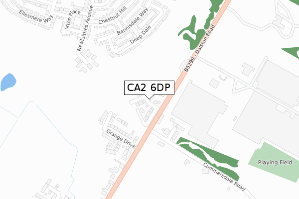
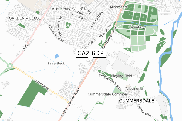
CA2 6DP is located in the Morton electoral ward, within the unitary authority of Cumberland and the English Parliamentary constituency of Carlisle. The Sub Integrated Care Board (ICB) Location is NHS North East and North Cumbria ICB - 01H and the police force is Cumbria. This postcode has been in use since June 2019.


GetTheData
Source: OS Open Zoomstack (Ordnance Survey)
Licence: Open Government Licence (requires attribution)
Attribution: Contains OS data © Crown copyright and database right 2024
Source: Open Postcode Geo
Licence: Open Government Licence (requires attribution)
Attribution: Contains OS data © Crown copyright and database right 2024; Contains Royal Mail data © Royal Mail copyright and database right 2024; Source: Office for National Statistics licensed under the Open Government Licence v.3.0
| Easting | 338396 |
| Northing | 553705 |
| Latitude | 54.874305 |
| Longitude | -2.961555 |
GetTheData
Source: Open Postcode Geo
Licence: Open Government Licence
| Country | England |
| Postcode District | CA2 |
| ➜ CA2 open data dashboard ➜ See where CA2 is on a map ➜ Where is Carlisle? | |
GetTheData
Source: Land Registry Price Paid Data
Licence: Open Government Licence
| Ward | Morton |
| Constituency | Carlisle |
GetTheData
Source: ONS Postcode Database
Licence: Open Government Licence
1, FAIRYBECK GARDENS, CARLISLE, CA2 6DP 2021 25 OCT £300,000 |
3, FAIRYBECK GARDENS, CARLISLE, CA2 6DP 2021 24 SEP £260,000 |
2021 2 SEP £220,000 |
7, FAIRYBECK GARDENS, CARLISLE, CA2 6DP 2021 27 AUG £300,000 |
5, FAIRYBECK GARDENS, CARLISLE, CA2 6DP 2021 29 JUL £275,000 |
9, FAIRYBECK GARDENS, CARLISLE, CA2 6DP 2021 29 JUL £345,000 |
4, FAIRYBECK GARDENS, CARLISLE, CA2 6DP 2021 26 MAR £295,000 |
2, FAIRYBECK GARDENS, CARLISLE, CA2 6DP 2021 25 MAR £250,000 |
11, FAIRYBECK GARDENS, CARLISLE, CA2 6DP 2020 14 DEC £210,000 |
21, FAIRYBECK GARDENS, CARLISLE, CA2 6DP 2020 27 NOV £207,995 |
GetTheData
Source: HM Land Registry Price Paid Data
Licence: Contains HM Land Registry data © Crown copyright and database right 2024. This data is licensed under the Open Government Licence v3.0.
| January 2024 | Criminal damage and arson | On or near Briery Grove | 352m |
| November 2023 | Anti-social behaviour | On or near Briery Grove | 352m |
| November 2023 | Anti-social behaviour | On or near Briery Grove | 352m |
| ➜ Get more crime data in our Crime section | |||
GetTheData
Source: data.police.uk
Licence: Open Government Licence
| Dalston Road (Cummersdale Road) | Cummersdale | 127m |
| Dalston Road (Cummersdale Road) | Cummersdale | 133m |
| Pirelli Factory (Dalston Road) | Dalston Road | 202m |
| Cummersdale Grange (Dalston Road) | Dalston Road | 213m |
| Bannisdale Way (Bannisdale Drive) | Morton Park | 244m |
| Carlisle Station | 2.6km |
| Dalston (Cumbria) Station | 3.6km |
GetTheData
Source: NaPTAN
Licence: Open Government Licence
| Percentage of properties with Next Generation Access | 100.0% |
| Percentage of properties with Superfast Broadband | 100.0% |
| Percentage of properties with Ultrafast Broadband | 0.0% |
| Percentage of properties with Full Fibre Broadband | 0.0% |
Superfast Broadband is between 30Mbps and 300Mbps
Ultrafast Broadband is > 300Mbps
| Percentage of properties unable to receive 2Mbps | 0.0% |
| Percentage of properties unable to receive 5Mbps | 0.0% |
| Percentage of properties unable to receive 10Mbps | 0.0% |
| Percentage of properties unable to receive 30Mbps | 0.0% |
GetTheData
Source: Ofcom
Licence: Ofcom Terms of Use (requires attribution)
GetTheData
Source: ONS Postcode Database
Licence: Open Government Licence


➜ Get more ratings from the Food Standards Agency
GetTheData
Source: Food Standards Agency
Licence: FSA terms & conditions
| Last Collection | |||
|---|---|---|---|
| Location | Mon-Fri | Sat | Distance |
| Cummersdale Road Ends | 17:30 | 09:30 | 343m |
| Chestnut Hill | 17:15 | 12:30 | 344m |
| Morton | 18:30 | 12:15 | 541m |
GetTheData
Source: Dracos
Licence: Creative Commons Attribution-ShareAlike
| Facility | Distance |
|---|---|
| Cummersdale Common The Crescent, Cummersdale, Carlisle Grass Pitches | 542m |
| Cummersdale School Cummersdale, Carlisle Grass Pitches, Outdoor Tennis Courts | 660m |
| Pirelli Sports And Social Club Dalston Road, Carlisle Grass Pitches | 683m |
GetTheData
Source: Active Places
Licence: Open Government Licence
| School | Phase of Education | Distance |
|---|---|---|
| Cummersdale School Cummersdale, Carlisle, CA2 6BD | Primary | 710m |
| Newlaithes Junior School Langrigg Road, Carlisle, CA2 6DX | Primary | 900m |
| Newlaithes Infant School Langrigg Road, Carlisle, CA2 6DX | Primary | 904m |
GetTheData
Source: Edubase
Licence: Open Government Licence
The below table lists the International Territorial Level (ITL) codes (formerly Nomenclature of Territorial Units for Statistics (NUTS) codes) and Local Administrative Units (LAU) codes for CA2 6DP:
| ITL 1 Code | Name |
|---|---|
| TLD | North West (England) |
| ITL 2 Code | Name |
| TLD1 | Cumbria |
| ITL 3 Code | Name |
| TLD12 | East Cumbria |
| LAU 1 Code | Name |
| E07000028 | Carlisle |
GetTheData
Source: ONS Postcode Directory
Licence: Open Government Licence
The below table lists the Census Output Area (OA), Lower Layer Super Output Area (LSOA), and Middle Layer Super Output Area (MSOA) for CA2 6DP:
| Code | Name | |
|---|---|---|
| OA | E00097202 | |
| LSOA | E01019231 | Carlisle 009D |
| MSOA | E02003995 | Carlisle 009 |
GetTheData
Source: ONS Postcode Directory
Licence: Open Government Licence
| CA2 6AU | Irvings Place | 87m |
| CA2 6NN | Millbeck | 213m |
| CA2 6LS | Deepdale Drive | 241m |
| CA2 6AX | Cummersdale Road | 250m |
| CA2 6LR | Bannisdale Way | 271m |
| CA2 6LW | Chestnut Hill | 325m |
| CA2 6BX | Dalston Road | 336m |
| CA2 6LL | Briery Grove | 347m |
| CA2 6LX | Irton Place | 356m |
| CA2 6HT | Winscale Way | 390m |
GetTheData
Source: Open Postcode Geo; Land Registry Price Paid Data
Licence: Open Government Licence