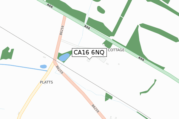
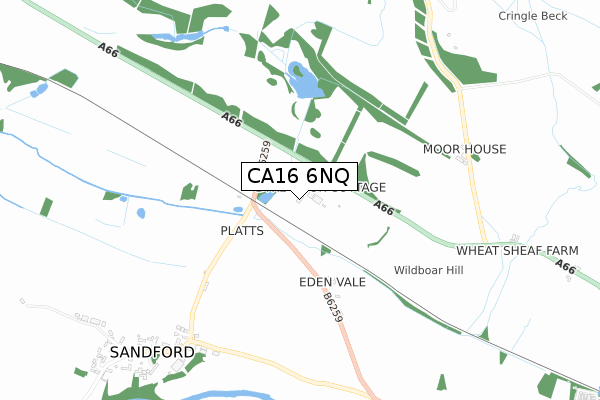
CA16 6NQ is located in the Appleby and Brough electoral ward, within the unitary authority of Westmorland and Furness and the English Parliamentary constituency of Penrith and The Border. The Sub Integrated Care Board (ICB) Location is NHS North East and North Cumbria ICB - 01H and the police force is Cumbria. This postcode has been in use since July 2019.


GetTheData
Source: OS Open Zoomstack (Ordnance Survey)
Licence: Open Government Licence (requires attribution)
Attribution: Contains OS data © Crown copyright and database right 2024
Source: Open Postcode Geo
Licence: Open Government Licence (requires attribution)
Attribution: Contains OS data © Crown copyright and database right 2024; Contains Royal Mail data © Royal Mail copyright and database right 2024; Source: Office for National Statistics licensed under the Open Government Licence v.3.0
| Easting | 373594 |
| Northing | 516801 |
| Latitude | 54.545779 |
| Longitude | -2.409705 |
GetTheData
Source: Open Postcode Geo
Licence: Open Government Licence
| Country | England |
| Postcode District | CA16 |
| ➜ CA16 open data dashboard ➜ See where CA16 is on a map | |
GetTheData
Source: Land Registry Price Paid Data
Licence: Open Government Licence
| Ward | Appleby And Brough |
| Constituency | Penrith And The Border |
GetTheData
Source: ONS Postcode Database
Licence: Open Government Licence
| Community Hall (Unnamed Road) | Sandford | 740m |
| Community Hall (Unnamed Road) | Sandford | 746m |
| Shelter (Castlehill Road) | Warcop | 1,786m |
| Shelter (Castlehill Road) | Warcop | 1,794m |
| Appleby Station | 6.3km |
GetTheData
Source: NaPTAN
Licence: Open Government Licence
GetTheData
Source: ONS Postcode Database
Licence: Open Government Licence


➜ Get more ratings from the Food Standards Agency
GetTheData
Source: Food Standards Agency
Licence: FSA terms & conditions
| Last Collection | |||
|---|---|---|---|
| Location | Mon-Fri | Sat | Distance |
| Sandford | 16:15 | 07:30 | 922m |
| Warcop Village | 16:15 | 08:30 | 1,780m |
| Warcop | 16:15 | 08:30 | 1,820m |
GetTheData
Source: Dracos
Licence: Creative Commons Attribution-ShareAlike
| Facility | Distance |
|---|---|
| Appleby Golf Club Brackenber, Appleby-in-westmorland Golf | 3.4km |
GetTheData
Source: Active Places
Licence: Open Government Licence
| School | Phase of Education | Distance |
|---|---|---|
| Warcop CofE Primary School Warcop, Appleby-in-Westmorland, CA16 6NX | Primary | 1.4km |
| Appleby Primary School Station Road, Appleby-in-Westmorland, CA16 6TX | Primary | 6.3km |
GetTheData
Source: Edubase
Licence: Open Government Licence
The below table lists the International Territorial Level (ITL) codes (formerly Nomenclature of Territorial Units for Statistics (NUTS) codes) and Local Administrative Units (LAU) codes for CA16 6NQ:
| ITL 1 Code | Name |
|---|---|
| TLD | North West (England) |
| ITL 2 Code | Name |
| TLD1 | Cumbria |
| ITL 3 Code | Name |
| TLD12 | East Cumbria |
| LAU 1 Code | Name |
| E07000030 | Eden |
GetTheData
Source: ONS Postcode Directory
Licence: Open Government Licence
The below table lists the Census Output Area (OA), Lower Layer Super Output Area (LSOA), and Middle Layer Super Output Area (MSOA) for CA16 6NQ:
| Code | Name | |
|---|---|---|
| OA | E00097745 | |
| LSOA | E01019340 | Eden 007E |
| MSOA | E02004014 | Eden 007 |
GetTheData
Source: ONS Postcode Directory
Licence: Open Government Licence
| CA16 6NS | 95m | |
| CA16 6NR | 970m | |
| CA16 6NP | 1194m | |
| CA16 6NX | 1682m | |
| CA16 6PH | The Croft | 1776m |
| CA16 6PF | 1795m | |
| CA16 6PD | 1801m | |
| CA16 6PB | 1806m | |
| CA16 6PG | Chapel Garth | 1818m |
| CA16 6PJ | Shoregill | 1819m |
GetTheData
Source: Open Postcode Geo; Land Registry Price Paid Data
Licence: Open Government Licence