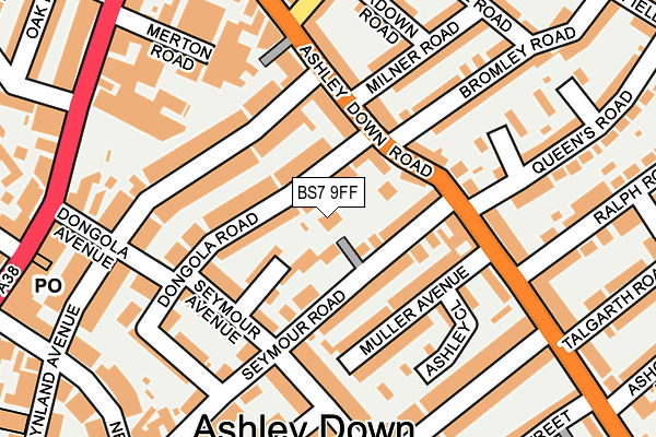
BS7 9FF is located in the Lockleaze electoral ward, within the unitary authority of Bristol, City of and the English Parliamentary constituency of Bristol North West. The Sub Integrated Care Board (ICB) Location is NHS Bristol, North Somerset and South Gloucestershire ICB - 15C and the police force is Avon and Somerset. This postcode has been in use since July 2017.


GetTheData
Source: OS OpenMap – Local (Ordnance Survey)
Source: OS VectorMap District (Ordnance Survey)
Licence: Open Government Licence (requires attribution)
| Easting | 360414 |
| Northing | 176143 |
| Latitude | 51.482845 |
| Longitude | -2.571463 |
GetTheData
Source: Open Postcode Geo
Licence: Open Government Licence
| Country | England |
| Postcode District | BS7 |
| ➜ BS7 open data dashboard ➜ See where BS7 is on a map ➜ Where is Bristol? | |
GetTheData
Source: Land Registry Price Paid Data
Licence: Open Government Licence
| Ward | Lockleaze |
| Constituency | Bristol North West |
GetTheData
Source: ONS Postcode Database
Licence: Open Government Licence
| June 2022 | Anti-social behaviour | On or near Downman Road | 80m |
| June 2022 | Violence and sexual offences | On or near Downman Road | 80m |
| June 2022 | Anti-social behaviour | On or near Morris Road | 87m |
| ➜ Get more crime data in our Crime section | |||
GetTheData
Source: data.police.uk
Licence: Open Government Licence
| Morris Road (Romney Avenue) | Lockleaze | 62m |
| Morris Road (Shaldon Road) | Lockleaze | 109m |
| Orpen Gardens (Romney Avenue) | Lockleaze | 121m |
| Orpen Gardens (Romney Avenue) | Lockleaze | 291m |
| Shaldon Road | Horfield | 378m |
| Stapleton Road Station | 1.7km |
| Montpelier Station | 2km |
| Redland Station | 2.5km |
GetTheData
Source: NaPTAN
Licence: Open Government Licence
| Percentage of properties with Next Generation Access | 100.0% |
| Percentage of properties with Superfast Broadband | 100.0% |
| Percentage of properties with Ultrafast Broadband | 0.0% |
| Percentage of properties with Full Fibre Broadband | 0.0% |
Superfast Broadband is between 30Mbps and 300Mbps
Ultrafast Broadband is > 300Mbps
| Percentage of properties unable to receive 2Mbps | 0.0% |
| Percentage of properties unable to receive 5Mbps | 0.0% |
| Percentage of properties unable to receive 10Mbps | 0.0% |
| Percentage of properties unable to receive 30Mbps | 0.0% |
GetTheData
Source: Ofcom
Licence: Ofcom Terms of Use (requires attribution)
GetTheData
Source: ONS Postcode Database
Licence: Open Government Licence


➜ Get more ratings from the Food Standards Agency
GetTheData
Source: Food Standards Agency
Licence: FSA terms & conditions
| Last Collection | |||
|---|---|---|---|
| Location | Mon-Fri | Sat | Distance |
| Danby House Post Office | 17:30 | 12:00 | 88m |
| Romney Avenue | 17:30 | 12:00 | 332m |
| Stottbury Road | 17:30 | 12:00 | 533m |
GetTheData
Source: Dracos
Licence: Creative Commons Attribution-ShareAlike
| Facility | Distance |
|---|---|
| Trinity Academy Bristol Romney Avenue, Bristol Artificial Grass Pitch, Sports Hall | 533m |
| St Thomas More Catholic Secondary School (Closed) Stottbury Road, Bristol Sports Hall | 637m |
| Fairfield High School (Muller Road Recreation Ground) Muller Road, Horfield, Bristol Grass Pitches | 691m |
GetTheData
Source: Active Places
Licence: Open Government Licence
| School | Phase of Education | Distance |
|---|---|---|
| Trinity Academy Romney Avenue, Lockleaze, Bristol, BS7 9BY | Secondary | 699m |
| Stoke Park Primary School Brangwyn Grove, Lockleaze, Bristol, BS7 9BY | Primary | 702m |
| Glenfrome Primary School Cottisford Road, Eastville, Bristol, BS5 6TY | Primary | 729m |
GetTheData
Source: Edubase
Licence: Open Government Licence
The below table lists the International Territorial Level (ITL) codes (formerly Nomenclature of Territorial Units for Statistics (NUTS) codes) and Local Administrative Units (LAU) codes for BS7 9FF:
| ITL 1 Code | Name |
|---|---|
| TLK | South West (England) |
| ITL 2 Code | Name |
| TLK1 | Gloucestershire, Wiltshire and Bath/Bristol area |
| ITL 3 Code | Name |
| TLK11 | Bristol, City of |
| LAU 1 Code | Name |
| E06000023 | Bristol, City of |
GetTheData
Source: ONS Postcode Directory
Licence: Open Government Licence
The below table lists the Census Output Area (OA), Lower Layer Super Output Area (LSOA), and Middle Layer Super Output Area (MSOA) for BS7 9FF:
| Code | Name | |
|---|---|---|
| OA | E00074049 | |
| LSOA | E01014664 | Bristol 014C |
| MSOA | E02003025 | Bristol 014 |
GetTheData
Source: ONS Postcode Directory
Licence: Open Government Licence
| BS7 9TZ | Downman Road | 44m |
| BS7 9TN | Romney Avenue | 83m |
| BS7 9TY | Downman Road | 108m |
| BS7 9TT | Morris Road | 130m |
| BS7 9ST | Romney Avenue | 140m |
| BS7 9TU | Morris Road | 200m |
| BS7 9NP | Lindsay Road | 234m |
| BS7 9NW | Shaldon Road | 246m |
| BS7 9SS | Romney Avenue | 257m |
| BS7 9NN | Shaldon Road | 265m |
GetTheData
Source: Open Postcode Geo; Land Registry Price Paid Data
Licence: Open Government Licence