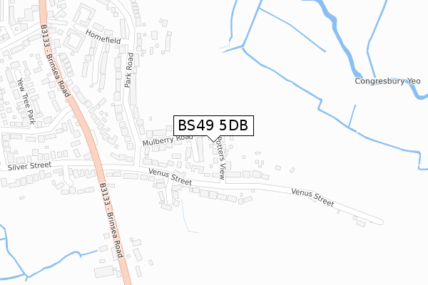
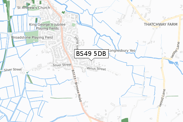
BS49 5DB is located in the Congresbury & Puxton electoral ward, within the unitary authority of North Somerset and the English Parliamentary constituency of Weston-Super-Mare. The Sub Integrated Care Board (ICB) Location is NHS Bristol, North Somerset and South Gloucestershire ICB - 15C and the police force is Avon and Somerset. This postcode has been in use since November 2017.


GetTheData
Source: OS Open Zoomstack (Ordnance Survey)
Licence: Open Government Licence (requires attribution)
Attribution: Contains OS data © Crown copyright and database right 2024
Source: Open Postcode Geo
Licence: Open Government Licence (requires attribution)
Attribution: Contains OS data © Crown copyright and database right 2024; Contains Royal Mail data © Royal Mail copyright and database right 2024; Source: Office for National Statistics licensed under the Open Government Licence v.3.0
| Easting | 344326 |
| Northing | 163017 |
| Latitude | 51.363473 |
| Longitude | -2.801059 |
GetTheData
Source: Open Postcode Geo
Licence: Open Government Licence
| Country | England |
| Postcode District | BS49 |
| ➜ BS49 open data dashboard ➜ See where BS49 is on a map ➜ Where is Congresbury? | |
GetTheData
Source: Land Registry Price Paid Data
Licence: Open Government Licence
| Ward | Congresbury & Puxton |
| Constituency | Weston-super-mare |
GetTheData
Source: ONS Postcode Database
Licence: Open Government Licence
2023 11 AUG £520,000 |
2022 29 JUN £409,950 |
2022 16 FEB £415,000 |
2020 31 JUL £460,000 |
2020 30 JUL £379,000 |
8, POTTERS VIEW, CONGRESBURY, BRISTOL, BS49 5DB 2018 30 AUG £565,000 |
5, POTTERS VIEW, CONGRESBURY, BRISTOL, BS49 5DB 2018 24 AUG £445,000 |
12, POTTERS VIEW, CONGRESBURY, BRISTOL, BS49 5DB 2018 24 AUG £445,000 |
2018 21 AUG £375,000 |
2018 20 JUL £455,000 |
GetTheData
Source: HM Land Registry Price Paid Data
Licence: Contains HM Land Registry data © Crown copyright and database right 2024. This data is licensed under the Open Government Licence v3.0.
| June 2022 | Violence and sexual offences | On or near Homefield | 356m |
| June 2022 | Anti-social behaviour | On or near Homefield | 356m |
| June 2022 | Anti-social behaviour | On or near Homefield | 356m |
| ➜ Get more crime data in our Crime section | |||
GetTheData
Source: data.police.uk
Licence: Open Government Licence
| Venus Street (Mulberry Road) | Iwood | 96m |
| Venus Street (Nomis Park) | Iwood | 112m |
| Yew Tree Park | Congresbury | 311m |
| Yew Tree Park | Congresbury | 326m |
| Mill Lane | Congresbury | 693m |
| Yatton Station | 3.6km |
GetTheData
Source: NaPTAN
Licence: Open Government Licence
➜ Broadband speed and availability dashboard for BS49 5DB
| Percentage of properties with Next Generation Access | 100.0% |
| Percentage of properties with Superfast Broadband | 100.0% |
| Percentage of properties with Ultrafast Broadband | 0.0% |
| Percentage of properties with Full Fibre Broadband | 0.0% |
Superfast Broadband is between 30Mbps and 300Mbps
Ultrafast Broadband is > 300Mbps
| Median download speed | 36.7Mbps |
| Average download speed | 32.7Mbps |
| Maximum download speed | 64.14Mbps |
| Median upload speed | 9.8Mbps |
| Average upload speed | 8.2Mbps |
| Maximum upload speed | 19.09Mbps |
| Percentage of properties unable to receive 2Mbps | 0.0% |
| Percentage of properties unable to receive 5Mbps | 0.0% |
| Percentage of properties unable to receive 10Mbps | 0.0% |
| Percentage of properties unable to receive 30Mbps | 0.0% |
➜ Broadband speed and availability dashboard for BS49 5DB
GetTheData
Source: Ofcom
Licence: Ofcom Terms of Use (requires attribution)
GetTheData
Source: ONS Postcode Database
Licence: Open Government Licence


➜ Get more ratings from the Food Standards Agency
GetTheData
Source: Food Standards Agency
Licence: FSA terms & conditions
| Last Collection | |||
|---|---|---|---|
| Location | Mon-Fri | Sat | Distance |
| Congresbury Post Office | 17:15 | 11:15 | 521m |
| Broad Street | 17:30 | 09:00 | 1,007m |
| Rhodyate | 15:45 | 09:00 | 1,457m |
GetTheData
Source: Dracos
Licence: Creative Commons Attribution-ShareAlike
| Facility | Distance |
|---|---|
| Congresbury Cricket Club Stonewell Drive, Congresbury, Bristol Grass Pitches, Outdoor Tennis Courts | 793m |
| Broadstone Playing Field Stonewell Park Road, Congresbury Grass Pitches | 830m |
| St Andrews Church Of England Primary School Station Road, Congresbury, Bristol Grass Pitches | 1.2km |
GetTheData
Source: Active Places
Licence: Open Government Licence
| School | Phase of Education | Distance |
|---|---|---|
| St Andrew's CofE Primary School Station Road, Congresbury, Bristol, BS49 5DX | Primary | 1.3km |
| Churchill Church of England Primary School Pudding Pie Lane, Langford, Bristol, BS40 5EL | Primary | 2.7km |
| Yatton Infant School High Street, Yatton, Bristol, BS49 4HJ | Primary | 2.8km |
GetTheData
Source: Edubase
Licence: Open Government Licence
The below table lists the International Territorial Level (ITL) codes (formerly Nomenclature of Territorial Units for Statistics (NUTS) codes) and Local Administrative Units (LAU) codes for BS49 5DB:
| ITL 1 Code | Name |
|---|---|
| TLK | South West (England) |
| ITL 2 Code | Name |
| TLK1 | Gloucestershire, Wiltshire and Bath/Bristol area |
| ITL 3 Code | Name |
| TLK12 | Bath and North East Somerset, North Somerset and South Gloucestershire |
| LAU 1 Code | Name |
| E06000024 | North Somerset |
GetTheData
Source: ONS Postcode Directory
Licence: Open Government Licence
The below table lists the Census Output Area (OA), Lower Layer Super Output Area (LSOA), and Middle Layer Super Output Area (MSOA) for BS49 5DB:
| Code | Name | |
|---|---|---|
| OA | E00074586 | |
| LSOA | E01014765 | North Somerset 014B |
| MSOA | E02003078 | North Somerset 014 |
GetTheData
Source: ONS Postcode Directory
Licence: Open Government Licence
| BS49 5HD | Mulberry Road | 90m |
| BS49 5HA | Venus Street | 112m |
| BS49 5EZ | Venus Street | 122m |
| BS49 5HB | Nomis Park | 177m |
| BS49 5HE | Park Road | 226m |
| BS49 5HH | Park Road | 247m |
| BS49 5JH | Brinsea Road | 277m |
| BS49 5HQ | Dickensons Grove | 318m |
| BS49 5EX | Silver Mead | 351m |
| BS49 5HG | Homefield | 373m |
GetTheData
Source: Open Postcode Geo; Land Registry Price Paid Data
Licence: Open Government Licence