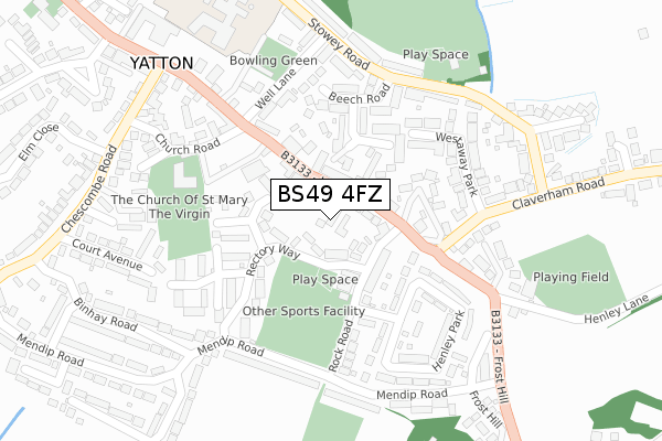
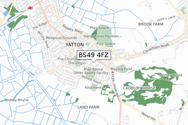
BS49 4FZ is located in the Yatton electoral ward, within the unitary authority of North Somerset and the English Parliamentary constituency of North Somerset. The Sub Integrated Care Board (ICB) Location is NHS Bristol, North Somerset and South Gloucestershire ICB - 15C and the police force is Avon and Somerset. This postcode has been in use since July 2019.


GetTheData
Source: OS Open Zoomstack (Ordnance Survey)
Licence: Open Government Licence (requires attribution)
Attribution: Contains OS data © Crown copyright and database right 2024
Source: Open Postcode Geo
Licence: Open Government Licence (requires attribution)
Attribution: Contains OS data © Crown copyright and database right 2024; Contains Royal Mail data © Royal Mail copyright and database right 2024; Source: Office for National Statistics licensed under the Open Government Licence v.3.0
| Easting | 343353 |
| Northing | 165357 |
| Latitude | 51.384416 |
| Longitude | -2.815407 |
GetTheData
Source: Open Postcode Geo
Licence: Open Government Licence
| Country | England |
| Postcode District | BS49 |
| ➜ BS49 open data dashboard ➜ See where BS49 is on a map ➜ Where is Yatton? | |
GetTheData
Source: Land Registry Price Paid Data
Licence: Open Government Licence
| Ward | Yatton |
| Constituency | North Somerset |
GetTheData
Source: ONS Postcode Database
Licence: Open Government Licence
| December 2023 | Criminal damage and arson | On or near Parking Area | 189m |
| September 2023 | Anti-social behaviour | On or near Parking Area | 189m |
| June 2022 | Anti-social behaviour | On or near Rock Road | 125m |
| ➜ Get more crime data in our Crime section | |||
GetTheData
Source: data.police.uk
Licence: Open Government Licence
| Westaway Close (High Street) | Frost Hill | 117m |
| Westaway Close (High Street) | Frost Hill | 125m |
| Henley Lodge (High Street) | Yatton | 204m |
| Henley Lodge (Frost Hill) | Yatton | 305m |
| Chescombe Road (High Street) | Yatton | 340m |
| Yatton Station | 1.1km |
| Nailsea & Backwell Station | 6km |
GetTheData
Source: NaPTAN
Licence: Open Government Licence
| Percentage of properties with Next Generation Access | 100.0% |
| Percentage of properties with Superfast Broadband | 100.0% |
| Percentage of properties with Ultrafast Broadband | 0.0% |
| Percentage of properties with Full Fibre Broadband | 0.0% |
Superfast Broadband is between 30Mbps and 300Mbps
Ultrafast Broadband is > 300Mbps
| Percentage of properties unable to receive 2Mbps | 0.0% |
| Percentage of properties unable to receive 5Mbps | 0.0% |
| Percentage of properties unable to receive 10Mbps | 0.0% |
| Percentage of properties unable to receive 30Mbps | 0.0% |
GetTheData
Source: Ofcom
Licence: Ofcom Terms of Use (requires attribution)
GetTheData
Source: ONS Postcode Database
Licence: Open Government Licence


➜ Get more ratings from the Food Standards Agency
GetTheData
Source: Food Standards Agency
Licence: FSA terms & conditions
| Last Collection | |||
|---|---|---|---|
| Location | Mon-Fri | Sat | Distance |
| Yatton Post Office | 17:45 | 11:15 | 421m |
| High Street | 17:00 | 08:30 | 814m |
| Yatton Station | 17:00 | 08:30 | 1,129m |
GetTheData
Source: Dracos
Licence: Creative Commons Attribution-ShareAlike
| Facility | Distance |
|---|---|
| Rock Road Playing Fields Rock Road, Yatton , Bristol Grass Pitches, Artificial Grass Pitch | 113m |
| Yatton Village Hall The Causeway, Yatton, Bristol Sports Hall | 138m |
| Hangstones Sports Ground Stowey Road, Yatton Grass Pitches | 317m |
GetTheData
Source: Active Places
Licence: Open Government Licence
| School | Phase of Education | Distance |
|---|---|---|
| Yatton Infant School High Street, Yatton, Bristol, BS49 4HJ | Primary | 285m |
| Yatton Church of England Junior School High Street, Yatton, Bristol, BS49 4HJ | Primary | 365m |
| St Andrew's CofE Primary School Station Road, Congresbury, Bristol, BS49 5DX | Primary | 1.5km |
GetTheData
Source: Edubase
Licence: Open Government Licence
The below table lists the International Territorial Level (ITL) codes (formerly Nomenclature of Territorial Units for Statistics (NUTS) codes) and Local Administrative Units (LAU) codes for BS49 4FZ:
| ITL 1 Code | Name |
|---|---|
| TLK | South West (England) |
| ITL 2 Code | Name |
| TLK1 | Gloucestershire, Wiltshire and Bath/Bristol area |
| ITL 3 Code | Name |
| TLK12 | Bath and North East Somerset, North Somerset and South Gloucestershire |
| LAU 1 Code | Name |
| E06000024 | North Somerset |
GetTheData
Source: ONS Postcode Directory
Licence: Open Government Licence
The below table lists the Census Output Area (OA), Lower Layer Super Output Area (LSOA), and Middle Layer Super Output Area (MSOA) for BS49 4FZ:
| Code | Name | |
|---|---|---|
| OA | E00075075 | |
| LSOA | E01014857 | North Somerset 012C |
| MSOA | E02003076 | North Somerset 012 |
GetTheData
Source: ONS Postcode Directory
Licence: Open Government Licence
| BS49 4JD | High Street | 37m |
| BS49 4JF | Rectory Way | 49m |
| BS49 4JA | High Street | 75m |
| BS49 4JE | Rock Road | 113m |
| BS49 4HG | Church Close | 136m |
| BS49 4HL | The Causeway | 138m |
| BS49 4HZ | Barnards Close | 145m |
| BS49 4JS | Westaway Close | 162m |
| BS49 4HQ | Rectory Way | 167m |
| BS49 4JH | Henley Park | 181m |
GetTheData
Source: Open Postcode Geo; Land Registry Price Paid Data
Licence: Open Government Licence