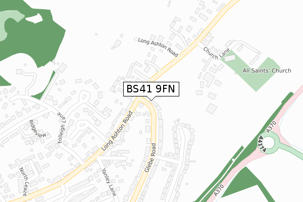
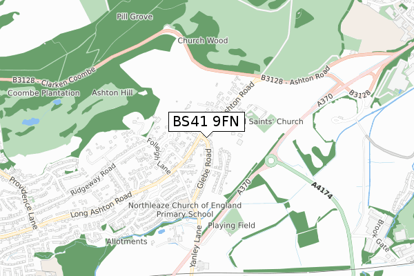
BS41 9FN is located in the Long Ashton electoral ward, within the unitary authority of North Somerset and the English Parliamentary constituency of North Somerset. The Sub Integrated Care Board (ICB) Location is NHS Bristol, North Somerset and South Gloucestershire ICB - 15C and the police force is Avon and Somerset. This postcode has been in use since December 2017.


GetTheData
Source: OS Open Zoomstack (Ordnance Survey)
Licence: Open Government Licence (requires attribution)
Attribution: Contains OS data © Crown copyright and database right 2024
Source: Open Postcode Geo
Licence: Open Government Licence (requires attribution)
Attribution: Contains OS data © Crown copyright and database right 2024; Contains Royal Mail data © Royal Mail copyright and database right 2024; Source: Office for National Statistics licensed under the Open Government Licence v.3.0
| Easting | 355081 |
| Northing | 170813 |
| Latitude | 51.434523 |
| Longitude | -2.647580 |
GetTheData
Source: Open Postcode Geo
Licence: Open Government Licence
| Country | England |
| Postcode District | BS41 |
| ➜ BS41 open data dashboard ➜ See where BS41 is on a map ➜ Where is Long Ashton? | |
GetTheData
Source: Land Registry Price Paid Data
Licence: Open Government Licence
| Ward | Long Ashton |
| Constituency | North Somerset |
GetTheData
Source: ONS Postcode Database
Licence: Open Government Licence
2023 24 FEB £520,000 |
2018 5 OCT £429,950 |
GetTheData
Source: HM Land Registry Price Paid Data
Licence: Contains HM Land Registry data © Crown copyright and database right 2024. This data is licensed under the Open Government Licence v3.0.
| June 2022 | Vehicle crime | On or near Hillside Road | 231m |
| June 2022 | Violence and sexual offences | On or near Church Lane | 302m |
| June 2022 | Violence and sexual offences | On or near Church Lane | 302m |
| ➜ Get more crime data in our Crime section | |||
GetTheData
Source: data.police.uk
Licence: Open Government Licence
| Glebe Close (Long Ashton Road) | Long Ashton | 47m |
| Glebe Close (Long Ashton Road) | Long Ashton | 62m |
| Angel Inn (Long Ashton Road) | Long Ashton | 316m |
| Angel Inn (Long Ashton Road) | Long Ashton | 338m |
| Theynes Croft (Long Ashton Road) | Long Ashton | 417m |
| Parson Street Station | 2.8km |
| Bedminster Station | 3.8km |
| Clifton Down Station | 4.2km |
GetTheData
Source: NaPTAN
Licence: Open Government Licence
| Percentage of properties with Next Generation Access | 0.0% |
| Percentage of properties with Superfast Broadband | 0.0% |
| Percentage of properties with Ultrafast Broadband | 0.0% |
| Percentage of properties with Full Fibre Broadband | 0.0% |
Superfast Broadband is between 30Mbps and 300Mbps
Ultrafast Broadband is > 300Mbps
| Median download speed | 23.4Mbps |
| Average download speed | 22.7Mbps |
| Maximum download speed | 23.44Mbps |
| Median upload speed | 1.2Mbps |
| Average upload speed | 1.2Mbps |
| Maximum upload speed | 1.28Mbps |
| Percentage of properties unable to receive 2Mbps | 0.0% |
| Percentage of properties unable to receive 5Mbps | 0.0% |
| Percentage of properties unable to receive 10Mbps | 0.0% |
| Percentage of properties unable to receive 30Mbps | 100.0% |
GetTheData
Source: Ofcom
Licence: Ofcom Terms of Use (requires attribution)
GetTheData
Source: ONS Postcode Database
Licence: Open Government Licence


➜ Get more ratings from the Food Standards Agency
GetTheData
Source: Food Standards Agency
Licence: FSA terms & conditions
| Last Collection | |||
|---|---|---|---|
| Location | Mon-Fri | Sat | Distance |
| Wycke | 17:00 | 09:15 | 206m |
| Chestnut Road | 17:00 | 09:00 | 630m |
| The Village | 16:45 | 09:00 | 908m |
GetTheData
Source: Dracos
Licence: Creative Commons Attribution-ShareAlike
| Facility | Distance |
|---|---|
| Northleaze Primary School Brook Close, Long Ashton, Bristol Grass Pitches | 480m |
| Long Ashton Cricket Club Parsonage Road, Long Ashton, Bristol Grass Pitches | 550m |
| David Lloyd (Bristol Long Ashton) Ashton Road, Bristol Sports Hall, Swimming Pool, Health and Fitness Gym, Indoor Tennis Centre, Studio, Squash Courts, Outdoor Tennis Courts | 1.2km |
GetTheData
Source: Active Places
Licence: Open Government Licence
| School | Phase of Education | Distance |
|---|---|---|
| Northleaze Church of England Primary School Brook Close, Long Ashton, Bristol, BS41 9NG | Primary | 494m |
| Birdwell Primary School Hollis Close, Long Ashton, Bristol, BS41 9AZ | Primary | 1.3km |
| Ashton Park School Blackmoor's Lane, Bower Ashton, Bristol, BS3 2JL | Secondary | 1.4km |
GetTheData
Source: Edubase
Licence: Open Government Licence
The below table lists the International Territorial Level (ITL) codes (formerly Nomenclature of Territorial Units for Statistics (NUTS) codes) and Local Administrative Units (LAU) codes for BS41 9FN:
| ITL 1 Code | Name |
|---|---|
| TLK | South West (England) |
| ITL 2 Code | Name |
| TLK1 | Gloucestershire, Wiltshire and Bath/Bristol area |
| ITL 3 Code | Name |
| TLK12 | Bath and North East Somerset, North Somerset and South Gloucestershire |
| LAU 1 Code | Name |
| E06000024 | North Somerset |
GetTheData
Source: ONS Postcode Directory
Licence: Open Government Licence
The below table lists the Census Output Area (OA), Lower Layer Super Output Area (LSOA), and Middle Layer Super Output Area (MSOA) for BS41 9FN:
| Code | Name | |
|---|---|---|
| OA | E00075032 | |
| LSOA | E01014850 | North Somerset 006C |
| MSOA | E02003070 | North Somerset 006 |
GetTheData
Source: ONS Postcode Directory
Licence: Open Government Licence
| BS41 9JE | Long Ashton Road | 103m |
| BS41 9JP | Beechfield Close | 126m |
| BS41 9DB | Glebe Close | 134m |
| BS41 9LS | Long Ashton Road | 140m |
| BS41 9JG | Hobwell Lane | 142m |
| BS41 9LL | Parsonage Road | 168m |
| BS41 9JD | Folleigh Drive | 179m |
| BS41 9LJ | Glebe Road | 199m |
| BS41 9LH | Glebe Road | 221m |
| BS41 9LG | Hillside Road | 227m |
GetTheData
Source: Open Postcode Geo; Land Registry Price Paid Data
Licence: Open Government Licence