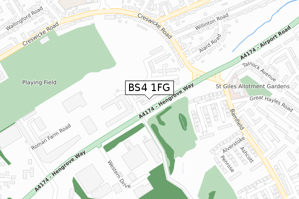
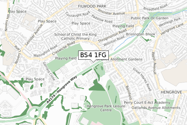
BS4 1FG is located in the Filwood electoral ward, within the unitary authority of Bristol, City of and the English Parliamentary constituency of Bristol South. The Sub Integrated Care Board (ICB) Location is NHS Bristol, North Somerset and South Gloucestershire ICB - 15C and the police force is Avon and Somerset. This postcode has been in use since May 2019.


GetTheData
Source: OS Open Zoomstack (Ordnance Survey)
Licence: Open Government Licence (requires attribution)
Attribution: Contains OS data © Crown copyright and database right 2024
Source: Open Postcode Geo
Licence: Open Government Licence (requires attribution)
Attribution: Contains OS data © Crown copyright and database right 2024; Contains Royal Mail data © Royal Mail copyright and database right 2024; Source: Office for National Statistics licensed under the Open Government Licence v.3.0
| Easting | 359545 |
| Northing | 169227 |
| Latitude | 51.420601 |
| Longitude | -2.583182 |
GetTheData
Source: Open Postcode Geo
Licence: Open Government Licence
| Country | England |
| Postcode District | BS4 |
| ➜ BS4 open data dashboard ➜ See where BS4 is on a map ➜ Where is Bristol? | |
GetTheData
Source: Land Registry Price Paid Data
Licence: Open Government Licence
| Ward | Filwood |
| Constituency | Bristol South |
GetTheData
Source: ONS Postcode Database
Licence: Open Government Licence
| June 2022 | Violence and sexual offences | On or near Bamfield | 203m |
| June 2022 | Violence and sexual offences | On or near Bamfield | 203m |
| June 2022 | Criminal damage and arson | On or near Bamfield | 203m |
| ➜ Get more crime data in our Crime section | |||
GetTheData
Source: data.police.uk
Licence: Open Government Licence
| Airport Road (Creswicke Road) | Filwood Park | 171m |
| Airport Road (Creswicke Road) | Filwood Park | 204m |
| Bideford Crescent (Throgmorton Road) | Filwood Park | 285m |
| Alverstoke (Bamfield) | Hengrove Park | 299m |
| Filwood Broadway (Creswicke Road) | Inn's Court | 320m |
| Parson Street Station | 2.2km |
| Bedminster Station | 2.3km |
| Bristol Temple Meads Station | 3.2km |
GetTheData
Source: NaPTAN
Licence: Open Government Licence
| Percentage of properties with Next Generation Access | 100.0% |
| Percentage of properties with Superfast Broadband | 100.0% |
| Percentage of properties with Ultrafast Broadband | 100.0% |
| Percentage of properties with Full Fibre Broadband | 100.0% |
Superfast Broadband is between 30Mbps and 300Mbps
Ultrafast Broadband is > 300Mbps
| Percentage of properties unable to receive 2Mbps | 0.0% |
| Percentage of properties unable to receive 5Mbps | 0.0% |
| Percentage of properties unable to receive 10Mbps | 0.0% |
| Percentage of properties unable to receive 30Mbps | 0.0% |
GetTheData
Source: Ofcom
Licence: Ofcom Terms of Use (requires attribution)
GetTheData
Source: ONS Postcode Database
Licence: Open Government Licence

➜ Get more ratings from the Food Standards Agency
GetTheData
Source: Food Standards Agency
Licence: FSA terms & conditions
| Last Collection | |||
|---|---|---|---|
| Location | Mon-Fri | Sat | Distance |
| Throgmorton Road | 16:00 | 12:00 | 468m |
| Fanshawe Road | 16:15 | 12:00 | 723m |
| Leinster Avenue | 17:00 | 12:45 | 853m |
GetTheData
Source: Dracos
Licence: Creative Commons Attribution-ShareAlike
| Facility | Distance |
|---|---|
| Filwood Park Playing Fields Creswicke Road, Knowle, Bristol Grass Pitches | 359m |
| Filwood Swimming Pool (Closed) Filwood Broadway, Bristol Swimming Pool | 381m |
| Ilminster Avenue E-act Academy Ilminster Avenue, Bristol Sports Hall, Grass Pitches | 763m |
GetTheData
Source: Active Places
Licence: Open Government Licence
| School | Phase of Education | Distance |
|---|---|---|
| School of Christ The King Catholic Primary Hartcliffe Road, Filwood Park, Bristol, BS4 1HD | Primary | 437m |
| Ilminster Avenue Nursery School Ilminster Avenue, Knowle West, Bristol, BS4 1BX | Nursery | 774m |
| Ilminster Avenue E-ACT Academy Ilminster Avenue, Knowle West, Avon, Bristol, BS4 1BX | Primary | 774m |
GetTheData
Source: Edubase
Licence: Open Government Licence
The below table lists the International Territorial Level (ITL) codes (formerly Nomenclature of Territorial Units for Statistics (NUTS) codes) and Local Administrative Units (LAU) codes for BS4 1FG:
| ITL 1 Code | Name |
|---|---|
| TLK | South West (England) |
| ITL 2 Code | Name |
| TLK1 | Gloucestershire, Wiltshire and Bath/Bristol area |
| ITL 3 Code | Name |
| TLK11 | Bristol, City of |
| LAU 1 Code | Name |
| E06000023 | Bristol, City of |
GetTheData
Source: ONS Postcode Directory
Licence: Open Government Licence
The below table lists the Census Output Area (OA), Lower Layer Super Output Area (LSOA), and Middle Layer Super Output Area (MSOA) for BS4 1FG:
| Code | Name | |
|---|---|---|
| OA | E00073661 | |
| LSOA | E01014583 | Bristol 044B |
| MSOA | E02003055 | Bristol 044 |
GetTheData
Source: ONS Postcode Directory
Licence: Open Government Licence
| BS14 0AD | Rowberrow | 179m |
| BS14 0AA | Heatherdene | 195m |
| BS4 1UE | Creswicke Road | 197m |
| BS4 1UJ | Roman Farm Road | 253m |
| BS14 0AB | Pinecroft | 270m |
| BS4 1HZ | Alard Road | 273m |
| BS4 1UD | Creswicke Road | 285m |
| BS14 0AE | Alverstoke | 288m |
| BS4 1HL | Throgmorton Road | 293m |
| BS4 1HY | Willinton Road | 295m |
GetTheData
Source: Open Postcode Geo; Land Registry Price Paid Data
Licence: Open Government Licence