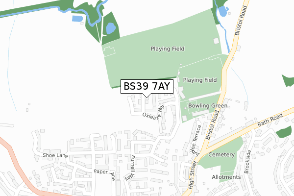
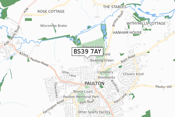
BS39 7AY is located in the Paulton electoral ward, within the unitary authority of Bath and North East Somerset and the English Parliamentary constituency of North East Somerset. The Sub Integrated Care Board (ICB) Location is NHS Bath and North East Somerset, Swindon and Wiltshire ICB - 92 and the police force is Avon and Somerset. This postcode has been in use since June 2019.


GetTheData
Source: OS Open Zoomstack (Ordnance Survey)
Licence: Open Government Licence (requires attribution)
Attribution: Contains OS data © Crown copyright and database right 2024
Source: Open Postcode Geo
Licence: Open Government Licence (requires attribution)
Attribution: Contains OS data © Crown copyright and database right 2024; Contains Royal Mail data © Royal Mail copyright and database right 2024; Source: Office for National Statistics licensed under the Open Government Licence v.3.0
| Easting | 364949 |
| Northing | 156970 |
| Latitude | 51.310752 |
| Longitude | -2.504259 |
GetTheData
Source: Open Postcode Geo
Licence: Open Government Licence
| Country | England |
| Postcode District | BS39 |
| ➜ BS39 open data dashboard ➜ See where BS39 is on a map ➜ Where is Paulton? | |
GetTheData
Source: Land Registry Price Paid Data
Licence: Open Government Licence
| Ward | Paulton |
| Constituency | North East Somerset |
GetTheData
Source: ONS Postcode Database
Licence: Open Government Licence
7, CERUTTI CLOSE, PAULTON, BRISTOL, BS39 7AY 2019 20 DEC £340,995 |
5, CERUTTI CLOSE, PAULTON, BRISTOL, BS39 7AY 2019 20 DEC £315,995 |
8, CERUTTI CLOSE, PAULTON, BRISTOL, BS39 7AY 2019 20 DEC £295,782 |
6, CERUTTI CLOSE, PAULTON, BRISTOL, BS39 7AY 2019 11 DEC £299,995 |
9, CERUTTI CLOSE, PAULTON, BRISTOL, BS39 7AY 2019 31 OCT £340,995 |
10, CERUTTI CLOSE, PAULTON, BRISTOL, BS39 7AY 2019 31 OCT £340,995 |
11, CERUTTI CLOSE, PAULTON, BRISTOL, BS39 7AY 2019 25 OCT £342,995 |
GetTheData
Source: HM Land Registry Price Paid Data
Licence: Contains HM Land Registry data © Crown copyright and database right 2024. This data is licensed under the Open Government Licence v3.0.
| December 2023 | Violence and sexual offences | On or near Parking Area | 425m |
| December 2023 | Criminal damage and arson | On or near Parking Area | 425m |
| October 2023 | Violence and sexual offences | On or near Weir Close | 220m |
| ➜ Get more crime data in our Crime section | |||
GetTheData
Source: data.police.uk
Licence: Open Government Licence
| Millward Terrace (High Street) | Paulton | 337m |
| Millward Terrace (High Street) | Paulton | 338m |
| Brookside (Bath Road) | Paulton | 371m |
| Brookside (Bath Road) | Paulton | 375m |
| Church Lane | Paulton | 376m |
GetTheData
Source: NaPTAN
Licence: Open Government Licence
| Percentage of properties with Next Generation Access | 100.0% |
| Percentage of properties with Superfast Broadband | 100.0% |
| Percentage of properties with Ultrafast Broadband | 100.0% |
| Percentage of properties with Full Fibre Broadband | 100.0% |
Superfast Broadband is between 30Mbps and 300Mbps
Ultrafast Broadband is > 300Mbps
| Percentage of properties unable to receive 2Mbps | 0.0% |
| Percentage of properties unable to receive 5Mbps | 0.0% |
| Percentage of properties unable to receive 10Mbps | 0.0% |
| Percentage of properties unable to receive 30Mbps | 0.0% |
GetTheData
Source: Ofcom
Licence: Ofcom Terms of Use (requires attribution)
GetTheData
Source: ONS Postcode Database
Licence: Open Government Licence
➜ Get more ratings from the Food Standards Agency
GetTheData
Source: Food Standards Agency
Licence: FSA terms & conditions
| Last Collection | |||
|---|---|---|---|
| Location | Mon-Fri | Sat | Distance |
| Paulton Post Office | 17:15 | 11:30 | 347m |
| Hallatrow S O | 17:15 | 11:45 | 1,225m |
| High Littleton Post Office | 17:15 | 10:00 | 1,519m |
GetTheData
Source: Dracos
Licence: Creative Commons Attribution-ShareAlike
| Facility | Distance |
|---|---|
| Purnell Sports Club Bristol Road, Paulton, Bristol Indoor Bowls, Grass Pitches, Outdoor Tennis Courts | 167m |
| Cam Valley Playing Fields Bristol Road, Paulton, Bristol Grass Pitches | 318m |
| Paulton Swimming Pool Plumptre Close, Paulton, Bristol Swimming Pool | 767m |
GetTheData
Source: Active Places
Licence: Open Government Licence
| School | Phase of Education | Distance |
|---|---|---|
| Paulton Infant School Plumptre Close, Paulton, Bristol, BS39 7QY | Primary | 794m |
| Paulton Junior School Plumptre Close, Paulton, BS39 7QY | Primary | 794m |
| High Littleton CofE VC Primary School Church Hill, High Littleton, Bristol, BS39 6HF | Primary | 1.1km |
GetTheData
Source: Edubase
Licence: Open Government Licence
The below table lists the International Territorial Level (ITL) codes (formerly Nomenclature of Territorial Units for Statistics (NUTS) codes) and Local Administrative Units (LAU) codes for BS39 7AY:
| ITL 1 Code | Name |
|---|---|
| TLK | South West (England) |
| ITL 2 Code | Name |
| TLK1 | Gloucestershire, Wiltshire and Bath/Bristol area |
| ITL 3 Code | Name |
| TLK12 | Bath and North East Somerset, North Somerset and South Gloucestershire |
| LAU 1 Code | Name |
| E06000022 | Bath and North East Somerset |
GetTheData
Source: ONS Postcode Directory
Licence: Open Government Licence
The below table lists the Census Output Area (OA), Lower Layer Super Output Area (LSOA), and Middle Layer Super Output Area (MSOA) for BS39 7AY:
| Code | Name | |
|---|---|---|
| OA | E00170255 | |
| LSOA | E01014441 | Bath and North East Somerset 023E |
| MSOA | E02003007 | Bath and North East Somerset 023 |
GetTheData
Source: ONS Postcode Directory
Licence: Open Government Licence
| BS39 7AH | Clifford Drive | 151m |
| BS39 7AS | Burnett Close | 163m |
| BS39 7AB | Purnell Way | 209m |
| BS39 7AG | Weir Close | 220m |
| BS39 7NU | Jubilee Terrace | 223m |
| BS39 7AT | Book Close | 230m |
| BS39 7NT | Rookery Villas | 248m |
| BS39 7AR | Old Print Works Road | 256m |
| BS39 7NR | Plummers Hill | 276m |
| BS39 7NX | Bristol Road | 277m |
GetTheData
Source: Open Postcode Geo; Land Registry Price Paid Data
Licence: Open Government Licence