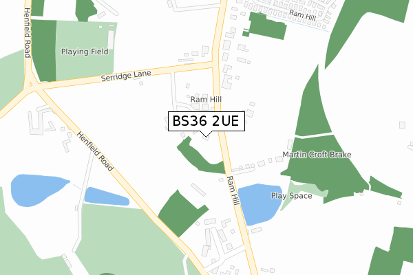
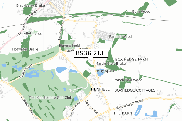
BS36 2UE is located in the Frampton Cotterell electoral ward, within the unitary authority of South Gloucestershire and the English Parliamentary constituency of Thornbury and Yate. The Sub Integrated Care Board (ICB) Location is NHS Bristol, North Somerset and South Gloucestershire ICB - 15C and the police force is Avon and Somerset. This postcode has been in use since April 2020.


GetTheData
Source: OS Open Zoomstack (Ordnance Survey)
Licence: Open Government Licence (requires attribution)
Attribution: Contains OS data © Crown copyright and database right 2024
Source: Open Postcode Geo
Licence: Open Government Licence (requires attribution)
Attribution: Contains OS data © Crown copyright and database right 2024; Contains Royal Mail data © Royal Mail copyright and database right 2024; Source: Office for National Statistics licensed under the Open Government Licence v.3.0
| Easting | 366469 |
| Northing | 180542 |
| Latitude | 51.522790 |
| Longitude | -2.484688 |
GetTheData
Source: Open Postcode Geo
Licence: Open Government Licence
| Country | England |
| Postcode District | BS36 |
| ➜ BS36 open data dashboard ➜ See where BS36 is on a map ➜ Where is Coalpit Heath? | |
GetTheData
Source: Land Registry Price Paid Data
Licence: Open Government Licence
| Ward | Frampton Cotterell |
| Constituency | Thornbury And Yate |
GetTheData
Source: ONS Postcode Database
Licence: Open Government Licence
2022 12 AUG £477,500 |
22, PARK LEAZE, COALPIT HEATH, BRISTOL, BS36 2UE 2021 7 MAY £428,995 |
32, PARK LEAZE, COALPIT HEATH, BRISTOL, BS36 2UE 2021 16 APR £431,995 |
2021 26 MAR £375,995 |
18, PARK LEAZE, COALPIT HEATH, BRISTOL, BS36 2UE 2021 26 MAR £429,995 |
16, PARK LEAZE, COALPIT HEATH, BRISTOL, BS36 2UE 2021 19 MAR £388,995 |
36, PARK LEAZE, COALPIT HEATH, BRISTOL, BS36 2UE 2021 17 MAR £387,995 |
14, PARK LEAZE, COALPIT HEATH, BRISTOL, BS36 2UE 2021 12 MAR £384,995 |
GetTheData
Source: HM Land Registry Price Paid Data
Licence: Contains HM Land Registry data © Crown copyright and database right 2024. This data is licensed under the Open Government Licence v3.0.
| May 2023 | Violence and sexual offences | On or near St Saviour'S Rise | 437m |
| March 2023 | Criminal damage and arson | On or near Kelbra Crescent | 493m |
| March 2023 | Criminal damage and arson | On or near Kelbra Crescent | 493m |
| ➜ Get more crime data in our Crime section | |||
GetTheData
Source: data.police.uk
Licence: Open Government Licence
| Heather Avenue | Frampton Cotterell | 537m |
| Heather Avenue | Frampton Cotterell | 549m |
| Frome View (Park Lane) | Frampton Cotterell | 604m |
| Lower Chapel Lane (Beesmoor Road) | Coalpit Heath | 640m |
| Lower Chapel Lane (Beesmoor Road) | Coalpit Heath | 650m |
| Bristol Parkway Station | 4.1km |
| Yate Station | 4.1km |
GetTheData
Source: NaPTAN
Licence: Open Government Licence
GetTheData
Source: ONS Postcode Database
Licence: Open Government Licence


➜ Get more ratings from the Food Standards Agency
GetTheData
Source: Food Standards Agency
Licence: FSA terms & conditions
| Last Collection | |||
|---|---|---|---|
| Location | Mon-Fri | Sat | Distance |
| Park Avenue | 16:00 | 08:15 | 429m |
| Bristol Road | 17:00 | 08:30 | 818m |
| Woodend Road | 16:00 | 09:00 | 832m |
GetTheData
Source: Dracos
Licence: Creative Commons Attribution-ShareAlike
| Facility | Distance |
|---|---|
| Beesmoor Road Playing Field Beesmoor Road, Frampton Cotterell, Bristol Grass Pitches | 803m |
| Salem Methodist Church Factory Road, Winterbourne, Bristol Sports Hall | 832m |
| Manor Playing Fields Henfield Road, Coalpit Heath, Bristol Grass Pitches | 976m |
GetTheData
Source: Active Places
Licence: Open Government Licence
| School | Phase of Education | Distance |
|---|---|---|
| The Manor Church of England Primary School Roundways, Coalpit Heath, Bristol, BS36 2LF | Primary | 1km |
| Elm Park Primary School Nicholls Lane, Winterbourne, Bristol, BS36 1NF | Primary | 1.1km |
| St Michael's Church of England Primary School, Winterbourne Linden Close, Winterbourne, Bristol, BS36 1LG | Primary | 1.2km |
GetTheData
Source: Edubase
Licence: Open Government Licence
The below table lists the International Territorial Level (ITL) codes (formerly Nomenclature of Territorial Units for Statistics (NUTS) codes) and Local Administrative Units (LAU) codes for BS36 2UE:
| ITL 1 Code | Name |
|---|---|
| TLK | South West (England) |
| ITL 2 Code | Name |
| TLK1 | Gloucestershire, Wiltshire and Bath/Bristol area |
| ITL 3 Code | Name |
| TLK12 | Bath and North East Somerset, North Somerset and South Gloucestershire |
| LAU 1 Code | Name |
| E06000025 | South Gloucestershire |
GetTheData
Source: ONS Postcode Directory
Licence: Open Government Licence
The below table lists the Census Output Area (OA), Lower Layer Super Output Area (LSOA), and Middle Layer Super Output Area (MSOA) for BS36 2UE:
| Code | Name | |
|---|---|---|
| OA | E00075753 | |
| LSOA | E01014994 | South Gloucestershire 019D |
| MSOA | E02003108 | South Gloucestershire 019 |
GetTheData
Source: ONS Postcode Directory
Licence: Open Government Licence
| BS36 1AT | Park Lane | 137m |
| BS36 2FR | Walter Road | 229m |
| BS36 2HA | Park Lane | 257m |
| BS36 2FG | Green Crescent | 274m |
| BS36 2FL | Wylington Road | 274m |
| BS36 2FN | Wylington Road | 307m |
| BS36 2HB | Nightingale Close | 321m |
| BS36 2FS | Christy Close | 325m |
| BS36 2FQ | Syms Avenue | 387m |
| BS36 2FP | Park Lane | 388m |
GetTheData
Source: Open Postcode Geo; Land Registry Price Paid Data
Licence: Open Government Licence