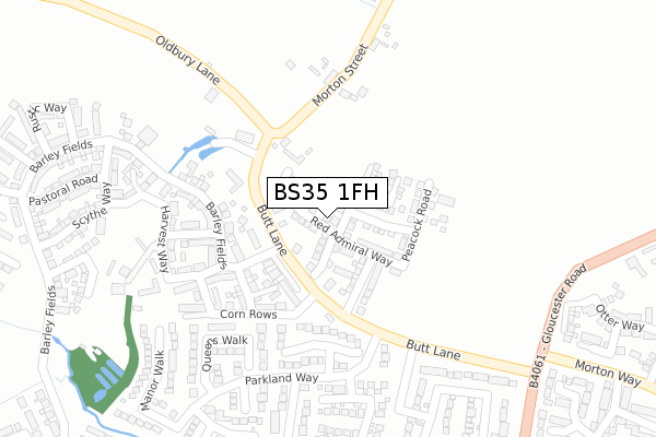
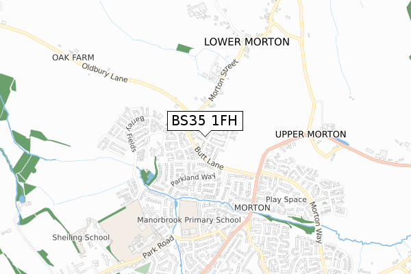
BS35 1FH is located in the Thornbury electoral ward, within the unitary authority of South Gloucestershire and the English Parliamentary constituency of Thornbury and Yate. The Sub Integrated Care Board (ICB) Location is NHS Bristol, North Somerset and South Gloucestershire ICB - 15C and the police force is Avon and Somerset. This postcode has been in use since June 2018.


GetTheData
Source: OS Open Zoomstack (Ordnance Survey)
Licence: Open Government Licence (requires attribution)
Attribution: Contains OS data © Crown copyright and database right 2024
Source: Open Postcode Geo
Licence: Open Government Licence (requires attribution)
Attribution: Contains OS data © Crown copyright and database right 2024; Contains Royal Mail data © Royal Mail copyright and database right 2024; Source: Office for National Statistics licensed under the Open Government Licence v.3.0
| Easting | 364179 |
| Northing | 191478 |
| Latitude | 51.620977 |
| Longitude | -2.518812 |
GetTheData
Source: Open Postcode Geo
Licence: Open Government Licence
| Country | England |
| Postcode District | BS35 |
| ➜ BS35 open data dashboard ➜ See where BS35 is on a map ➜ Where is Thornbury? | |
GetTheData
Source: Land Registry Price Paid Data
Licence: Open Government Licence
| Ward | Thornbury |
| Constituency | Thornbury And Yate |
GetTheData
Source: ONS Postcode Database
Licence: Open Government Licence
2022 30 NOV £455,000 |
46, RED ADMIRAL WAY, THORNBURY, BRISTOL, BS35 1FH 2020 18 DEC £584,995 |
44, RED ADMIRAL WAY, THORNBURY, BRISTOL, BS35 1FH 2020 17 DEC £595,000 |
39, RED ADMIRAL WAY, THORNBURY, BRISTOL, BS35 1FH 2020 27 NOV £544,995 |
42, RED ADMIRAL WAY, THORNBURY, BRISTOL, BS35 1FH 2020 25 NOV £570,000 |
41, RED ADMIRAL WAY, THORNBURY, BRISTOL, BS35 1FH 2020 29 OCT £518,000 |
43, RED ADMIRAL WAY, THORNBURY, BRISTOL, BS35 1FH 2020 30 SEP £422,000 |
45, RED ADMIRAL WAY, THORNBURY, BRISTOL, BS35 1FH 2020 25 SEP £435,000 |
25, RED ADMIRAL WAY, THORNBURY, BRISTOL, BS35 1FH 2019 16 AUG £469,995 |
5, RED ADMIRAL WAY, THORNBURY, BRISTOL, BS35 1FH 2019 14 JUN £390,000 |
GetTheData
Source: HM Land Registry Price Paid Data
Licence: Contains HM Land Registry data © Crown copyright and database right 2024. This data is licensed under the Open Government Licence v3.0.
| November 2022 | Other theft | On or near Queens Walk | 287m |
| June 2022 | Public order | On or near Butt Lane | 144m |
| June 2022 | Anti-social behaviour | On or near Butt Lane | 144m |
| ➜ Get more crime data in our Crime section | |||
GetTheData
Source: data.police.uk
Licence: Open Government Licence
| Post Farm | Lower Morton | 184m |
| Post Farm (Morton Street) | Lower Morton | 194m |
| Manor Walk | Thornbury | 387m |
| Swallow Park | Thornbury | 445m |
| Swallow Park (Morton Way) | Thornbury | 447m |
GetTheData
Source: NaPTAN
Licence: Open Government Licence
➜ Broadband speed and availability dashboard for BS35 1FH
| Percentage of properties with Next Generation Access | 100.0% |
| Percentage of properties with Superfast Broadband | 100.0% |
| Percentage of properties with Ultrafast Broadband | 100.0% |
| Percentage of properties with Full Fibre Broadband | 100.0% |
Superfast Broadband is between 30Mbps and 300Mbps
Ultrafast Broadband is > 300Mbps
| Median download speed | 360.0Mbps |
| Average download speed | 328.7Mbps |
| Maximum download speed | 360.00Mbps |
| Median upload speed | 360.0Mbps |
| Average upload speed | 325.3Mbps |
| Maximum upload speed | 360.00Mbps |
| Percentage of properties unable to receive 2Mbps | 0.0% |
| Percentage of properties unable to receive 5Mbps | 0.0% |
| Percentage of properties unable to receive 10Mbps | 0.0% |
| Percentage of properties unable to receive 30Mbps | 0.0% |
➜ Broadband speed and availability dashboard for BS35 1FH
GetTheData
Source: Ofcom
Licence: Ofcom Terms of Use (requires attribution)
GetTheData
Source: ONS Postcode Database
Licence: Open Government Licence


➜ Get more ratings from the Food Standards Agency
GetTheData
Source: Food Standards Agency
Licence: FSA terms & conditions
| Last Collection | |||
|---|---|---|---|
| Location | Mon-Fri | Sat | Distance |
| Alexandra Way | 16:15 | 10:00 | 472m |
| Morton Mill | 16:30 | 10:00 | 506m |
| Upper Morton | 16:15 | 09:15 | 603m |
GetTheData
Source: Dracos
Licence: Creative Commons Attribution-ShareAlike
| Facility | Distance |
|---|---|
| Manorbrook Primary School Park Road, Thornbury, Bristol Grass Pitches | 572m |
| The Castle School (Thornbury) Park Road, Thornbury, Bristol Health and Fitness Gym, Grass Pitches, Sports Hall, Artificial Grass Pitch, Studio | 720m |
| Sheiling School Thornbury Park, Thornbury, Bristol Sports Hall | 1km |
GetTheData
Source: Active Places
Licence: Open Government Licence
| School | Phase of Education | Distance |
|---|---|---|
| Manorbrook Primary School Park Road, Thornbury, Bristol, BS35 1JW | Primary | 572m |
| The Castle School Park Road, Thornbury, Bristol, BS35 1HT | Secondary | 720m |
| Sheiling School Thornbury Park, Park Road, Thornbury, South Gloucestershire, BS35 1HP | Not applicable | 963m |
GetTheData
Source: Edubase
Licence: Open Government Licence
The below table lists the International Territorial Level (ITL) codes (formerly Nomenclature of Territorial Units for Statistics (NUTS) codes) and Local Administrative Units (LAU) codes for BS35 1FH:
| ITL 1 Code | Name |
|---|---|
| TLK | South West (England) |
| ITL 2 Code | Name |
| TLK1 | Gloucestershire, Wiltshire and Bath/Bristol area |
| ITL 3 Code | Name |
| TLK12 | Bath and North East Somerset, North Somerset and South Gloucestershire |
| LAU 1 Code | Name |
| E06000025 | South Gloucestershire |
GetTheData
Source: ONS Postcode Directory
Licence: Open Government Licence
The below table lists the Census Output Area (OA), Lower Layer Super Output Area (LSOA), and Middle Layer Super Output Area (MSOA) for BS35 1FH:
| Code | Name | |
|---|---|---|
| OA | E00075714 | |
| LSOA | E01014989 | South Gloucestershire 001E |
| MSOA | E02003090 | South Gloucestershire 001 |
GetTheData
Source: ONS Postcode Directory
Licence: Open Government Licence
| BS35 1RB | Butt Lane | 92m |
| BS35 1SX | Dyrham Close | 153m |
| BS35 1RA | Butt Lane | 190m |
| BS35 1SA | Parkland Way | 194m |
| BS35 1SU | Dyrham Close | 199m |
| BS35 1SS | Queens Walk | 213m |
| BS35 1ST | Queens Walk | 254m |
| BS35 1SE | Pittville Close | 270m |
| BS35 1SF | Rosslyn Way | 275m |
| BS35 1SB | Pittville Close | 277m |
GetTheData
Source: Open Postcode Geo; Land Registry Price Paid Data
Licence: Open Government Licence