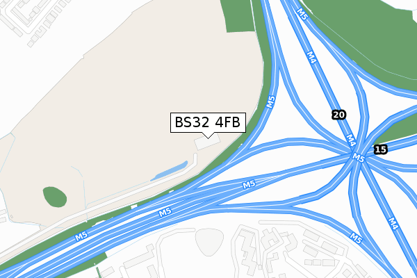
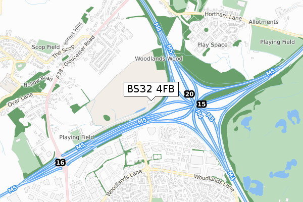
BS32 4FB is located in the Severn Vale electoral ward, within the unitary authority of South Gloucestershire and the English Parliamentary constituency of Filton and Bradley Stoke. The Sub Integrated Care Board (ICB) Location is NHS Bristol, North Somerset and South Gloucestershire ICB - 15C and the police force is Avon and Somerset. This postcode has been in use since October 2018.


GetTheData
Source: OS Open Zoomstack (Ordnance Survey)
Licence: Open Government Licence (requires attribution)
Attribution: Contains OS data © Crown copyright and database right 2024
Source: Open Postcode Geo
Licence: Open Government Licence (requires attribution)
Attribution: Contains OS data © Crown copyright and database right 2024; Contains Royal Mail data © Royal Mail copyright and database right 2024; Source: Office for National Statistics licensed under the Open Government Licence v.3.0
| Easting | 361420 |
| Northing | 183786 |
| Latitude | 51.551634 |
| Longitude | -2.557816 |
GetTheData
Source: Open Postcode Geo
Licence: Open Government Licence
| Country | England |
| Postcode District | BS32 |
| ➜ BS32 open data dashboard ➜ See where BS32 is on a map | |
GetTheData
Source: Land Registry Price Paid Data
Licence: Open Government Licence
| Ward | Severn Vale |
| Constituency | Filton And Bradley Stoke |
GetTheData
Source: ONS Postcode Database
Licence: Open Government Licence
| May 2022 | Anti-social behaviour | On or near St James Court | 343m |
| May 2022 | Public order | On or near Parking Area | 427m |
| May 2022 | Violence and sexual offences | On or near Parking Area | 427m |
| ➜ Get more crime data in our Crime section | |||
GetTheData
Source: data.police.uk
Licence: Open Government Licence
| Eagles Wood (Woodlands Lane) | Bradley Stoke | 570m |
| Eagles Wood (Woodlands Lane) | Bradley Stoke | 591m |
| Newleaze (Woodlands Lane) | Bradley Stoke | 613m |
| Newleaze (Woodlands Lane) | Bradley Stoke | 656m |
| Foxfield Avenue (Trench Lane) | Bradley Stoke | 671m |
| Patchway Station | 2.9km |
| Bristol Parkway Station | 4.3km |
| Pilning Station | 4.8km |
GetTheData
Source: NaPTAN
Licence: Open Government Licence
GetTheData
Source: ONS Postcode Database
Licence: Open Government Licence


➜ Get more ratings from the Food Standards Agency
GetTheData
Source: Food Standards Agency
Licence: FSA terms & conditions
| Last Collection | |||
|---|---|---|---|
| Location | Mon-Fri | Sat | Distance |
| Beaufort Park | 18:30 | 600m | |
| Woodlands | 17:30 | 12:15 | 681m |
| Florence Park | 16:15 | 12:15 | 691m |
GetTheData
Source: Dracos
Licence: Creative Commons Attribution-ShareAlike
| Facility | Distance |
|---|---|
| Almondsbury Sports And Social Club Gloucester Road, Almondsbury, Bristol Grass Pitches, Sports Hall, Outdoor Tennis Courts | 813m |
| Holy Trinity Primary School Broad Croft, Bradley Stoke, Bristol Grass Pitches | 856m |
| Livingwell Health Club (Bristol) Ash Ridge Road, Bradley Stoke, Bristol Swimming Pool, Health and Fitness Gym | 960m |
GetTheData
Source: Active Places
Licence: Open Government Licence
| School | Phase of Education | Distance |
|---|---|---|
| Holy Trinity Primary School Broad Croft, Bradley Stoke, Bristol, BS32 0BD | Primary | 855m |
| Almondsbury Church of England Primary School Sundays Hill, Almondsbury, BS32 4DS | Primary | 1.2km |
| Bowsland Green Primary School Ellicks Close, Bradley Stoke, Bristol, BS32 0ES | Primary | 1.3km |
GetTheData
Source: Edubase
Licence: Open Government Licence
The below table lists the International Territorial Level (ITL) codes (formerly Nomenclature of Territorial Units for Statistics (NUTS) codes) and Local Administrative Units (LAU) codes for BS32 4FB:
| ITL 1 Code | Name |
|---|---|
| TLK | South West (England) |
| ITL 2 Code | Name |
| TLK1 | Gloucestershire, Wiltshire and Bath/Bristol area |
| ITL 3 Code | Name |
| TLK12 | Bath and North East Somerset, North Somerset and South Gloucestershire |
| LAU 1 Code | Name |
| E06000025 | South Gloucestershire |
GetTheData
Source: ONS Postcode Directory
Licence: Open Government Licence
The below table lists the Census Output Area (OA), Lower Layer Super Output Area (LSOA), and Middle Layer Super Output Area (MSOA) for BS32 4FB:
| Code | Name | |
|---|---|---|
| OA | E00075095 | |
| LSOA | E01014862 | South Gloucestershire 005B |
| MSOA | E02003094 | South Gloucestershire 005 |
GetTheData
Source: ONS Postcode Directory
Licence: Open Government Licence
| BS32 4JT | Woodlands | 466m |
| BS32 4HG | Crantock Drive | 474m |
| BS32 4AF | Gloucester Road | 509m |
| BS32 4HF | Crantock Drive | 544m |
| BS32 4EU | Eagles Wood Business Park | 553m |
| BS32 4NF | Beaufort Office Park | 555m |
| BS32 4HE | Florence Park | 587m |
| BS32 4EZ | Cope Park | 590m |
| BS32 4JN | Orchard Close | 616m |
| BS32 0BA | Cooks Close | 656m |
GetTheData
Source: Open Postcode Geo; Land Registry Price Paid Data
Licence: Open Government Licence