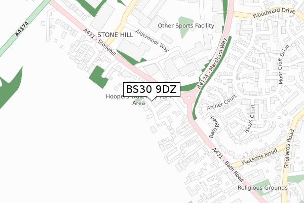
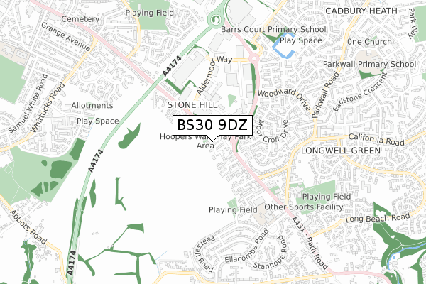
BS30 9DZ is located in the Longwell Green electoral ward, within the unitary authority of South Gloucestershire and the English Parliamentary constituency of Kingswood. The Sub Integrated Care Board (ICB) Location is NHS Bristol, North Somerset and South Gloucestershire ICB - 15C and the police force is Avon and Somerset. This postcode has been in use since November 2017.


GetTheData
Source: OS Open Zoomstack (Ordnance Survey)
Licence: Open Government Licence (requires attribution)
Attribution: Contains OS data © Crown copyright and database right 2024
Source: Open Postcode Geo
Licence: Open Government Licence (requires attribution)
Attribution: Contains OS data © Crown copyright and database right 2024; Contains Royal Mail data © Royal Mail copyright and database right 2024; Source: Office for National Statistics licensed under the Open Government Licence v.3.0
| Easting | 365398 |
| Northing | 171457 |
| Latitude | 51.441040 |
| Longitude | -2.499232 |
GetTheData
Source: Open Postcode Geo
Licence: Open Government Licence
| Country | England |
| Postcode District | BS30 |
| ➜ BS30 open data dashboard ➜ See where BS30 is on a map ➜ Where is Kingswood? | |
GetTheData
Source: Land Registry Price Paid Data
Licence: Open Government Licence
| Ward | Longwell Green |
| Constituency | Kingswood |
GetTheData
Source: ONS Postcode Database
Licence: Open Government Licence
2022 25 NOV £415,000 |
2020 30 OCT £505,000 |
2019 27 MAR £485,000 |
51, HOOPERS WALK, LONGWELL GREEN, BRISTOL, BS30 9DZ 2019 25 JAN £439,995 |
50, HOOPERS WALK, LONGWELL GREEN, BRISTOL, BS30 9DZ 2018 10 DEC £484,995 |
48, HOOPERS WALK, LONGWELL GREEN, BRISTOL, BS30 9DZ 2018 25 OCT £469,995 |
62, HOOPERS WALK, LONGWELL GREEN, BRISTOL, BS30 9DZ 2018 5 SEP £349,995 |
64, HOOPERS WALK, LONGWELL GREEN, BRISTOL, BS30 9DZ 2018 28 AUG £324,995 |
2018 1 AUG £344,995 |
GetTheData
Source: HM Land Registry Price Paid Data
Licence: Contains HM Land Registry data © Crown copyright and database right 2024. This data is licensed under the Open Government Licence v3.0.
| January 2024 | Shoplifting | On or near Empire Crescent | 243m |
| January 2024 | Violence and sexual offences | On or near Empire Crescent | 243m |
| January 2024 | Shoplifting | On or near Empire Crescent | 243m |
| ➜ Get more crime data in our Crime section | |||
GetTheData
Source: data.police.uk
Licence: Open Government Licence
| The Butchers Arms (Bath Road) | Longwell Green | 94m |
| The Butchers Arms (Bath Road) | Longwell Green | 164m |
| Stonehill | Hanham | 290m |
| Woodward Drive | Longwell Green | 325m |
| Woodward Drive (Marsham Way) | Longwell Green | 435m |
| Keynsham Station | 2.6km |
| Lawrence Hill Station | 4.9km |
| Stapleton Road Station | 5.5km |
GetTheData
Source: NaPTAN
Licence: Open Government Licence
| Percentage of properties with Next Generation Access | 100.0% |
| Percentage of properties with Superfast Broadband | 100.0% |
| Percentage of properties with Ultrafast Broadband | 100.0% |
| Percentage of properties with Full Fibre Broadband | 100.0% |
Superfast Broadband is between 30Mbps and 300Mbps
Ultrafast Broadband is > 300Mbps
| Percentage of properties unable to receive 2Mbps | 0.0% |
| Percentage of properties unable to receive 5Mbps | 0.0% |
| Percentage of properties unable to receive 10Mbps | 0.0% |
| Percentage of properties unable to receive 30Mbps | 0.0% |
GetTheData
Source: Ofcom
Licence: Ofcom Terms of Use (requires attribution)
GetTheData
Source: ONS Postcode Database
Licence: Open Government Licence


➜ Get more ratings from the Food Standards Agency
GetTheData
Source: Food Standards Agency
Licence: FSA terms & conditions
| Last Collection | |||
|---|---|---|---|
| Location | Mon-Fri | Sat | Distance |
| Hanham Road Central | 17:45 | 13:00 | 1,815m |
| St Annes Drive | 17:15 | 12:00 | 1,864m |
| Woodstock Road | 16:15 | 12:00 | 2,112m |
GetTheData
Source: Dracos
Licence: Creative Commons Attribution-ShareAlike
| Facility | Distance |
|---|---|
| Longwell Green Bmx Track Aldermoor Way, Aldermoor Way, Longwell Green, Bristol Cycling | 259m |
| Longwell Green Community Centre Shellards Road, Longwell Green, Bristol Grass Pitches, Artificial Grass Pitch, Sports Hall | 579m |
| Barrs Court Primary School Stephens Drive, Barrs Court, Bristol Grass Pitches | 793m |
GetTheData
Source: Active Places
Licence: Open Government Licence
| School | Phase of Education | Distance |
|---|---|---|
| Longwell Green Primary School Ellacombe Road, Longwell Green, Bristol, BS30 9BA | Primary | 569m |
| Barrs Court Primary School Stephens Drive, Barrs Court, Bristol, BS30 7JB | Primary | 793m |
| Parkwall Primary School Earlstone Crescent, Cadbury Heath, Bristol, BS30 8AA | Primary | 1.1km |
GetTheData
Source: Edubase
Licence: Open Government Licence
The below table lists the International Territorial Level (ITL) codes (formerly Nomenclature of Territorial Units for Statistics (NUTS) codes) and Local Administrative Units (LAU) codes for BS30 9DZ:
| ITL 1 Code | Name |
|---|---|
| TLK | South West (England) |
| ITL 2 Code | Name |
| TLK1 | Gloucestershire, Wiltshire and Bath/Bristol area |
| ITL 3 Code | Name |
| TLK12 | Bath and North East Somerset, North Somerset and South Gloucestershire |
| LAU 1 Code | Name |
| E06000025 | South Gloucestershire |
GetTheData
Source: ONS Postcode Directory
Licence: Open Government Licence
The below table lists the Census Output Area (OA), Lower Layer Super Output Area (LSOA), and Middle Layer Super Output Area (MSOA) for BS30 9DZ:
| Code | Name | |
|---|---|---|
| OA | E00075441 | |
| LSOA | E01014931 | South Gloucestershire 032B |
| MSOA | E02003121 | South Gloucestershire 032 |
GetTheData
Source: ONS Postcode Directory
Licence: Open Government Licence
| BS30 9BU | The Willows | 130m |
| BS30 9DG | Bath Road | 145m |
| BS30 9DH | Stonehill | 166m |
| BS30 6DL | Kingsfield Lane | 167m |
| BS30 9DL | Mapstone Rise | 183m |
| BS30 7DW | Archer Court | 207m |
| BS30 9DQ | Bath Road | 215m |
| BS30 7DN | Fox Court | 215m |
| BS30 9DN | Mount Pleasant Close | 226m |
| BS30 7DG | Laphams Court | 235m |
GetTheData
Source: Open Postcode Geo; Land Registry Price Paid Data
Licence: Open Government Licence