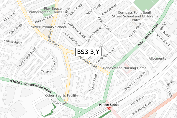
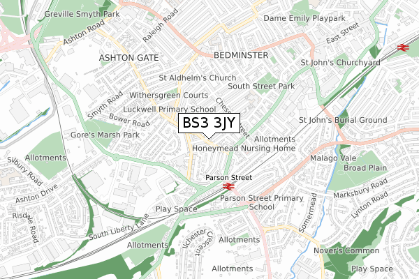
BS3 3JY is located in the Bedminster electoral ward, within the unitary authority of Bristol, City of and the English Parliamentary constituency of Bristol South. The Sub Integrated Care Board (ICB) Location is NHS Bristol, North Somerset and South Gloucestershire ICB - 15C and the police force is Avon and Somerset. This postcode has been in use since November 2019.


GetTheData
Source: OS Open Zoomstack (Ordnance Survey)
Licence: Open Government Licence (requires attribution)
Attribution: Contains OS data © Crown copyright and database right 2024
Source: Open Postcode Geo
Licence: Open Government Licence (requires attribution)
Attribution: Contains OS data © Crown copyright and database right 2024; Contains Royal Mail data © Royal Mail copyright and database right 2024; Source: Office for National Statistics licensed under the Open Government Licence v.3.0
| Easting | 357724 |
| Northing | 170927 |
| Latitude | 51.435752 |
| Longitude | -2.609575 |
GetTheData
Source: Open Postcode Geo
Licence: Open Government Licence
| Country | England |
| Postcode District | BS3 |
| ➜ BS3 open data dashboard ➜ See where BS3 is on a map ➜ Where is Bristol? | |
GetTheData
Source: Land Registry Price Paid Data
Licence: Open Government Licence
| Ward | Bedminster |
| Constituency | Bristol South |
GetTheData
Source: ONS Postcode Database
Licence: Open Government Licence
| January 2024 | Anti-social behaviour | On or near Luckwell Road | 194m |
| January 2024 | Violence and sexual offences | On or near Luckwell Road | 194m |
| December 2023 | Anti-social behaviour | On or near Luckwell Road | 194m |
| ➜ Get more crime data in our Crime section | |||
GetTheData
Source: data.police.uk
Licence: Open Government Licence
| Luckwell Road | Bedminster | 128m |
| Parson St West Street (West Street) | Bedminster | 176m |
| Luckwell Road | Bedminster | 184m |
| Chessel Street (West Street) | Bedminster | 211m |
| Marsh Lane (Luckwell Road) | Ashton Vale | 241m |
| Parson Street Station | 0.3km |
| Bedminster Station | 1.2km |
| Bristol Temple Meads Station | 2.5km |
GetTheData
Source: NaPTAN
Licence: Open Government Licence
GetTheData
Source: ONS Postcode Database
Licence: Open Government Licence


➜ Get more ratings from the Food Standards Agency
GetTheData
Source: Food Standards Agency
Licence: FSA terms & conditions
| Last Collection | |||
|---|---|---|---|
| Location | Mon-Fri | Sat | Distance |
| Chessel Street | 16:30 | 12:30 | 204m |
| Luckwell Road | 16:45 | 12:15 | 271m |
| The Chessels Post Office | 17:15 | 11:45 | 345m |
GetTheData
Source: Dracos
Licence: Creative Commons Attribution-ShareAlike
| Facility | Distance |
|---|---|
| Parson Street Primary School Bedminster Road, Bristol Sports Hall, Swimming Pool | 485m |
| Snap Fitness (Bristol Ashton Gate) Winterstoke Road, Winterstoke Road, Ashton, Bristol Health and Fitness Gym | 614m |
| Workout Bristol North Street, Bedminster, Bristol Health and Fitness Gym, Studio | 905m |
GetTheData
Source: Active Places
Licence: Open Government Licence
| School | Phase of Education | Distance |
|---|---|---|
| Luckwell Primary School Luckwell Road, Bedminster, Bristol, BS3 3ET | Primary | 288m |
| Compass Point Primary School South Street, Bedminster, Bristol, BS3 3AU | Primary | 366m |
| Parson Street Primary School Bedminster Road, Bedminster, Bristol, BS3 5NR | Primary | 479m |
GetTheData
Source: Edubase
Licence: Open Government Licence
The below table lists the International Territorial Level (ITL) codes (formerly Nomenclature of Territorial Units for Statistics (NUTS) codes) and Local Administrative Units (LAU) codes for BS3 3JY:
| ITL 1 Code | Name |
|---|---|
| TLK | South West (England) |
| ITL 2 Code | Name |
| TLK1 | Gloucestershire, Wiltshire and Bath/Bristol area |
| ITL 3 Code | Name |
| TLK11 | Bristol, City of |
| LAU 1 Code | Name |
| E06000023 | Bristol, City of |
GetTheData
Source: ONS Postcode Directory
Licence: Open Government Licence
The below table lists the Census Output Area (OA), Lower Layer Super Output Area (LSOA), and Middle Layer Super Output Area (MSOA) for BS3 3JY:
| Code | Name | |
|---|---|---|
| OA | E00073224 | |
| LSOA | E01014504 | Bristol 041B |
| MSOA | E02003052 | Bristol 041 |
GetTheData
Source: ONS Postcode Directory
Licence: Open Government Licence
| BS3 3JA | Avonleigh Road | 56m |
| BS3 3HS | Avonleigh Road | 56m |
| BS3 3JH | Garnet Street | 62m |
| BS3 3JD | Elmdale Road | 72m |
| BS3 3JG | Palmyra Road | 84m |
| BS3 3JF | Elmdale Road | 85m |
| BS3 3HU | Palmyra Road | 88m |
| BS3 3HT | Hengaston Street | 90m |
| BS3 3JE | Elmdale Road | 91m |
| BS3 3JQ | Palmyra Road | 95m |
GetTheData
Source: Open Postcode Geo; Land Registry Price Paid Data
Licence: Open Government Licence