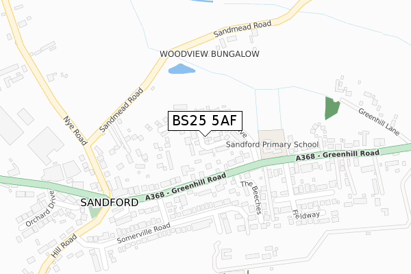
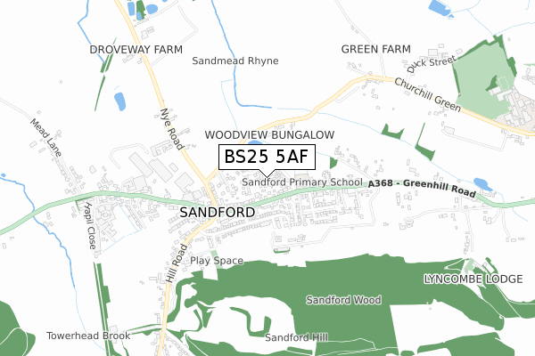
BS25 5AF is located in the Banwell & Winscombe electoral ward, within the unitary authority of North Somerset and the English Parliamentary constituency of Weston-Super-Mare. The Sub Integrated Care Board (ICB) Location is NHS Bristol, North Somerset and South Gloucestershire ICB - 15C and the police force is Avon and Somerset. This postcode has been in use since April 2019.


GetTheData
Source: OS Open Zoomstack (Ordnance Survey)
Licence: Open Government Licence (requires attribution)
Attribution: Contains OS data © Crown copyright and database right 2025
Source: Open Postcode Geo
Licence: Open Government Licence (requires attribution)
Attribution: Contains OS data © Crown copyright and database right 2025; Contains Royal Mail data © Royal Mail copyright and database right 2025; Source: Office for National Statistics licensed under the Open Government Licence v.3.0
| Easting | 342391 |
| Northing | 159749 |
| Latitude | 51.333898 |
| Longitude | -2.828320 |
GetTheData
Source: Open Postcode Geo
Licence: Open Government Licence
| Country | England |
| Postcode District | BS25 |
➜ See where BS25 is on a map ➜ Where is Sandford? | |
GetTheData
Source: Land Registry Price Paid Data
Licence: Open Government Licence
| Ward | Banwell & Winscombe |
| Constituency | Weston-super-mare |
GetTheData
Source: ONS Postcode Database
Licence: Open Government Licence
2025 21 MAR £560,000 |
2025 21 FEB £528,000 |
2024 29 OCT £535,000 |
91, DABINETT DRIVE, SANDFORD, WINSCOMBE, BS25 5AF 2022 24 MAY £365,000 |
2022 28 APR £530,000 |
103, DABINETT DRIVE, SANDFORD, WINSCOMBE, BS25 5AF 2022 18 FEB £360,000 |
2021 17 SEP £364,995 |
101, DABINETT DRIVE, SANDFORD, WINSCOMBE, BS25 5AF 2021 1 SEP £370,000 |
3, DABINETT DRIVE, SANDFORD, WINSCOMBE, BS25 5AF 2021 23 JUL £520,000 |
109, DABINETT DRIVE, SANDFORD, WINSCOMBE, BS25 5AF 2021 25 JUN £499,500 |
GetTheData
Source: HM Land Registry Price Paid Data
Licence: Contains HM Land Registry data © Crown copyright and database right 2025. This data is licensed under the Open Government Licence v3.0.
| School (Greenhill Road) | Sandford | 230m |
| School | Sandford | 236m |
| Church (Hill Road) | Sandford | 276m |
| Church (Hill Road) | Sandford | 285m |
| Railway Inn | Towerhead | 461m |
GetTheData
Source: NaPTAN
Licence: Open Government Licence
| Percentage of properties with Next Generation Access | 100.0% |
| Percentage of properties with Superfast Broadband | 49.1% |
| Percentage of properties with Ultrafast Broadband | 49.1% |
| Percentage of properties with Full Fibre Broadband | 49.1% |
Superfast Broadband is between 30Mbps and 300Mbps
Ultrafast Broadband is > 300Mbps
| Percentage of properties unable to receive 2Mbps | 0.0% |
| Percentage of properties unable to receive 5Mbps | 1.8% |
| Percentage of properties unable to receive 10Mbps | 36.4% |
| Percentage of properties unable to receive 30Mbps | 50.9% |
GetTheData
Source: Ofcom
Licence: Ofcom Terms of Use (requires attribution)
GetTheData
Source: ONS Postcode Database
Licence: Open Government Licence


➜ Get more ratings from the Food Standards Agency
GetTheData
Source: Food Standards Agency
Licence: FSA terms & conditions
| Last Collection | |||
|---|---|---|---|
| Location | Mon-Fri | Sat | Distance |
| Moorham Road | 16:15 | 09:30 | 1,682m |
| Belmont | 17:00 | 10:30 | 2,322m |
| Winscombe Post Office | 17:15 | 12:15 | 2,631m |
GetTheData
Source: Dracos
Licence: Creative Commons Attribution-ShareAlike
The below table lists the International Territorial Level (ITL) codes (formerly Nomenclature of Territorial Units for Statistics (NUTS) codes) and Local Administrative Units (LAU) codes for BS25 5AF:
| ITL 1 Code | Name |
|---|---|
| TLK | South West (England) |
| ITL 2 Code | Name |
| TLK1 | Gloucestershire, Wiltshire and Bath/Bristol area |
| ITL 3 Code | Name |
| TLK12 | Bath and North East Somerset, North Somerset and South Gloucestershire |
| LAU 1 Code | Name |
| E06000024 | North Somerset |
GetTheData
Source: ONS Postcode Directory
Licence: Open Government Licence
The below table lists the Census Output Area (OA), Lower Layer Super Output Area (LSOA), and Middle Layer Super Output Area (MSOA) for BS25 5AF:
| Code | Name | |
|---|---|---|
| OA | E00074470 | |
| LSOA | E01014745 | North Somerset 024C |
| MSOA | E02003088 | North Somerset 024 |
GetTheData
Source: ONS Postcode Directory
Licence: Open Government Licence
| BS25 5SB | Greenhill Road | 118m |
| BS25 5QG | Sandmead Road | 122m |
| BS25 5QB | Greenhill Road | 153m |
| BS25 5QA | Greenhill Road | 161m |
| BS25 5RR | Somerville Road | 196m |
| BS25 5QD | Nye Road | 212m |
| BS25 5RU | Court Drive | 250m |
| BS25 5RT | Underwood End | 251m |
| BS25 5QQ | Sandmead Road | 260m |
| BS25 5QR | Yew Tree Gardens | 261m |
GetTheData
Source: Open Postcode Geo; Land Registry Price Paid Data
Licence: Open Government Licence