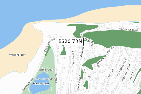
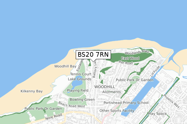
BS20 7RN is located in the Portishead North electoral ward, within the unitary authority of North Somerset and the English Parliamentary constituency of North Somerset. The Sub Integrated Care Board (ICB) Location is NHS Bristol, North Somerset and South Gloucestershire ICB - 15C and the police force is Avon and Somerset. This postcode has been in use since February 2019.


GetTheData
Source: OS Open Zoomstack (Ordnance Survey)
Licence: Open Government Licence (requires attribution)
Attribution: Contains OS data © Crown copyright and database right 2024
Source: Open Postcode Geo
Licence: Open Government Licence (requires attribution)
Attribution: Contains OS data © Crown copyright and database right 2024; Contains Royal Mail data © Royal Mail copyright and database right 2024; Source: Office for National Statistics licensed under the Open Government Licence v.3.0
| Easting | 346654 |
| Northing | 177422 |
| Latitude | 51.493211 |
| Longitude | -2.769797 |
GetTheData
Source: Open Postcode Geo
Licence: Open Government Licence
| Country | England |
| Postcode District | BS20 |
| ➜ BS20 open data dashboard ➜ See where BS20 is on a map ➜ Where is Portishead? | |
GetTheData
Source: Land Registry Price Paid Data
Licence: Open Government Licence
| Ward | Portishead North |
| Constituency | North Somerset |
GetTheData
Source: ONS Postcode Database
Licence: Open Government Licence
| October 2023 | Violence and sexual offences | On or near Woodlands Road | 457m |
| September 2023 | Violence and sexual offences | On or near Park/Open Space | 362m |
| June 2022 | Anti-social behaviour | On or near The Knoll | 221m |
| ➜ Get more crime data in our Crime section | |||
GetTheData
Source: data.police.uk
Licence: Open Government Licence
| Open Air Pool (Esplanade Road) | Woodhill | 120m |
| Open Air Pool (Esplanade Road) | Woodhill | 133m |
| Pier Road (South Road) | Woodhill | 341m |
| Pier Road (South Road) | Woodhill | 356m |
| South Road | Portishead Dock | 477m |
| Avonmouth Station | 4.9km |
GetTheData
Source: NaPTAN
Licence: Open Government Licence
| Percentage of properties with Next Generation Access | 100.0% |
| Percentage of properties with Superfast Broadband | 100.0% |
| Percentage of properties with Ultrafast Broadband | 0.0% |
| Percentage of properties with Full Fibre Broadband | 0.0% |
Superfast Broadband is between 30Mbps and 300Mbps
Ultrafast Broadband is > 300Mbps
| Percentage of properties unable to receive 2Mbps | 0.0% |
| Percentage of properties unable to receive 5Mbps | 0.0% |
| Percentage of properties unable to receive 10Mbps | 0.0% |
| Percentage of properties unable to receive 30Mbps | 0.0% |
GetTheData
Source: Ofcom
Licence: Ofcom Terms of Use (requires attribution)
GetTheData
Source: ONS Postcode Database
Licence: Open Government Licence


➜ Get more ratings from the Food Standards Agency
GetTheData
Source: Food Standards Agency
Licence: FSA terms & conditions
| Last Collection | |||
|---|---|---|---|
| Location | Mon-Fri | Sat | Distance |
| Woodhill | 17:45 | 12:15 | 93m |
| Leighview Road | 17:45 | 12:15 | 452m |
| South Road | 17:45 | 12:30 | 531m |
GetTheData
Source: Dracos
Licence: Creative Commons Attribution-ShareAlike
| Facility | Distance |
|---|---|
| Portishead Open Air Pool Esplanade Road, Portishead, Bristol Swimming Pool | 173m |
| Portishead Lawn Tennis Club Esplanade Road, Portishead Outdoor Tennis Courts | 251m |
| Portishead Cricket Club Lake Road, Portishead Grass Pitches | 456m |
GetTheData
Source: Active Places
Licence: Open Government Licence
| School | Phase of Education | Distance |
|---|---|---|
| Portishead Primary School Station Road, Portishead, BS20 7DB | Primary | 689m |
| St Peter's Church of England Primary School Hallett's Way, Portishead, BS20 6BT | Primary | 1.4km |
| Trinity Anglican-Methodist Primary School Marjoram Way, Portishead, Bristol, BS20 7JF | Primary | 1.6km |
GetTheData
Source: Edubase
Licence: Open Government Licence
The below table lists the International Territorial Level (ITL) codes (formerly Nomenclature of Territorial Units for Statistics (NUTS) codes) and Local Administrative Units (LAU) codes for BS20 7RN:
| ITL 1 Code | Name |
|---|---|
| TLK | South West (England) |
| ITL 2 Code | Name |
| TLK1 | Gloucestershire, Wiltshire and Bath/Bristol area |
| ITL 3 Code | Name |
| TLK12 | Bath and North East Somerset, North Somerset and South Gloucestershire |
| LAU 1 Code | Name |
| E06000024 | North Somerset |
GetTheData
Source: ONS Postcode Directory
Licence: Open Government Licence
The below table lists the Census Output Area (OA), Lower Layer Super Output Area (LSOA), and Middle Layer Super Output Area (MSOA) for BS20 7RN:
| Code | Name | |
|---|---|---|
| OA | E00074720 | |
| LSOA | E01014790 | North Somerset 001B |
| MSOA | E02003065 | North Somerset 001 |
GetTheData
Source: ONS Postcode Directory
Licence: Open Government Licence
| BS20 7HB | Esplanade Road | 60m |
| BS20 7HE | Woodlands Road | 126m |
| BS20 7HA | Woodhill Road | 185m |
| BS20 7JA | Lake Road | 210m |
| BS20 7JD | Battery Lane | 239m |
| BS20 7DR | Wood Hill Park | 258m |
| BS20 7NU | The Knoll | 272m |
| BS20 7DZ | Pier Road | 300m |
| BS20 7HQ | Fircliff Park | 326m |
| BS20 7EY | Woodhill Road | 344m |
GetTheData
Source: Open Postcode Geo; Land Registry Price Paid Data
Licence: Open Government Licence