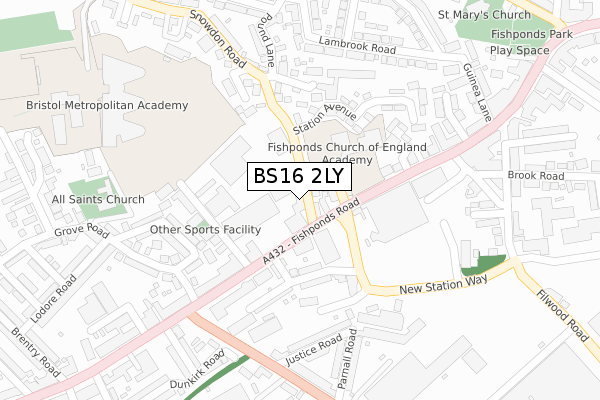
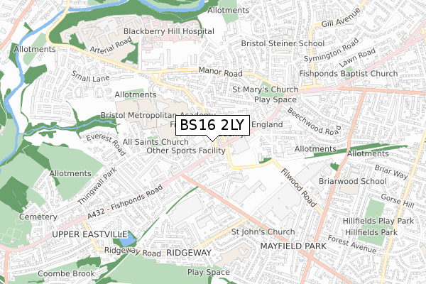
BS16 2LY is located in the Eastville electoral ward, within the unitary authority of Bristol, City of and the English Parliamentary constituency of Bristol East. The Sub Integrated Care Board (ICB) Location is NHS Bristol, North Somerset and South Gloucestershire ICB - 15C and the police force is Avon and Somerset. This postcode has been in use since January 2020.


GetTheData
Source: OS Open Zoomstack (Ordnance Survey)
Licence: Open Government Licence (requires attribution)
Attribution: Contains OS data © Crown copyright and database right 2024
Source: Open Postcode Geo
Licence: Open Government Licence (requires attribution)
Attribution: Contains OS data © Crown copyright and database right 2024; Contains Royal Mail data © Royal Mail copyright and database right 2024; Source: Office for National Statistics licensed under the Open Government Licence v.3.0
| Easting | 362986 |
| Northing | 175682 |
| Latitude | 51.478875 |
| Longitude | -2.534377 |
GetTheData
Source: Open Postcode Geo
Licence: Open Government Licence
| Country | England |
| Postcode District | BS16 |
| ➜ BS16 open data dashboard ➜ See where BS16 is on a map ➜ Where is Fishponds? | |
GetTheData
Source: Land Registry Price Paid Data
Licence: Open Government Licence
| Ward | Eastville |
| Constituency | Bristol East |
GetTheData
Source: ONS Postcode Database
Licence: Open Government Licence
| January 2024 | Anti-social behaviour | On or near Alexandra Park | 150m |
| January 2024 | Anti-social behaviour | On or near Alexandra Park | 150m |
| January 2024 | Public order | On or near Alexandra Park | 150m |
| ➜ Get more crime data in our Crime section | |||
GetTheData
Source: data.police.uk
Licence: Open Government Licence
| Channons Hill | Fishponds | 16m |
| Channon's Hill (Fishponds Road) | Fishponds | 81m |
| Channons Hill (Fishponds Road) | Fishponds | 110m |
| Channons Hill (Fishponds Road) | Fishponds | 112m |
| Hockeys Lane (Hockey's Lane) | Fishponds | 132m |
| Stapleton Road Station | 2.5km |
| Lawrence Hill Station | 3.1km |
| Filton Abbey Wood Station | 3.5km |
GetTheData
Source: NaPTAN
Licence: Open Government Licence
GetTheData
Source: ONS Postcode Database
Licence: Open Government Licence


➜ Get more ratings from the Food Standards Agency
GetTheData
Source: Food Standards Agency
Licence: FSA terms & conditions
| Last Collection | |||
|---|---|---|---|
| Location | Mon-Fri | Sat | Distance |
| Lodore Road | 17:15 | 12:15 | 365m |
| Fishponds Old Post Office | 18:00 | 11:30 | 449m |
| Fishponds Old Post Office | 18:00 | 11:30 | 449m |
GetTheData
Source: Dracos
Licence: Creative Commons Attribution-ShareAlike
| Facility | Distance |
|---|---|
| Jd Gyms (Bristol) Channons Hill, Bristol Health and Fitness Gym, Studio | 51m |
| Fishponds Church Of England Academy Fishponds Road, Fishponds, Bristol Grass Pitches | 151m |
| Bristol Metropolitan Academy Snowdon Road, Bristol Sports Hall, Artificial Grass Pitch, Grass Pitches, Studio | 342m |
GetTheData
Source: Active Places
Licence: Open Government Licence
| School | Phase of Education | Distance |
|---|---|---|
| Fishponds Church of England Academy Fishponds Road, Fishponds, Bristol, BS16 3UH | Primary | 160m |
| St Matthias Academy Alexandra Park, Fishponds, Bristol, BS16 2BG | Not applicable | 162m |
| Bristol Metropolitan Academy Snowdon Road, Fishponds, Bristol, BS16 2HD | Secondary | 358m |
GetTheData
Source: Edubase
Licence: Open Government Licence
The below table lists the International Territorial Level (ITL) codes (formerly Nomenclature of Territorial Units for Statistics (NUTS) codes) and Local Administrative Units (LAU) codes for BS16 2LY:
| ITL 1 Code | Name |
|---|---|
| TLK | South West (England) |
| ITL 2 Code | Name |
| TLK1 | Gloucestershire, Wiltshire and Bath/Bristol area |
| ITL 3 Code | Name |
| TLK11 | Bristol, City of |
| LAU 1 Code | Name |
| E06000023 | Bristol, City of |
GetTheData
Source: ONS Postcode Directory
Licence: Open Government Licence
The below table lists the Census Output Area (OA), Lower Layer Super Output Area (LSOA), and Middle Layer Super Output Area (MSOA) for BS16 2LY:
| Code | Name | |
|---|---|---|
| OA | E00073630 | |
| LSOA | E01014572 | Bristol 019A |
| MSOA | E02003030 | Bristol 019 |
GetTheData
Source: ONS Postcode Directory
Licence: Open Government Licence
| BS16 2DY | Channons Hill | 35m |
| BS16 3BG | Fishponds Road | 42m |
| BS16 3HJ | Fishponds Road | 82m |
| BS16 2EA | Channons Hill | 101m |
| BS16 3BQ | Fishponds Road | 114m |
| BS16 3AT | Wharf Road | 124m |
| BS16 3HS | Lower Station Road | 138m |
| BS16 3HU | Fishponds Road | 141m |
| BS16 2DU | Station Avenue | 154m |
| BS16 2EE | Adelaide Terrace | 173m |
GetTheData
Source: Open Postcode Geo; Land Registry Price Paid Data
Licence: Open Government Licence