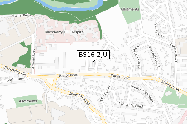
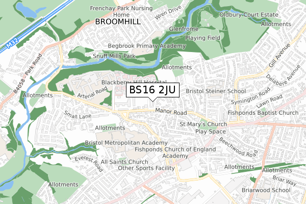
BS16 2JU is located in the Frome Vale electoral ward, within the unitary authority of Bristol, City of and the English Parliamentary constituency of Bristol East. The Sub Integrated Care Board (ICB) Location is NHS Bristol, North Somerset and South Gloucestershire ICB - 15C and the police force is Avon and Somerset. This postcode has been in use since June 2019.


GetTheData
Source: OS Open Zoomstack (Ordnance Survey)
Licence: Open Government Licence (requires attribution)
Attribution: Contains OS data © Crown copyright and database right 2024
Source: Open Postcode Geo
Licence: Open Government Licence (requires attribution)
Attribution: Contains OS data © Crown copyright and database right 2024; Contains Royal Mail data © Royal Mail copyright and database right 2024; Source: Office for National Statistics licensed under the Open Government Licence v.3.0
| Easting | 362883 |
| Northing | 176201 |
| Latitude | 51.483534 |
| Longitude | -2.535915 |
GetTheData
Source: Open Postcode Geo
Licence: Open Government Licence
| Country | England |
| Postcode District | BS16 |
| ➜ BS16 open data dashboard ➜ See where BS16 is on a map ➜ Where is Fishponds? | |
GetTheData
Source: Land Registry Price Paid Data
Licence: Open Government Licence
| Ward | Frome Vale |
| Constituency | Bristol East |
GetTheData
Source: ONS Postcode Database
Licence: Open Government Licence
19, QUARTERBRIDGE ROAD, FISHPONDS, BRISTOL, BS16 2JU 2020 10 SEP £330,000 |
GetTheData
Source: HM Land Registry Price Paid Data
Licence: Contains HM Land Registry data © Crown copyright and database right 2024. This data is licensed under the Open Government Licence v3.0.
| January 2024 | Criminal damage and arson | On or near Guinea Lane | 469m |
| January 2024 | Anti-social behaviour | On or near Guinea Lane | 469m |
| January 2024 | Burglary | On or near Guinea Lane | 469m |
| ➜ Get more crime data in our Crime section | |||
GetTheData
Source: data.police.uk
Licence: Open Government Licence
| Blackberry Hospital (Manor Road) | Fishponds | 160m |
| Eastbury Road (Manor Road) | Fishponds | 187m |
| Eastbury Road (Manor Road) | Fishponds | 214m |
| Snowdon Road | Fishponds | 218m |
| Snowdon Road | Fishponds | 246m |
| Stapleton Road Station | 2.8km |
| Filton Abbey Wood Station | 3km |
| Bristol Parkway Station | 3.4km |
GetTheData
Source: NaPTAN
Licence: Open Government Licence
| Percentage of properties with Next Generation Access | 100.0% |
| Percentage of properties with Superfast Broadband | 100.0% |
| Percentage of properties with Ultrafast Broadband | 100.0% |
| Percentage of properties with Full Fibre Broadband | 100.0% |
Superfast Broadband is between 30Mbps and 300Mbps
Ultrafast Broadband is > 300Mbps
| Percentage of properties unable to receive 2Mbps | 0.0% |
| Percentage of properties unable to receive 5Mbps | 0.0% |
| Percentage of properties unable to receive 10Mbps | 0.0% |
| Percentage of properties unable to receive 30Mbps | 0.0% |
GetTheData
Source: Ofcom
Licence: Ofcom Terms of Use (requires attribution)
GetTheData
Source: ONS Postcode Database
Licence: Open Government Licence


➜ Get more ratings from the Food Standards Agency
GetTheData
Source: Food Standards Agency
Licence: FSA terms & conditions
| Last Collection | |||
|---|---|---|---|
| Location | Mon-Fri | Sat | Distance |
| Snowdon | 17:45 | 12:00 | 250m |
| The College | 18:00 | 12:00 | 564m |
| Fishponds Old Post Office | 18:00 | 11:30 | 590m |
GetTheData
Source: Dracos
Licence: Creative Commons Attribution-ShareAlike
| Facility | Distance |
|---|---|
| Bristol Metropolitan Academy Snowdon Road, Bristol Sports Hall, Artificial Grass Pitch, Grass Pitches, Studio | 407m |
| Begbrook Primary Academy Begbrook Drive, Bristol Grass Pitches | 444m |
| Whitefield Fishponds School Sports Hall (Closed) Snowdon Road, Bristol Sports Hall, Health and Fitness Gym, Grass Pitches | 450m |
GetTheData
Source: Active Places
Licence: Open Government Licence
| School | Phase of Education | Distance |
|---|---|---|
| Bristol Metropolitan Academy Snowdon Road, Fishponds, Bristol, BS16 2HD | Secondary | 390m |
| Begbrook Primary Academy Begbrook Drive, Stapleton, Bristol, BS16 1HG | Primary | 423m |
| Avanti Gardens School College Road, Bristol, BS16 2JP | Primary | 462m |
GetTheData
Source: Edubase
Licence: Open Government Licence
The below table lists the International Territorial Level (ITL) codes (formerly Nomenclature of Territorial Units for Statistics (NUTS) codes) and Local Administrative Units (LAU) codes for BS16 2JU:
| ITL 1 Code | Name |
|---|---|
| TLK | South West (England) |
| ITL 2 Code | Name |
| TLK1 | Gloucestershire, Wiltshire and Bath/Bristol area |
| ITL 3 Code | Name |
| TLK11 | Bristol, City of |
| LAU 1 Code | Name |
| E06000023 | Bristol, City of |
GetTheData
Source: ONS Postcode Directory
Licence: Open Government Licence
The below table lists the Census Output Area (OA), Lower Layer Super Output Area (LSOA), and Middle Layer Super Output Area (MSOA) for BS16 2JU:
| Code | Name | |
|---|---|---|
| OA | E00174283 | |
| LSOA | E01014588 | Bristol 013A |
| MSOA | E02003024 | Bristol 013 |
GetTheData
Source: ONS Postcode Directory
Licence: Open Government Licence
| BS16 2EN | Manor Road | 86m |
| BS16 2EL | Manor Road | 117m |
| BS16 2ER | Manor Road | 177m |
| BS16 2EP | Pound Lane | 182m |
| BS16 2EG | Pound Drive | 198m |
| BS16 2ES | Manor Road | 199m |
| BS16 2EJ | Snowdon Road | 207m |
| BS16 2HS | Claverham Road | 208m |
| BS16 2HF | Glaisdale Road | 217m |
| BS16 2EQ | Snowdon Road | 242m |
GetTheData
Source: Open Postcode Geo; Land Registry Price Paid Data
Licence: Open Government Licence