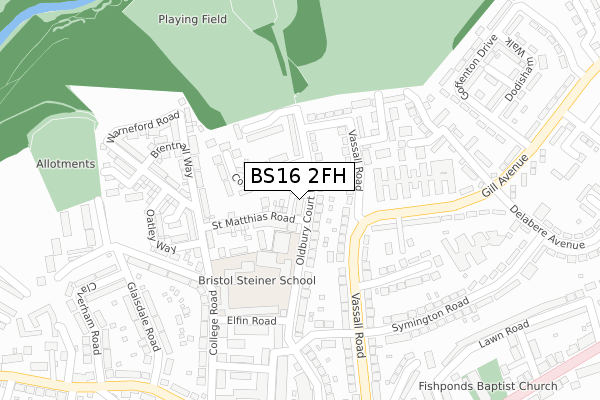
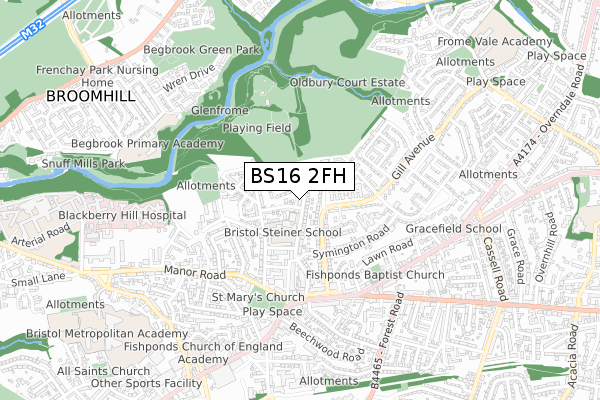
BS16 2FH is located in the Frome Vale electoral ward, within the unitary authority of Bristol, City of and the English Parliamentary constituency of Bristol East. The Sub Integrated Care Board (ICB) Location is NHS Bristol, North Somerset and South Gloucestershire ICB - 15C and the police force is Avon and Somerset. This postcode has been in use since August 2018.


GetTheData
Source: OS Open Zoomstack (Ordnance Survey)
Licence: Open Government Licence (requires attribution)
Attribution: Contains OS data © Crown copyright and database right 2024
Source: Open Postcode Geo
Licence: Open Government Licence (requires attribution)
Attribution: Contains OS data © Crown copyright and database right 2024; Contains Royal Mail data © Royal Mail copyright and database right 2024; Source: Office for National Statistics licensed under the Open Government Licence v.3.0
| Easting | 363468 |
| Northing | 176396 |
| Latitude | 51.485326 |
| Longitude | -2.527510 |
GetTheData
Source: Open Postcode Geo
Licence: Open Government Licence
| Country | England |
| Postcode District | BS16 |
| ➜ BS16 open data dashboard ➜ See where BS16 is on a map ➜ Where is Fishponds? | |
GetTheData
Source: Land Registry Price Paid Data
Licence: Open Government Licence
| Ward | Frome Vale |
| Constituency | Bristol East |
GetTheData
Source: ONS Postcode Database
Licence: Open Government Licence
| January 2024 | Other theft | On or near Willow Bed Close | 274m |
| December 2023 | Other theft | On or near Sherston Close | 202m |
| August 2023 | Robbery | On or near Parking Area | 181m |
| ➜ Get more crime data in our Crime section | |||
GetTheData
Source: data.police.uk
Licence: Open Government Licence
| Vassal Road (Gill Avenue) | Oldbury Court | 167m |
| Vassal Road (Gill Avenue) | Oldbury Court | 198m |
| Straits Parade (Vassall Road) | Fishponds | 387m |
| Straits Parade | Fishponds | 394m |
| College Road (Manor Road) | Fishponds | 399m |
| Filton Abbey Wood Station | 3.3km |
| Bristol Parkway Station | 3.3km |
| Stapleton Road Station | 3.3km |
GetTheData
Source: NaPTAN
Licence: Open Government Licence
GetTheData
Source: ONS Postcode Database
Licence: Open Government Licence


➜ Get more ratings from the Food Standards Agency
GetTheData
Source: Food Standards Agency
Licence: FSA terms & conditions
| Last Collection | |||
|---|---|---|---|
| Location | Mon-Fri | Sat | Distance |
| The College | 18:00 | 12:00 | 178m |
| The Straits | 17:00 | 11:30 | 425m |
| Fishponds Old Post Office | 18:00 | 11:30 | 513m |
GetTheData
Source: Dracos
Licence: Creative Commons Attribution-ShareAlike
| Facility | Distance |
|---|---|
| University Of The West Of England (St Matthias Campus) (Closed) Oldbury Court Road, Bristol Grass Pitches, Sports Hall | 148m |
| Avanti Gardens School Oldbury Court Road, Oldbury Court Road, Fishponds, Bristol Sports Hall | 198m |
| Oldbury Court Estate Warneford Road, Bristol Grass Pitches | 395m |
GetTheData
Source: Active Places
Licence: Open Government Licence
| School | Phase of Education | Distance |
|---|---|---|
| Avanti Gardens School College Road, Bristol, BS16 2JP | Primary | 198m |
| Little Hayes Nursery School Symington Road, Fishponds, Bristol, BS16 2LL | Nursery | 402m |
| Gracefield Preparatory School 266 Overndale Road, Fishponds, 266 Overndale Road, Bristol, BS16 2RG | Not applicable | 651m |
GetTheData
Source: Edubase
Licence: Open Government Licence
The below table lists the International Territorial Level (ITL) codes (formerly Nomenclature of Territorial Units for Statistics (NUTS) codes) and Local Administrative Units (LAU) codes for BS16 2FH:
| ITL 1 Code | Name |
|---|---|
| TLK | South West (England) |
| ITL 2 Code | Name |
| TLK1 | Gloucestershire, Wiltshire and Bath/Bristol area |
| ITL 3 Code | Name |
| TLK11 | Bristol, City of |
| LAU 1 Code | Name |
| E06000023 | Bristol, City of |
GetTheData
Source: ONS Postcode Directory
Licence: Open Government Licence
The below table lists the Census Output Area (OA), Lower Layer Super Output Area (LSOA), and Middle Layer Super Output Area (MSOA) for BS16 2FH:
| Code | Name | |
|---|---|---|
| OA | E00073686 | |
| LSOA | E01014590 | Bristol 013C |
| MSOA | E02003024 | Bristol 013 |
GetTheData
Source: ONS Postcode Directory
Licence: Open Government Licence
| BS16 2JQ | Oldbury Court Road | 74m |
| BS16 2JH | Oldbury Court Road | 89m |
| BS16 2JL | Comyn Walk | 93m |
| BS16 2LS | Vassall Road | 102m |
| BS16 2JG | Oldbury Court Road | 110m |
| BS16 2JN | Perrymans Close | 128m |
| BS16 2LW | Vassall Road | 129m |
| BS16 2LR | Vassall Road | 136m |
| BS16 2JW | Oldbury Court Drive | 153m |
| BS16 2LD | Little Hayes | 185m |
GetTheData
Source: Open Postcode Geo; Land Registry Price Paid Data
Licence: Open Government Licence