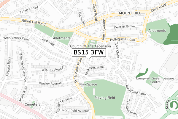
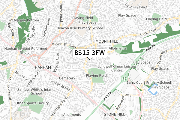
BS15 3FW is located in the Hanham electoral ward, within the unitary authority of South Gloucestershire and the English Parliamentary constituency of Kingswood. The Sub Integrated Care Board (ICB) Location is NHS Bristol, North Somerset and South Gloucestershire ICB - 15C and the police force is Avon and Somerset. This postcode has been in use since January 2019.


GetTheData
Source: OS Open Zoomstack (Ordnance Survey)
Licence: Open Government Licence (requires attribution)
Attribution: Contains OS data © Crown copyright and database right 2024
Source: Open Postcode Geo
Licence: Open Government Licence (requires attribution)
Attribution: Contains OS data © Crown copyright and database right 2024; Contains Royal Mail data © Royal Mail copyright and database right 2024; Source: Office for National Statistics licensed under the Open Government Licence v.3.0
| Easting | 364958 |
| Northing | 172433 |
| Latitude | 51.449788 |
| Longitude | -2.505659 |
GetTheData
Source: Open Postcode Geo
Licence: Open Government Licence
| Country | England |
| Postcode District | BS15 |
| ➜ BS15 open data dashboard ➜ See where BS15 is on a map ➜ Where is Kingswood? | |
GetTheData
Source: Land Registry Price Paid Data
Licence: Open Government Licence
| Ward | Hanham |
| Constituency | Kingswood |
GetTheData
Source: ONS Postcode Database
Licence: Open Government Licence
1, FAITHFIELDS CLOSE, HANHAM, BRISTOL, BS15 3FW 2021 16 APR £406,000 |
5, FAITHFIELDS CLOSE, HANHAM, BRISTOL, BS15 3FW 2021 22 MAR £412,000 |
3, FAITHFIELDS CLOSE, HANHAM, BRISTOL, BS15 3FW 2021 19 MAR £407,000 |
7, FAITHFIELDS CLOSE, HANHAM, BRISTOL, BS15 3FW 2021 15 JAN £410,000 |
4, FAITHFIELDS CLOSE, HANHAM, BRISTOL, BS15 3FW 2020 25 SEP £369,995 |
9, FAITHFIELDS CLOSE, HANHAM, BRISTOL, BS15 3FW 2020 4 SEP £366,500 |
6, FAITHFIELDS CLOSE, HANHAM, BRISTOL, BS15 3FW 2020 17 MAR £407,500 |
2, FAITHFIELDS CLOSE, HANHAM, BRISTOL, BS15 3FW 2019 31 JUL £415,500 |
GetTheData
Source: HM Land Registry Price Paid Data
Licence: Contains HM Land Registry data © Crown copyright and database right 2024. This data is licensed under the Open Government Licence v3.0.
| January 2024 | Shoplifting | On or near Kingsfield Lane | 458m |
| January 2024 | Shoplifting | On or near Kingsfield Lane | 458m |
| January 2024 | Shoplifting | On or near Kingsfield Lane | 458m |
| ➜ Get more crime data in our Crime section | |||
GetTheData
Source: data.police.uk
Licence: Open Government Licence
| Woodcote (Mount Hill Road) | Hanham | 198m |
| Mounthill Road (Mount Hill Road) | Kingswood | 249m |
| Mounthill Road (Court Road) | Kingswood | 251m |
| Hanham Mount (Mount Hill Road) | Kingswood | 278m |
| Hanham Mount (Mount Hill Road) | Kingswood | 290m |
| Keynsham Station | 3.6km |
| Lawrence Hill Station | 4.2km |
| Stapleton Road Station | 4.6km |
GetTheData
Source: NaPTAN
Licence: Open Government Licence
| Percentage of properties with Next Generation Access | 100.0% |
| Percentage of properties with Superfast Broadband | 100.0% |
| Percentage of properties with Ultrafast Broadband | 100.0% |
| Percentage of properties with Full Fibre Broadband | 100.0% |
Superfast Broadband is between 30Mbps and 300Mbps
Ultrafast Broadband is > 300Mbps
| Percentage of properties unable to receive 2Mbps | 0.0% |
| Percentage of properties unable to receive 5Mbps | 0.0% |
| Percentage of properties unable to receive 10Mbps | 0.0% |
| Percentage of properties unable to receive 30Mbps | 0.0% |
GetTheData
Source: Ofcom
Licence: Ofcom Terms of Use (requires attribution)
GetTheData
Source: ONS Postcode Database
Licence: Open Government Licence


➜ Get more ratings from the Food Standards Agency
GetTheData
Source: Food Standards Agency
Licence: FSA terms & conditions
| Last Collection | |||
|---|---|---|---|
| Location | Mon-Fri | Sat | Distance |
| Hanham Road Central | 17:45 | 13:00 | 749m |
| Kingswood Post Office | 18:00 | 13:15 | 1,282m |
| Woodstock Road | 16:15 | 12:00 | 1,344m |
GetTheData
Source: Dracos
Licence: Creative Commons Attribution-ShareAlike
| Facility | Distance |
|---|---|
| Greenbank Recreation Ground Greenbank Road, Hanham, Bristol Grass Pitches | 177m |
| Longwell Green Active Lifestyle Centre Kingswood Aspects Leisure Park, Kingswood, Bristol Swimming Pool, Health and Fitness Gym, Studio | 378m |
| The Gym Group (Bristol Longwell Green) Kingswood Aspects Leisure Park, Kingswood, Bristol Health and Fitness Gym, Studio | 522m |
GetTheData
Source: Active Places
Licence: Open Government Licence
| School | Phase of Education | Distance |
|---|---|---|
| Beacon Rise Primary School Hanham Road, Kingswood, Bristol, BS15 8NU | Primary | 548m |
| Hanham Abbots Junior School Abbots Avenue, Hanham, Bristol, BS15 3PN | Primary | 824m |
| Samuel White's Infant School Abbots Avenue, Hanham, Bristol, BS15 3PN | Primary | 864m |
GetTheData
Source: Edubase
Licence: Open Government Licence
The below table lists the International Territorial Level (ITL) codes (formerly Nomenclature of Territorial Units for Statistics (NUTS) codes) and Local Administrative Units (LAU) codes for BS15 3FW:
| ITL 1 Code | Name |
|---|---|
| TLK | South West (England) |
| ITL 2 Code | Name |
| TLK1 | Gloucestershire, Wiltshire and Bath/Bristol area |
| ITL 3 Code | Name |
| TLK12 | Bath and North East Somerset, North Somerset and South Gloucestershire |
| LAU 1 Code | Name |
| E06000025 | South Gloucestershire |
GetTheData
Source: ONS Postcode Directory
Licence: Open Government Licence
The below table lists the Census Output Area (OA), Lower Layer Super Output Area (LSOA), and Middle Layer Super Output Area (MSOA) for BS15 3FW:
| Code | Name | |
|---|---|---|
| OA | E00075383 | |
| LSOA | E01014917 | South Gloucestershire 031B |
| MSOA | E02003120 | South Gloucestershire 031 |
GetTheData
Source: ONS Postcode Directory
Licence: Open Government Licence
| BS15 9NS | Kingsfield Lane | 64m |
| BS15 3RX | Greenbank Road | 88m |
| BS15 9NT | Hollyguest Road | 96m |
| BS15 3RY | Greenbank Road | 119m |
| BS15 3RZ | Greenbank Road | 152m |
| BS15 9NU | Hollyguest Road | 161m |
| BS15 9NG | Tyler Close | 175m |
| BS15 8QR | Mount Hill Road | 190m |
| BS15 3QT | Wilshire Avenue | 203m |
| BS15 9NN | Hollyguest Road | 227m |
GetTheData
Source: Open Postcode Geo; Land Registry Price Paid Data
Licence: Open Government Licence