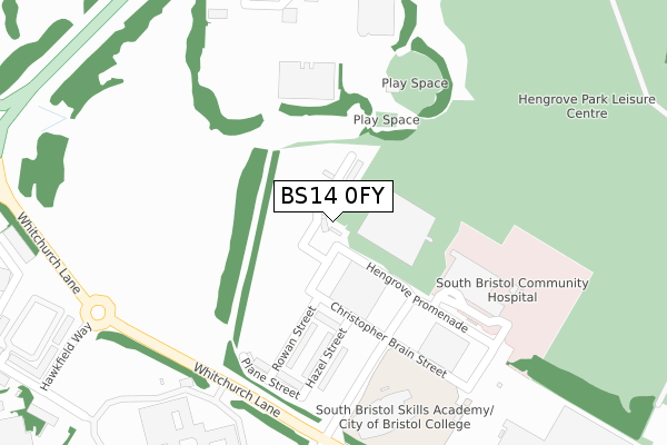
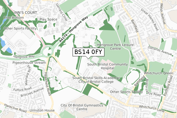
BS14 0FY is located in the Hengrove and Whitchurch Park electoral ward, within the unitary authority of Bristol, City of and the English Parliamentary constituency of Bristol South. The Sub Integrated Care Board (ICB) Location is NHS Bristol, North Somerset and South Gloucestershire ICB - 15C and the police force is Avon and Somerset. This postcode has been in use since November 2019.


GetTheData
Source: OS Open Zoomstack (Ordnance Survey)
Licence: Open Government Licence (requires attribution)
Attribution: Contains OS data © Crown copyright and database right 2024
Source: Open Postcode Geo
Licence: Open Government Licence (requires attribution)
Attribution: Contains OS data © Crown copyright and database right 2024; Contains Royal Mail data © Royal Mail copyright and database right 2024; Source: Office for National Statistics licensed under the Open Government Licence v.3.0
| Easting | 359328 |
| Northing | 168433 |
| Latitude | 51.413446 |
| Longitude | -2.586211 |
GetTheData
Source: Open Postcode Geo
Licence: Open Government Licence
| Country | England |
| Postcode District | BS14 |
| ➜ BS14 open data dashboard ➜ See where BS14 is on a map ➜ Where is Bristol? | |
GetTheData
Source: Land Registry Price Paid Data
Licence: Open Government Licence
| Ward | Hengrove And Whitchurch Park |
| Constituency | Bristol South |
GetTheData
Source: ONS Postcode Database
Licence: Open Government Licence
2, HENGROVE SQUARE, BRISTOL, BS14 0FY 2020 10 DEC £460,000 |
4, HENGROVE SQUARE, BRISTOL, BS14 0FY 2020 27 NOV £350,000 |
GetTheData
Source: HM Land Registry Price Paid Data
Licence: Contains HM Land Registry data © Crown copyright and database right 2024. This data is licensed under the Open Government Licence v3.0.
| June 2022 | Criminal damage and arson | On or near Sports/Recreation Area | 358m |
| June 2022 | Anti-social behaviour | On or near Sports/Recreation Area | 358m |
| June 2022 | Anti-social behaviour | On or near Sports/Recreation Area | 358m |
| ➜ Get more crime data in our Crime section | |||
GetTheData
Source: data.police.uk
Licence: Open Government Licence
| Skills Academy (The Boulevard) | Hengrove Park | 241m |
| South Bristol Hosp | Hengrove Park | 258m |
| The Boulevard (Whitchurch Lane) | Hengrove Park | 281m |
| The Boulevard (Whitchurch Lane) | Hengrove Park | 293m |
| Hengrove Leisure Park (Hengrove Way) | Hengrove | 477m |
| Parson Street Station | 2.7km |
| Bedminster Station | 3km |
| Bristol Temple Meads Station | 4km |
GetTheData
Source: NaPTAN
Licence: Open Government Licence
| Percentage of properties with Next Generation Access | 0.0% |
| Percentage of properties with Superfast Broadband | 0.0% |
| Percentage of properties with Ultrafast Broadband | 0.0% |
| Percentage of properties with Full Fibre Broadband | 0.0% |
Superfast Broadband is between 30Mbps and 300Mbps
Ultrafast Broadband is > 300Mbps
| Percentage of properties unable to receive 2Mbps | 0.0% |
| Percentage of properties unable to receive 5Mbps | 0.0% |
| Percentage of properties unable to receive 10Mbps | 0.0% |
| Percentage of properties unable to receive 30Mbps | 0.0% |
GetTheData
Source: Ofcom
Licence: Ofcom Terms of Use (requires attribution)
GetTheData
Source: ONS Postcode Database
Licence: Open Government Licence


➜ Get more ratings from the Food Standards Agency
GetTheData
Source: Food Standards Agency
Licence: FSA terms & conditions
| Last Collection | |||
|---|---|---|---|
| Location | Mon-Fri | Sat | Distance |
| Bamfield | 16:15 | 11:30 | 931m |
| Bishport Avenue | 16:00 | 12:00 | 932m |
| Langhill Avenue | 17:00 | 11:45 | 1,103m |
GetTheData
Source: Dracos
Licence: Creative Commons Attribution-ShareAlike
| Facility | Distance |
|---|---|
| Hengrove Park Leisure Centre Hengrove Promenade, Bristol Sports Hall, Swimming Pool, Health and Fitness Gym, Studio | 184m |
| City Of Bristol Gymnastics Centre Teyfant Road, Bristol Studio | 675m |
| Bristol Cycling Centre Bamfield, Bamfield, Bristol Cycling | 684m |
GetTheData
Source: Active Places
Licence: Open Government Licence
| School | Phase of Education | Distance |
|---|---|---|
| New Fosseway School Bridge Learning Campus, Teyfant Road, Hartcliffe, Bristol, BS13 0RG | Not applicable | 680m |
| Bridge Learning Campus William Jessop Way, Hartcliffe, Bristol, BS13 0RL | All-through | 835m |
| Wansdyke Primary School School Close, Whitchurch, Bristol, BS14 0DU | Primary | 851m |
GetTheData
Source: Edubase
Licence: Open Government Licence
The below table lists the International Territorial Level (ITL) codes (formerly Nomenclature of Territorial Units for Statistics (NUTS) codes) and Local Administrative Units (LAU) codes for BS14 0FY:
| ITL 1 Code | Name |
|---|---|
| TLK | South West (England) |
| ITL 2 Code | Name |
| TLK1 | Gloucestershire, Wiltshire and Bath/Bristol area |
| ITL 3 Code | Name |
| TLK11 | Bristol, City of |
| LAU 1 Code | Name |
| E06000023 | Bristol, City of |
GetTheData
Source: ONS Postcode Directory
Licence: Open Government Licence
The below table lists the Census Output Area (OA), Lower Layer Super Output Area (LSOA), and Middle Layer Super Output Area (MSOA) for BS14 0FY:
| Code | Name | |
|---|---|---|
| OA | E00073784 | |
| LSOA | E01014607 | Bristol 047A |
| MSOA | E02003058 | Bristol 047 |
GetTheData
Source: ONS Postcode Directory
Licence: Open Government Licence
| BS14 0BB | Hawkfield Way | 508m |
| BS4 1XJ | Sullivan Close | 586m |
| BS4 1XL | Coates Walk | 605m |
| BS4 1XH | Lambert Place | 609m |
| BS14 0BN | Hawkfield Close | 611m |
| BS14 0AP | Rowacres | 641m |
| BS4 1XQ | Farrant Close | 646m |
| BS13 0BH | Hawkfield Road | 652m |
| BS14 0DJ | Longway Avenue | 664m |
| BS4 1XF | Dowland Grove | 670m |
GetTheData
Source: Open Postcode Geo; Land Registry Price Paid Data
Licence: Open Government Licence