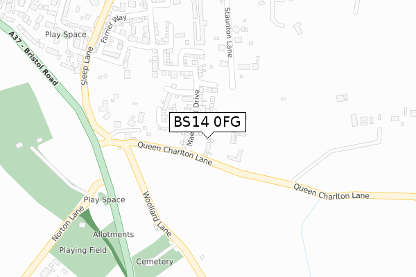
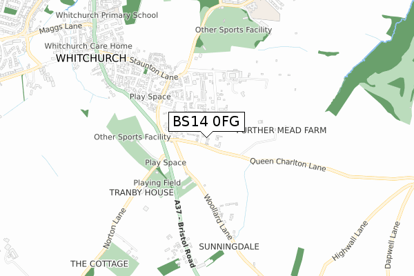
BS14 0FG is located in the Publow & Whitchurch electoral ward, within the unitary authority of Bath and North East Somerset and the English Parliamentary constituency of North East Somerset. The Sub Integrated Care Board (ICB) Location is NHS Bath and North East Somerset, Swindon and Wiltshire ICB - 92 and the police force is Avon and Somerset. This postcode has been in use since May 2018.


GetTheData
Source: OS Open Zoomstack (Ordnance Survey)
Licence: Open Government Licence (requires attribution)
Attribution: Contains OS data © Crown copyright and database right 2024
Source: Open Postcode Geo
Licence: Open Government Licence (requires attribution)
Attribution: Contains OS data © Crown copyright and database right 2024; Contains Royal Mail data © Royal Mail copyright and database right 2024; Source: Office for National Statistics licensed under the Open Government Licence v.3.0
| Easting | 361922 |
| Northing | 167105 |
| Latitude | 51.401686 |
| Longitude | -2.548771 |
GetTheData
Source: Open Postcode Geo
Licence: Open Government Licence
| Country | England |
| Postcode District | BS14 |
| ➜ BS14 open data dashboard ➜ See where BS14 is on a map ➜ Where is Whitchurch? | |
GetTheData
Source: Land Registry Price Paid Data
Licence: Open Government Licence
| Ward | Publow & Whitchurch |
| Constituency | North East Somerset |
GetTheData
Source: ONS Postcode Database
Licence: Open Government Licence
2023 14 FEB £427,000 |
2, DOBUNNI CLOSE, WHITCHURCH, BRISTOL, BS14 0FG 2018 2 NOV £389,995 |
2018 12 JUL £362,995 |
3, DOBUNNI CLOSE, WHITCHURCH, BRISTOL, BS14 0FG 2018 29 JUN £444,995 |
5, DOBUNNI CLOSE, WHITCHURCH, BRISTOL, BS14 0FG 2018 11 MAY £442,995 |
6, DOBUNNI CLOSE, WHITCHURCH, BRISTOL, BS14 0FG 2018 11 MAY £436,995 |
7, DOBUNNI CLOSE, WHITCHURCH, BRISTOL, BS14 0FG 2018 11 MAY £362,995 |
GetTheData
Source: HM Land Registry Price Paid Data
Licence: Contains HM Land Registry data © Crown copyright and database right 2024. This data is licensed under the Open Government Licence v3.0.
| May 2022 | Anti-social behaviour | On or near Sleep Lane | 347m |
| May 2022 | Violence and sexual offences | On or near Sleep Lane | 347m |
| May 2022 | Violence and sexual offences | On or near Sleep Lane | 347m |
| ➜ Get more crime data in our Crime section | |||
GetTheData
Source: data.police.uk
Licence: Open Government Licence
| Norton Lane (Bristol Road) | Whitchurch | 264m |
| Sleep Lane (Bristol Road) | Whitchurch | 296m |
| Sleep Lane | Whitchurch | 327m |
| Staunton Lodge (Staunton Lane) | Whitchurch | 653m |
| Staunton Lodge (Staunton Lane) | Whitchurch | 658m |
| Keynsham Station | 4.1km |
| Bedminster Station | 5.3km |
| Parson Street Station | 5.4km |
GetTheData
Source: NaPTAN
Licence: Open Government Licence
| Percentage of properties with Next Generation Access | 100.0% |
| Percentage of properties with Superfast Broadband | 100.0% |
| Percentage of properties with Ultrafast Broadband | 100.0% |
| Percentage of properties with Full Fibre Broadband | 100.0% |
Superfast Broadband is between 30Mbps and 300Mbps
Ultrafast Broadband is > 300Mbps
| Percentage of properties unable to receive 2Mbps | 0.0% |
| Percentage of properties unable to receive 5Mbps | 0.0% |
| Percentage of properties unable to receive 10Mbps | 0.0% |
| Percentage of properties unable to receive 30Mbps | 0.0% |
GetTheData
Source: Ofcom
Licence: Ofcom Terms of Use (requires attribution)
GetTheData
Source: ONS Postcode Database
Licence: Open Government Licence


➜ Get more ratings from the Food Standards Agency
GetTheData
Source: Food Standards Agency
Licence: FSA terms & conditions
| Last Collection | |||
|---|---|---|---|
| Location | Mon-Fri | Sat | Distance |
| Staunton Lane | 16:45 | 10:00 | 434m |
| Whitchurch Old Post Office | 17:30 | 12:30 | 859m |
| Gilda Parade | 17:30 | 12:45 | 1,586m |
GetTheData
Source: Dracos
Licence: Creative Commons Attribution-ShareAlike
| Facility | Distance |
|---|---|
| Whitchurch Cricket Club Norton Lane, Whitchurch, Bristol Grass Pitches | 369m |
| Bristol Barbarians Rfc Norton Lane, Whitchurch, Bristol Grass Pitches | 405m |
| Cutters Friday Ground Stockwood Lane, Stockwood, Bristol Grass Pitches | 544m |
GetTheData
Source: Active Places
Licence: Open Government Licence
| School | Phase of Education | Distance |
|---|---|---|
| Lansdown Park Academy Stockwood Lane, Bristol, BS14 8SJ | Not applicable | 840m |
| Whitchurch Primary School 22 Bristol Road, Whitchurch, Bristol, BS14 0PT | Primary | 958m |
| Waycroft Academy Selden Road, Stockwood, Bristol, BS14 8PS | Primary | 1.3km |
GetTheData
Source: Edubase
Licence: Open Government Licence
The below table lists the International Territorial Level (ITL) codes (formerly Nomenclature of Territorial Units for Statistics (NUTS) codes) and Local Administrative Units (LAU) codes for BS14 0FG:
| ITL 1 Code | Name |
|---|---|
| TLK | South West (England) |
| ITL 2 Code | Name |
| TLK1 | Gloucestershire, Wiltshire and Bath/Bristol area |
| ITL 3 Code | Name |
| TLK12 | Bath and North East Somerset, North Somerset and South Gloucestershire |
| LAU 1 Code | Name |
| E06000022 | Bath and North East Somerset |
GetTheData
Source: ONS Postcode Directory
Licence: Open Government Licence
The below table lists the Census Output Area (OA), Lower Layer Super Output Area (LSOA), and Middle Layer Super Output Area (MSOA) for BS14 0FG:
| Code | Name | |
|---|---|---|
| OA | E00072969 | |
| LSOA | E01014447 | Bath and North East Somerset 020E |
| MSOA | E02003004 | Bath and North East Somerset 020 |
GetTheData
Source: ONS Postcode Directory
Licence: Open Government Licence
| BS14 0QP | Queen Charlton Lane | 80m |
| BS14 0QL | Staunton Lane | 326m |
| BS14 0QN | Sleep Lane | 356m |
| BS14 0SZ | Hamilton Way | 459m |
| BS14 0QW | Bristol Road | 495m |
| BS14 0QR | Woollard Lane | 520m |
| BS14 0QG | Staunton Lane | 521m |
| BS14 0TT | Lines Way | 531m |
| BS14 0BT | Norton Lane | 563m |
| BS14 0TP | Oldbridge Road | 578m |
GetTheData
Source: Open Postcode Geo; Land Registry Price Paid Data
Licence: Open Government Licence