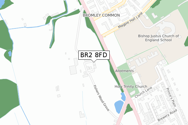
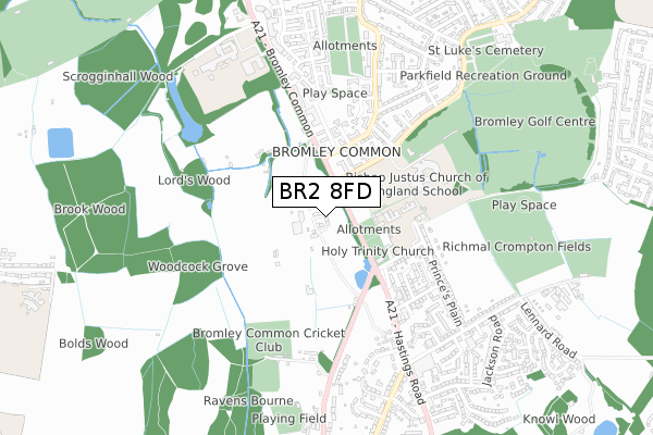
BR2 8FD is located in the Bromley Common & Holwood electoral ward, within the London borough of Bromley and the English Parliamentary constituency of Beckenham. The Sub Integrated Care Board (ICB) Location is NHS South East London ICB - 72Q and the police force is Metropolitan Police. This postcode has been in use since December 2018.


GetTheData
Source: OS Open Zoomstack (Ordnance Survey)
Licence: Open Government Licence (requires attribution)
Attribution: Contains OS data © Crown copyright and database right 2024
Source: Open Postcode Geo
Licence: Open Government Licence (requires attribution)
Attribution: Contains OS data © Crown copyright and database right 2024; Contains Royal Mail data © Royal Mail copyright and database right 2024; Source: Office for National Statistics licensed under the Open Government Licence v.3.0
| Easting | 542040 |
| Northing | 166606 |
| Latitude | 51.380740 |
| Longitude | 0.039662 |
GetTheData
Source: Open Postcode Geo
Licence: Open Government Licence
| Country | England |
| Postcode District | BR2 |
| ➜ BR2 open data dashboard ➜ See where BR2 is on a map ➜ Where is London? | |
GetTheData
Source: Land Registry Price Paid Data
Licence: Open Government Licence
| Ward | Bromley Common & Holwood |
| Constituency | Beckenham |
GetTheData
Source: ONS Postcode Database
Licence: Open Government Licence
2023 25 JUL £1,280,000 |
2020 13 JUL £950,000 |
8, FISHERS WOOD GROVE, BROMLEY, BR2 8FD 2020 28 FEB £980,000 |
1, FISHERS WOOD GROVE, BROMLEY, BR2 8FD 2019 7 JUN £950,000 |
2, FISHERS WOOD GROVE, BROMLEY, BR2 8FD 2019 30 APR £955,000 |
GetTheData
Source: HM Land Registry Price Paid Data
Licence: Contains HM Land Registry data © Crown copyright and database right 2024. This data is licensed under the Open Government Licence v3.0.
| December 2023 | Anti-social behaviour | On or near Link Way | 414m |
| December 2023 | Violence and sexual offences | On or near Link Way | 414m |
| December 2023 | Violence and sexual offences | On or near Link Way | 414m |
| ➜ Get more crime data in our Crime section | |||
GetTheData
Source: data.police.uk
Licence: Open Government Licence
| Bromley Common Holy Trinity Church (Bromley Common) | Bromley Common | 166m |
| Bromley Common Turpington Lane | Bromley Common | 212m |
| Turpington Lane Bromley Common (Turpington Lane) | Bromley Common | 291m |
| Hastings Road Trinity Church (Oakley Road) | Bromley Common | 296m |
| Bromley Common Turpington Lane | Bromley Common | 306m |
| Hayes (Kent) Station | 2.1km |
| Bickley Station | 2.2km |
| Petts Wood Station | 2.6km |
GetTheData
Source: NaPTAN
Licence: Open Government Licence
| Percentage of properties with Next Generation Access | 100.0% |
| Percentage of properties with Superfast Broadband | 100.0% |
| Percentage of properties with Ultrafast Broadband | 100.0% |
| Percentage of properties with Full Fibre Broadband | 0.0% |
Superfast Broadband is between 30Mbps and 300Mbps
Ultrafast Broadband is > 300Mbps
| Percentage of properties unable to receive 2Mbps | 0.0% |
| Percentage of properties unable to receive 5Mbps | 0.0% |
| Percentage of properties unable to receive 10Mbps | 0.0% |
| Percentage of properties unable to receive 30Mbps | 0.0% |
GetTheData
Source: Ofcom
Licence: Ofcom Terms of Use (requires attribution)
GetTheData
Source: ONS Postcode Database
Licence: Open Government Licence


➜ Get more ratings from the Food Standards Agency
GetTheData
Source: Food Standards Agency
Licence: FSA terms & conditions
| Last Collection | |||
|---|---|---|---|
| Location | Mon-Fri | Sat | Distance |
| Bromley Common | 18:00 | 12:00 | 759m |
| Sunray Avenue (32 Magpie) | 18:15 | 12:00 | 952m |
| Salisbury Road (18) | 18:30 | 12:00 | 1,055m |
GetTheData
Source: Dracos
Licence: Creative Commons Attribution-ShareAlike
| Facility | Distance |
|---|---|
| Bromley Sea Cadets Hall Magpie Hall Lane, Bromley Sports Hall | 243m |
| Holy Trinity Church Church Lane, Bromley Studio | 258m |
| Trinity Church Of England Primary School Princes Plain, Bromley Artificial Grass Pitch | 276m |
GetTheData
Source: Active Places
Licence: Open Government Licence
| School | Phase of Education | Distance |
|---|---|---|
| Bishop Justus CofE School Magpie Hall Lane, Bromley, BR2 8HZ | Secondary | 266m |
| TLC The Learning Centre Princes Plain, Bromley, Orpington, BR2 8LD | Not applicable | 390m |
| Trinity Church of England Primary School Princes Plain, Bromley, BR2 8LD | Primary | 390m |
GetTheData
Source: Edubase
Licence: Open Government Licence
The below table lists the International Territorial Level (ITL) codes (formerly Nomenclature of Territorial Units for Statistics (NUTS) codes) and Local Administrative Units (LAU) codes for BR2 8FD:
| ITL 1 Code | Name |
|---|---|
| TLI | London |
| ITL 2 Code | Name |
| TLI6 | Outer London - South |
| ITL 3 Code | Name |
| TLI61 | Bromley |
| LAU 1 Code | Name |
| E09000006 | Bromley |
GetTheData
Source: ONS Postcode Directory
Licence: Open Government Licence
The below table lists the Census Output Area (OA), Lower Layer Super Output Area (LSOA), and Middle Layer Super Output Area (MSOA) for BR2 8FD:
| Code | Name | |
|---|---|---|
| OA | E00003212 | |
| LSOA | E01000661 | Bromley 026A |
| MSOA | E02000152 | Bromley 026 |
GetTheData
Source: ONS Postcode Directory
Licence: Open Government Licence
| BR2 8LD | Princes Plain | 276m |
| BR2 8FF | Brosse Way | 289m |
| BR2 8JW | Cobham Close | 308m |
| BR2 8JE | Magpie Hall Lane | 320m |
| BR2 8LA | Church Lane | 324m |
| BR2 8JN | Turpington Lane | 328m |
| BR2 8NZ | Hastings Road | 352m |
| BR2 8LB | Church Lane | 352m |
| BR2 8JR | Turpington Lane | 367m |
| BR2 8JP | Turpington Close | 371m |
GetTheData
Source: Open Postcode Geo; Land Registry Price Paid Data
Licence: Open Government Licence