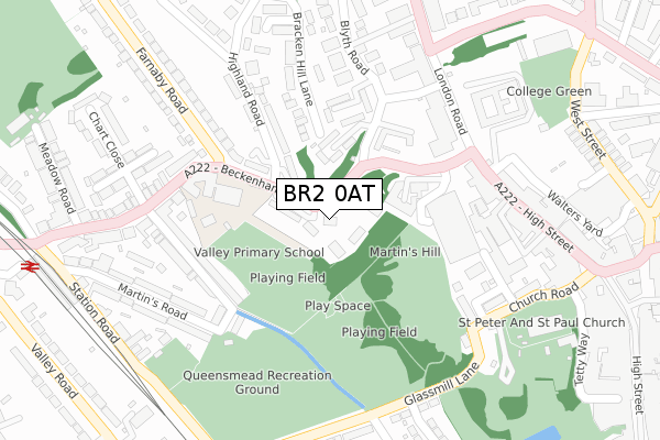
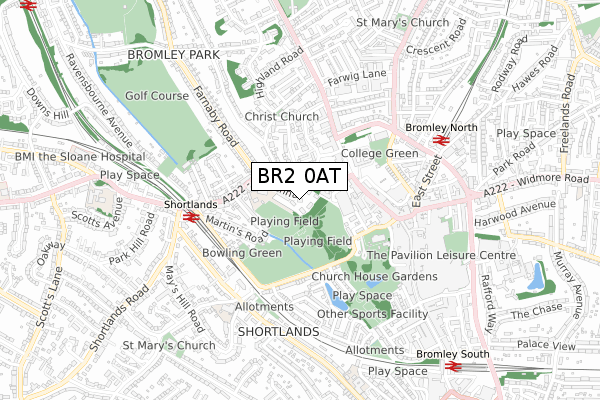
BR2 0AT is located in the Shortlands & Park Langley electoral ward, within the London borough of Bromley and the English Parliamentary constituency of Bromley and Chislehurst. The Sub Integrated Care Board (ICB) Location is NHS South East London ICB - 72Q and the police force is Metropolitan Police. This postcode has been in use since December 2019.


GetTheData
Source: OS Open Zoomstack (Ordnance Survey)
Licence: Open Government Licence (requires attribution)
Attribution: Contains OS data © Crown copyright and database right 2024
Source: Open Postcode Geo
Licence: Open Government Licence (requires attribution)
Attribution: Contains OS data © Crown copyright and database right 2024; Contains Royal Mail data © Royal Mail copyright and database right 2024; Source: Office for National Statistics licensed under the Open Government Licence v.3.0
| Easting | 539795 |
| Northing | 169406 |
| Latitude | 51.406457 |
| Longitude | 0.008525 |
GetTheData
Source: Open Postcode Geo
Licence: Open Government Licence
| Country | England |
| Postcode District | BR2 |
| ➜ BR2 open data dashboard ➜ See where BR2 is on a map ➜ Where is Bromley? | |
GetTheData
Source: Land Registry Price Paid Data
Licence: Open Government Licence
| Ward | Shortlands & Park Langley |
| Constituency | Bromley And Chislehurst |
GetTheData
Source: ONS Postcode Database
Licence: Open Government Licence
| January 2024 | Anti-social behaviour | On or near Blyth Road | 256m |
| January 2024 | Anti-social behaviour | On or near Blyth Road | 256m |
| January 2024 | Anti-social behaviour | On or near Blyth Road | 256m |
| ➜ Get more crime data in our Crime section | |||
GetTheData
Source: data.police.uk
Licence: Open Government Licence
| Bromley Magistrates Court | Bromley | 168m |
| Beckenham Lane (Farnaby Road) | Bromley Park | 225m |
| Bromley Magistrates Court | Bromley | 243m |
| Bromley Magistrates Court (London Road) | Bromley | 262m |
| Farnaby Road Beckenham Lane (Farnaby Road) | Bromley Park | 264m |
| Shortlands Station | 0.5km |
| Bromley North Station | 0.6km |
| Bromley South Station | 0.9km |
GetTheData
Source: NaPTAN
Licence: Open Government Licence
GetTheData
Source: ONS Postcode Database
Licence: Open Government Licence


➜ Get more ratings from the Food Standards Agency
GetTheData
Source: Food Standards Agency
Licence: FSA terms & conditions
| Last Collection | |||
|---|---|---|---|
| Location | Mon-Fri | Sat | Distance |
| Beckenham Lane (Hollydene) | 18:00 | 12:00 | 149m |
| College Slip (Opp' 258) | 18:30 | 12:00 | 250m |
| Church Road | 18:00 | 12:00 | 298m |
GetTheData
Source: Dracos
Licence: Creative Commons Attribution-ShareAlike
| Facility | Distance |
|---|---|
| Valley Primary School Beckenham Lane, Bromley Sports Hall, Grass Pitches | 206m |
| Queensmead Recreation Ground Queensmead Road, Bromley Grass Pitches | 273m |
| West Wickham New Church Hall High Street, Bromley Sports Hall | 482m |
GetTheData
Source: Active Places
Licence: Open Government Licence
| School | Phase of Education | Distance |
|---|---|---|
| Valley Primary School Beckenham Lane, Shortlands, Bromley, BR2 0DA | Primary | 206m |
| Harris Primary Academy Shortlands Kingswood Road, Bromley, BR2 0HG | Primary | 559m |
| Bromley Mencap Station Road, Bromley, BR1 3LP | Not applicable | 626m |
GetTheData
Source: Edubase
Licence: Open Government Licence
The below table lists the International Territorial Level (ITL) codes (formerly Nomenclature of Territorial Units for Statistics (NUTS) codes) and Local Administrative Units (LAU) codes for BR2 0AT:
| ITL 1 Code | Name |
|---|---|
| TLI | London |
| ITL 2 Code | Name |
| TLI6 | Outer London - South |
| ITL 3 Code | Name |
| TLI61 | Bromley |
| LAU 1 Code | Name |
| E09000006 | Bromley |
GetTheData
Source: ONS Postcode Directory
Licence: Open Government Licence
The below table lists the Census Output Area (OA), Lower Layer Super Output Area (LSOA), and Middle Layer Super Output Area (MSOA) for BR2 0AT:
| Code | Name | |
|---|---|---|
| OA | E00003261 | |
| LSOA | E01000677 | Bromley 018C |
| MSOA | E02000144 | Bromley 018 |
GetTheData
Source: ONS Postcode Directory
Licence: Open Government Licence
| BR2 0DA | Beckenham Lane | 46m |
| BR2 0DB | Beckenham Lane | 53m |
| BR2 0DG | Beckenham Lane | 59m |
| BR2 0DF | Beckenham Lane | 75m |
| BR2 0DJ | Highland Road | 90m |
| BR2 0DD | Hill House Mews | 102m |
| BR1 3RT | Blyth Road | 122m |
| BR2 0DL | Beckenham Lane | 137m |
| BR2 0DE | Hill House Mews | 139m |
| BR1 3RU | Blyth Road | 158m |
GetTheData
Source: Open Postcode Geo; Land Registry Price Paid Data
Licence: Open Government Licence