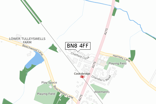
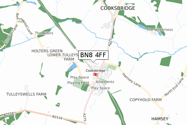
BN8 4FF is located in the Chailey, Barcombe & Hamsey electoral ward, within the local authority district of Lewes and the English Parliamentary constituency of Lewes. The Sub Integrated Care Board (ICB) Location is NHS Sussex ICB - 97R and the police force is Sussex. This postcode has been in use since May 2018.


GetTheData
Source: OS Open Zoomstack (Ordnance Survey)
Licence: Open Government Licence (requires attribution)
Attribution: Contains OS data © Crown copyright and database right 2024
Source: Open Postcode Geo
Licence: Open Government Licence (requires attribution)
Attribution: Contains OS data © Crown copyright and database right 2024; Contains Royal Mail data © Royal Mail copyright and database right 2024; Source: Office for National Statistics licensed under the Open Government Licence v.3.0
| Easting | 540041 |
| Northing | 113629 |
| Latitude | 50.905151 |
| Longitude | -0.009628 |
GetTheData
Source: Open Postcode Geo
Licence: Open Government Licence
| Country | England |
| Postcode District | BN8 |
| ➜ BN8 open data dashboard ➜ See where BN8 is on a map ➜ Where is Cooksbridge? | |
GetTheData
Source: Land Registry Price Paid Data
Licence: Open Government Licence
| Ward | Chailey, Barcombe & Hamsey |
| Constituency | Lewes |
GetTheData
Source: ONS Postcode Database
Licence: Open Government Licence
| March 2023 | Public order | On or near Parking Area | 155m |
| May 2022 | Other crime | On or near Malthouse Way | 430m |
| March 2022 | Criminal damage and arson | On or near A275 | 485m |
| ➜ Get more crime data in our Crime section | |||
GetTheData
Source: data.police.uk
Licence: Open Government Licence
| Railway Station (A275) | Cooksbridge | 153m |
| Railway Station (A275) | Cooksbridge | 168m |
| The Rainbow Ph (Resting Oak Hill) | Cooksbridge | 668m |
| The Rainbow Ph (Resting Oak Hill) | Cooksbridge | 678m |
| Winterlands Farm (A275) | Cooksbridge | 1,271m |
| Cooksbridge Station | 0.2km |
| Lewes Station | 4.1km |
| Plumpton Station | 4.4km |
GetTheData
Source: NaPTAN
Licence: Open Government Licence
| Percentage of properties with Next Generation Access | 100.0% |
| Percentage of properties with Superfast Broadband | 100.0% |
| Percentage of properties with Ultrafast Broadband | 100.0% |
| Percentage of properties with Full Fibre Broadband | 100.0% |
Superfast Broadband is between 30Mbps and 300Mbps
Ultrafast Broadband is > 300Mbps
| Percentage of properties unable to receive 2Mbps | 0.0% |
| Percentage of properties unable to receive 5Mbps | 0.0% |
| Percentage of properties unable to receive 10Mbps | 0.0% |
| Percentage of properties unable to receive 30Mbps | 0.0% |
GetTheData
Source: Ofcom
Licence: Ofcom Terms of Use (requires attribution)
GetTheData
Source: ONS Postcode Database
Licence: Open Government Licence


➜ Get more ratings from the Food Standards Agency
GetTheData
Source: Food Standards Agency
Licence: FSA terms & conditions
| Last Collection | |||
|---|---|---|---|
| Location | Mon-Fri | Sat | Distance |
| Cooksbridge Station | 16:45 | 10:15 | 167m |
| Tulley Wells | 16:15 | 09:00 | 1,242m |
| Hamsey House | 16:15 | 07:30 | 1,317m |
GetTheData
Source: Dracos
Licence: Creative Commons Attribution-ShareAlike
| Facility | Distance |
|---|---|
| The Recreation Ground (Closed) Beechwood Lane, Cooksbridge, Lewes Grass Pitches | 1.3km |
| Wallands Community Primary School Gundreda Road, Lewes Grass Pitches, Swimming Pool | 2.9km |
| Barcombe Recreation Ground School Gardens, Barcombe, Lewes Grass Pitches, Outdoor Tennis Courts | 3km |
GetTheData
Source: Active Places
Licence: Open Government Licence
| School | Phase of Education | Distance |
|---|---|---|
| Hamsey Community Primary School Cooksbridge, Lewes, BN8 4SJ | Primary | 150m |
| Wallands Community Primary and Nursery School Gundreda Road, Lewes, BN7 1PU | Primary | 2.9km |
| Barcombe Church of England Primary School Barcombe Cross, Lewes, BN8 5DN | Primary | 3km |
GetTheData
Source: Edubase
Licence: Open Government Licence
The below table lists the International Territorial Level (ITL) codes (formerly Nomenclature of Territorial Units for Statistics (NUTS) codes) and Local Administrative Units (LAU) codes for BN8 4FF:
| ITL 1 Code | Name |
|---|---|
| TLJ | South East (England) |
| ITL 2 Code | Name |
| TLJ2 | Surrey, East and West Sussex |
| ITL 3 Code | Name |
| TLJ22 | East Sussex CC |
| LAU 1 Code | Name |
| E07000063 | Lewes |
GetTheData
Source: ONS Postcode Directory
Licence: Open Government Licence
The below table lists the Census Output Area (OA), Lower Layer Super Output Area (LSOA), and Middle Layer Super Output Area (MSOA) for BN8 4FF:
| Code | Name | |
|---|---|---|
| OA | E00106768 | |
| LSOA | E01021022 | Lewes 001A |
| MSOA | E02004379 | Lewes 001 |
GetTheData
Source: ONS Postcode Directory
Licence: Open Government Licence
| BN8 4SN | Wellington Cottages | 115m |
| BN8 4FE | Station Mews | 139m |
| BN8 4SJ | 146m | |
| BN8 4SW | 157m | |
| BN8 4SY | Littlemead | 165m |
| BN8 4SZ | Chandlers Mead | 245m |
| BN8 4TA | Downsview Cottages | 301m |
| BN7 3QG | Beechwood Lane | 315m |
| BN8 4SP | 348m | |
| BN7 3PT | Malthouse Way | 374m |
GetTheData
Source: Open Postcode Geo; Land Registry Price Paid Data
Licence: Open Government Licence