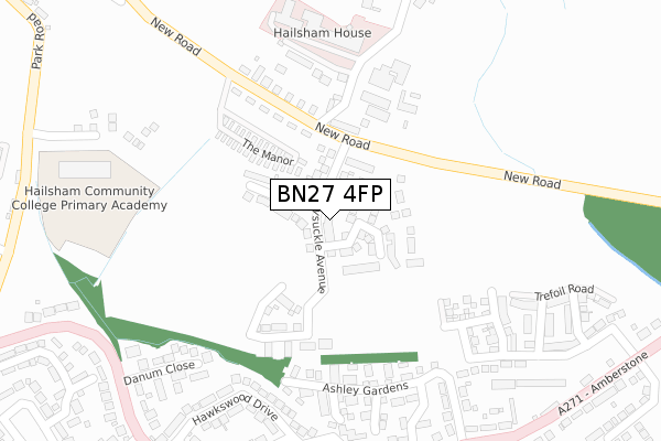
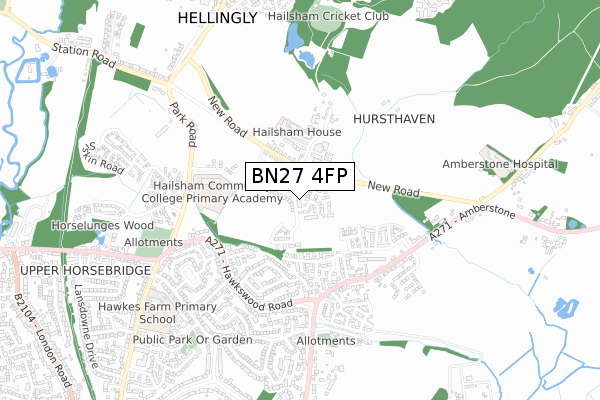
BN27 4FP is located in the Hellingly electoral ward, within the local authority district of Wealden and the English Parliamentary constituency of Wealden. The Sub Integrated Care Board (ICB) Location is NHS Sussex ICB - 97R and the police force is Sussex. This postcode has been in use since June 2019.


GetTheData
Source: OS Open Zoomstack (Ordnance Survey)
Licence: Open Government Licence (requires attribution)
Attribution: Contains OS data © Crown copyright and database right 2024
Source: Open Postcode Geo
Licence: Open Government Licence (requires attribution)
Attribution: Contains OS data © Crown copyright and database right 2024; Contains Royal Mail data © Royal Mail copyright and database right 2024; Source: Office for National Statistics licensed under the Open Government Licence v.3.0
| Easting | 559382 |
| Northing | 111342 |
| Latitude | 50.879591 |
| Longitude | 0.264236 |
GetTheData
Source: Open Postcode Geo
Licence: Open Government Licence
| Country | England |
| Postcode District | BN27 |
| ➜ BN27 open data dashboard ➜ See where BN27 is on a map ➜ Where is Hellingly? | |
GetTheData
Source: Land Registry Price Paid Data
Licence: Open Government Licence
| Ward | Hellingly |
| Constituency | Wealden |
GetTheData
Source: ONS Postcode Database
Licence: Open Government Licence
2023 13 FEB £505,000 |
77, HONEYSUCKLE AVENUE, HELLINGLY, HAILSHAM, BN27 4FP 2021 19 NOV £375,995 |
71, HONEYSUCKLE AVENUE, HELLINGLY, HAILSHAM, BN27 4FP 2021 16 NOV £354,995 |
72, HONEYSUCKLE AVENUE, HELLINGLY, HAILSHAM, BN27 4FP 2021 18 OCT £375,995 |
66, HONEYSUCKLE AVENUE, HELLINGLY, HAILSHAM, BN27 4FP 2021 8 OCT £351,750 |
57, HONEYSUCKLE AVENUE, HELLINGLY, HAILSHAM, BN27 4FP 2021 20 AUG £444,995 |
63, HONEYSUCKLE AVENUE, HELLINGLY, HAILSHAM, BN27 4FP 2021 9 AUG £436,000 |
36, HONEYSUCKLE AVENUE, HELLINGLY, HAILSHAM, BN27 4FP 2021 28 JUN £389,995 |
69, HONEYSUCKLE AVENUE, HELLINGLY, HAILSHAM, BN27 4FP 2021 4 JUN £349,995 |
54, HONEYSUCKLE AVENUE, HELLINGLY, HAILSHAM, BN27 4FP 2021 28 MAY £387,995 |
GetTheData
Source: HM Land Registry Price Paid Data
Licence: Contains HM Land Registry data © Crown copyright and database right 2024. This data is licensed under the Open Government Licence v3.0.
| December 2022 | Criminal damage and arson | On or near Linden Grove | 206m |
| June 2022 | Other theft | On or near Linden Grove | 161m |
| June 2022 | Public order | On or near New Road | 227m |
| ➜ Get more crime data in our Crime section | |||
GetTheData
Source: data.police.uk
Licence: Open Government Licence
| Park Gate (Hawkswood Road) | Upper Horsebridge | 298m |
| Park Gate (Hawkswood Road) | Upper Horsebridge | 311m |
| Amberstone View (Hawkswood Road) | Upper Horsebridge | 315m |
| Amberstone View (Hawkswood Road) | Upper Horsebridge | 327m |
| Hawkswood Drive (Hawkswood Road) | Upper Horsebridge | 377m |
GetTheData
Source: NaPTAN
Licence: Open Government Licence
| Percentage of properties with Next Generation Access | 100.0% |
| Percentage of properties with Superfast Broadband | 100.0% |
| Percentage of properties with Ultrafast Broadband | 100.0% |
| Percentage of properties with Full Fibre Broadband | 100.0% |
Superfast Broadband is between 30Mbps and 300Mbps
Ultrafast Broadband is > 300Mbps
| Percentage of properties unable to receive 2Mbps | 0.0% |
| Percentage of properties unable to receive 5Mbps | 0.0% |
| Percentage of properties unable to receive 10Mbps | 0.0% |
| Percentage of properties unable to receive 30Mbps | 0.0% |
GetTheData
Source: Ofcom
Licence: Ofcom Terms of Use (requires attribution)
GetTheData
Source: ONS Postcode Database
Licence: Open Government Licence


➜ Get more ratings from the Food Standards Agency
GetTheData
Source: Food Standards Agency
Licence: FSA terms & conditions
| Last Collection | |||
|---|---|---|---|
| Location | Mon-Fri | Sat | Distance |
| Hawkswood Post Office | 16:45 | 12:00 | 377m |
| Harebeating Drive | 16:45 | 12:00 | 574m |
| Hawks Road | 17:00 | 12:00 | 684m |
GetTheData
Source: Dracos
Licence: Creative Commons Attribution-ShareAlike
| Facility | Distance |
|---|---|
| Hailsham Primary Academy Bulrush Lane, Hellingly, Hailsham Grass Pitches, Sports Hall | 474m |
| Hellingley Hospital Fc (Closed) Hellingly, Hailsham Grass Pitches | 965m |
| Hellingly Centre The Drive, Hellingly Artificial Grass Pitch | 1.3km |
GetTheData
Source: Active Places
Licence: Open Government Licence
| School | Phase of Education | Distance |
|---|---|---|
| Hawkes Farm Academy Hawks Road, Hailsham, BN27 1ND | Primary | 721m |
| The Ropemakers' Academy Reef Way, Hailsham, BN27 1FB | Not applicable | 1.5km |
| Hailsham Community College Battle Road, Hailsham, BN27 1DT | All-through | 1.6km |
GetTheData
Source: Edubase
Licence: Open Government Licence
The below table lists the International Territorial Level (ITL) codes (formerly Nomenclature of Territorial Units for Statistics (NUTS) codes) and Local Administrative Units (LAU) codes for BN27 4FP:
| ITL 1 Code | Name |
|---|---|
| TLJ | South East (England) |
| ITL 2 Code | Name |
| TLJ2 | Surrey, East and West Sussex |
| ITL 3 Code | Name |
| TLJ22 | East Sussex CC |
| LAU 1 Code | Name |
| E07000065 | Wealden |
GetTheData
Source: ONS Postcode Directory
Licence: Open Government Licence
The below table lists the Census Output Area (OA), Lower Layer Super Output Area (LSOA), and Middle Layer Super Output Area (MSOA) for BN27 4FP:
| Code | Name | |
|---|---|---|
| OA | E00107682 | |
| LSOA | E01021195 | Wealden 018D |
| MSOA | E02004420 | Wealden 018 |
GetTheData
Source: ONS Postcode Directory
Licence: Open Government Licence
| BN27 1NQ | Ashley Gardens | 123m |
| BN27 1NT | Pembroke Close | 173m |
| BN27 1NS | Warwick Close | 180m |
| BN27 1PD | Park Gate | 222m |
| BN27 1NR | Linden Grove | 227m |
| BN27 1UP | Hawkswood Drive | 244m |
| BN27 1UT | Hawkswood Drive | 273m |
| BN27 1UR | Hawkswood Drive | 296m |
| BN27 1UG | Hawkswood Road | 302m |
| BN27 1UX | Danum Close | 305m |
GetTheData
Source: Open Postcode Geo; Land Registry Price Paid Data
Licence: Open Government Licence