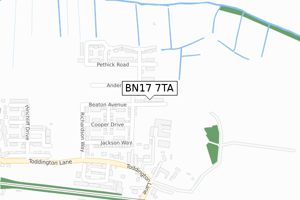
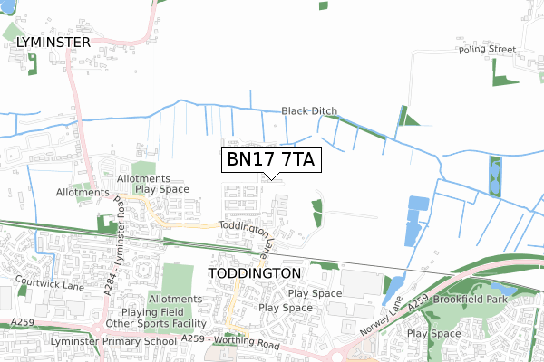
BN17 7TA maps, stats, and open data
BN17 7TA is located in the Courtwick with Toddington electoral ward, within the local authority district of Arun and the English Parliamentary constituency of Bognor Regis and Littlehampton. The Sub Integrated Care Board (ICB) Location is NHS Sussex ICB - 70F and the police force is Sussex. This postcode has been in use since December 2018.
BN17 7TA maps


Licence: Open Government Licence (requires attribution)
Attribution: Contains OS data © Crown copyright and database right 2025
Source: Open Postcode Geo
Licence: Open Government Licence (requires attribution)
Attribution: Contains OS data © Crown copyright and database right 2025; Contains Royal Mail data © Royal Mail copyright and database right 2025; Source: Office for National Statistics licensed under the Open Government Licence v.3.0
BN17 7TA geodata
| Easting | 503495 |
| Northing | 104085 |
| Latitude | 50.827053 |
| Longitude | -0.531884 |
Where is BN17 7TA?
| Country | England |
| Postcode District | BN17 |
Politics
| Ward | Courtwick With Toddington |
|---|---|
| Constituency | Bognor Regis And Littlehampton |
House Prices
Sales of detached houses in BN17 7TA
30, KENNEY DRIVE, WICK, LITTLEHAMPTON, BN17 7TA 2023 29 SEP £474,000 |
34, KENNEY DRIVE, WICK, LITTLEHAMPTON, BN17 7TA 2023 27 SEP £490,000 |
32, KENNEY DRIVE, WICK, LITTLEHAMPTON, BN17 7TA 2023 7 SEP £482,500 |
52, KENNEY DRIVE, WICK, LITTLEHAMPTON, BN17 7TA 2023 31 MAY £400,000 |
39, KENNEY DRIVE, WICK, LITTLEHAMPTON, BN17 7TA 2023 19 MAY £395,000 |
26, KENNEY DRIVE, WICK, LITTLEHAMPTON, BN17 7TA 2023 28 APR £482,000 |
48, KENNEY DRIVE, WICK, LITTLEHAMPTON, BN17 7TA 2022 22 DEC £405,000 |
22, KENNEY DRIVE, WICK, LITTLEHAMPTON, BN17 7TA 2022 16 DEC £390,000 |
28, KENNEY DRIVE, WICK, LITTLEHAMPTON, BN17 7TA 2022 15 DEC £400,000 |
24, KENNEY DRIVE, WICK, LITTLEHAMPTON, BN17 7TA 2022 24 NOV £405,000 |
Licence: Contains HM Land Registry data © Crown copyright and database right 2025. This data is licensed under the Open Government Licence v3.0.
Transport
Nearest bus stops to BN17 7TA
| Seaton Road (Lyminster Road) | Wick | 847m |
| Worthing Road | Littlehampton | 857m |
| Worthing Road | Littlehampton | 871m |
| Seaton Road (Lyminster Road) | Wick | 884m |
| The Six Bells (Lyminster Road) | Lyminster | 909m |
Nearest railway stations to BN17 7TA
| Littlehampton Station | 2.1km |
| Arundel Station | 2.6km |
| Angmering Station | 3.2km |
Broadband
Broadband access in BN17 7TA (2020 data)
| Percentage of properties with Next Generation Access | 100.0% |
| Percentage of properties with Superfast Broadband | 100.0% |
| Percentage of properties with Ultrafast Broadband | 100.0% |
| Percentage of properties with Full Fibre Broadband | 100.0% |
Superfast Broadband is between 30Mbps and 300Mbps
Ultrafast Broadband is > 300Mbps
Broadband speed in BN17 7TA (2019 data)
Download
| Median download speed | 360.0Mbps |
| Average download speed | 360.0Mbps |
| Maximum download speed | 360.00Mbps |
Upload
| Median upload speed | 360.0Mbps |
| Average upload speed | 360.0Mbps |
| Maximum upload speed | 360.00Mbps |
Broadband limitations in BN17 7TA (2020 data)
| Percentage of properties unable to receive 2Mbps | 0.0% |
| Percentage of properties unable to receive 5Mbps | 0.0% |
| Percentage of properties unable to receive 10Mbps | 0.0% |
| Percentage of properties unable to receive 30Mbps | 0.0% |
Deprivation
42.2% of English postcodes are less deprived than BN17 7TA:Food Standards Agency
Three nearest food hygiene ratings to BN17 7TA (metres)


➜ Get more ratings from the Food Standards Agency
Nearest post box to BN17 7TA
| Last Collection | |||
|---|---|---|---|
| Location | Mon-Fri | Sat | Distance |
| Toddington Lane | 17:00 | 12:00 | 437m |
| Lansdowne Road | 17:15 | 12:15 | 880m |
| Lyminster Road | 16:00 | 09:00 | 929m |
Environment
| Risk of BN17 7TA flooding from rivers and sea | Low |
BN17 7TA ITL and BN17 7TA LAU
The below table lists the International Territorial Level (ITL) codes (formerly Nomenclature of Territorial Units for Statistics (NUTS) codes) and Local Administrative Units (LAU) codes for BN17 7TA:
| ITL 1 Code | Name |
|---|---|
| TLJ | South East (England) |
| ITL 2 Code | Name |
| TLJ2 | Surrey, East and West Sussex |
| ITL 3 Code | Name |
| TLJ27 | West Sussex (South West) |
| LAU 1 Code | Name |
| E07000224 | Arun |
BN17 7TA census areas
The below table lists the Census Output Area (OA), Lower Layer Super Output Area (LSOA), and Middle Layer Super Output Area (MSOA) for BN17 7TA:
| Code | Name | |
|---|---|---|
| OA | E00172648 | |
| LSOA | E01031468 | Arun 004E |
| MSOA | E02006545 | Arun 004 |
Nearest postcodes to BN17 7TA
| BN17 7PP | Toddington Lane | 128m |
| BN17 7PN | Toddington Lane | 202m |
| BN17 7PW | Toddington Lane | 258m |
| BN17 6GP | Butts Mead | 336m |
| BN17 6GQ | Butts Mead | 388m |
| BN17 6JX | Toddington Lane | 422m |
| BN17 6GN | Steele Crescent | 428m |
| BN17 6FR | Cheal Way | 435m |
| BN17 6GX | Gratwicke Drive | 467m |
| BN17 6FL | Cheal Way | 469m |