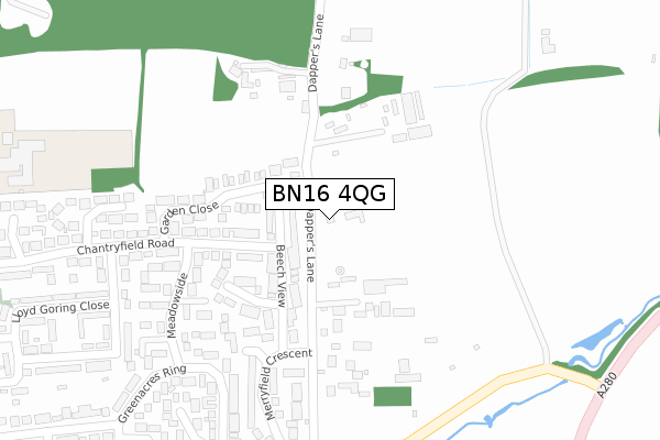
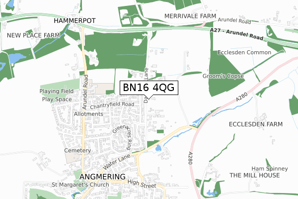
BN16 4QG is located in the Angmering & Findon electoral ward, within the local authority district of Arun and the English Parliamentary constituency of Arundel and South Downs. The Sub Integrated Care Board (ICB) Location is NHS Sussex ICB - 70F and the police force is Sussex. This postcode has been in use since February 2020.


GetTheData
Source: OS Open Zoomstack (Ordnance Survey)
Licence: Open Government Licence (requires attribution)
Attribution: Contains OS data © Crown copyright and database right 2024
Source: Open Postcode Geo
Licence: Open Government Licence (requires attribution)
Attribution: Contains OS data © Crown copyright and database right 2024; Contains Royal Mail data © Royal Mail copyright and database right 2024; Source: Office for National Statistics licensed under the Open Government Licence v.3.0
| Easting | 507326 |
| Northing | 105074 |
| Latitude | 50.835248 |
| Longitude | -0.477221 |
GetTheData
Source: Open Postcode Geo
Licence: Open Government Licence
| Country | England |
| Postcode District | BN16 |
| ➜ BN16 open data dashboard ➜ See where BN16 is on a map ➜ Where is Angmering? | |
GetTheData
Source: Land Registry Price Paid Data
Licence: Open Government Licence
| Ward | Angmering & Findon |
| Constituency | Arundel And South Downs |
GetTheData
Source: ONS Postcode Database
Licence: Open Government Licence
3, SWALLOWS GATE, ANGMERING, LITTLEHAMPTON, BN16 4QG 2022 21 JUN £770,000 |
7, SWALLOWS GATE, ANGMERING, LITTLEHAMPTON, BN16 4QG 2022 25 MAY £795,000 |
10, SWALLOWS GATE, ANGMERING, LITTLEHAMPTON, BN16 4QG 2022 18 MAY £775,000 |
9, SWALLOWS GATE, ANGMERING, LITTLEHAMPTON, BN16 4QG 2022 8 APR £775,000 |
8, SWALLOWS GATE, ANGMERING, LITTLEHAMPTON, BN16 4QG 2022 28 FEB £795,000 |
6, SWALLOWS GATE, ANGMERING, LITTLEHAMPTON, BN16 4QG 2022 20 JAN £850,000 |
5, SWALLOWS GATE, ANGMERING, LITTLEHAMPTON, BN16 4QG 2022 19 JAN £765,000 |
4, SWALLOWS GATE, ANGMERING, LITTLEHAMPTON, BN16 4QG 2021 21 DEC £765,000 |
15, SWALLOWS GATE, ANGMERING, LITTLEHAMPTON, BN16 4QG 2021 16 DEC £750,000 |
11, SWALLOWS GATE, ANGMERING, LITTLEHAMPTON, BN16 4QG 2021 13 DEC £700,000 |
GetTheData
Source: HM Land Registry Price Paid Data
Licence: Contains HM Land Registry data © Crown copyright and database right 2024. This data is licensed under the Open Government Licence v3.0.
| June 2022 | Criminal damage and arson | On or near Dapper'S Lane | 107m |
| June 2022 | Other theft | On or near Ferndale Walk | 287m |
| June 2022 | Violence and sexual offences | On or near Meadowside | 319m |
| ➜ Get more crime data in our Crime section | |||
GetTheData
Source: data.police.uk
Licence: Open Government Licence
| Meadowside (Chantryfield Road) | Angmering | 217m |
| Meadowside (Chantryfield Road) | Angmering | 262m |
| Beech View (Merryfield Crescent) | Angmering | 265m |
| Shardeloes Road (Chantryfield Road) | Angmering | 378m |
| Shardeloes Road (Chantryfield Road) | Angmering | 419m |
| Angmering Station | 2.2km |
| Goring-by-Sea Station | 3.7km |
| Durrington-on-Sea Station | 5km |
GetTheData
Source: NaPTAN
Licence: Open Government Licence
GetTheData
Source: ONS Postcode Database
Licence: Open Government Licence


➜ Get more ratings from the Food Standards Agency
GetTheData
Source: Food Standards Agency
Licence: FSA terms & conditions
| Last Collection | |||
|---|---|---|---|
| Location | Mon-Fri | Sat | Distance |
| Harefield Avenue | 16:45 | 11:45 | 719m |
| Angmering Post Office | 17:15 | 12:30 | 858m |
| Bentley Close | 17:00 | 12:15 | 1,298m |
GetTheData
Source: Dracos
Licence: Creative Commons Attribution-ShareAlike
| Facility | Distance |
|---|---|
| St Margaret's School Arundel Road, Angmering, Littlehampton Grass Pitches | 518m |
| Palmer Rd Recreation Ground Decoy Drive, Angmering, Littlehampton Grass Pitches | 731m |
| St. Wilfrids Catholic Primary School Arundel Road, Angmering, Littlehampton Grass Pitches | 793m |
GetTheData
Source: Active Places
Licence: Open Government Licence
| School | Phase of Education | Distance |
|---|---|---|
| St Margaret's CofE Primary School Arundel Road, Angmering, Littlehampton, BN16 4LP | Primary | 518m |
| St Wilfrids Catholic Primary School Arundel Road, Angmering, Littlehampton, BN16 4JR | Primary | 774m |
| The Angmering School Station Road, Angmering, Littlehampton, BN16 4HH | Secondary | 1.6km |
GetTheData
Source: Edubase
Licence: Open Government Licence
The below table lists the International Territorial Level (ITL) codes (formerly Nomenclature of Territorial Units for Statistics (NUTS) codes) and Local Administrative Units (LAU) codes for BN16 4QG:
| ITL 1 Code | Name |
|---|---|
| TLJ | South East (England) |
| ITL 2 Code | Name |
| TLJ2 | Surrey, East and West Sussex |
| ITL 3 Code | Name |
| TLJ27 | West Sussex (South West) |
| LAU 1 Code | Name |
| E07000224 | Arun |
GetTheData
Source: ONS Postcode Directory
Licence: Open Government Licence
The below table lists the Census Output Area (OA), Lower Layer Super Output Area (LSOA), and Middle Layer Super Output Area (MSOA) for BN16 4QG:
| Code | Name | |
|---|---|---|
| OA | E00160045 | |
| LSOA | E01031386 | Arun 002A |
| MSOA | E02006543 | Arun 002 |
GetTheData
Source: ONS Postcode Directory
Licence: Open Government Licence
| BN16 4EN | Dappers Lane | 139m |
| BN16 4NA | Woodlands Close | 152m |
| BN16 4DE | Beech View | 171m |
| BN16 4DH | Chantryfield Road | 197m |
| BN16 4DD | Brambletyne Close | 249m |
| BN16 4LX | Garden Close | 260m |
| BN16 4DB | Ferndale Walk | 282m |
| BN16 4BN | Meadowside | 298m |
| BN16 4LU | Chantryfield Road | 310m |
| BN16 4LY | Chantryfield Road | 322m |
GetTheData
Source: Open Postcode Geo; Land Registry Price Paid Data
Licence: Open Government Licence