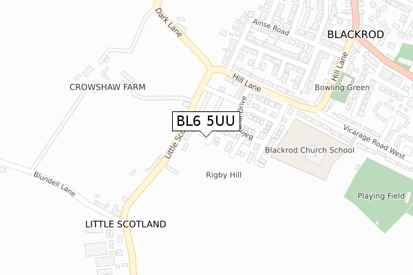
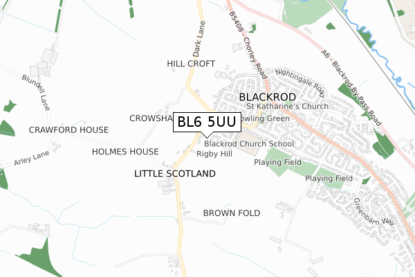
BL6 5UU is located in the Horwich South & Blackrod electoral ward, within the metropolitan district of Bolton and the English Parliamentary constituency of Bolton West. The Sub Integrated Care Board (ICB) Location is NHS Greater Manchester ICB - 00T and the police force is Greater Manchester. This postcode has been in use since June 2019.


GetTheData
Source: OS Open Zoomstack (Ordnance Survey)
Licence: Open Government Licence (requires attribution)
Attribution: Contains OS data © Crown copyright and database right 2024
Source: Open Postcode Geo
Licence: Open Government Licence (requires attribution)
Attribution: Contains OS data © Crown copyright and database right 2024; Contains Royal Mail data © Royal Mail copyright and database right 2024; Source: Office for National Statistics licensed under the Open Government Licence v.3.0
| Easting | 360840 |
| Northing | 410882 |
| Latitude | 53.593057 |
| Longitude | -2.593112 |
GetTheData
Source: Open Postcode Geo
Licence: Open Government Licence
| Country | England |
| Postcode District | BL6 |
| ➜ BL6 open data dashboard ➜ See where BL6 is on a map ➜ Where is Blackrod? | |
GetTheData
Source: Land Registry Price Paid Data
Licence: Open Government Licence
| Ward | Horwich South & Blackrod |
| Constituency | Bolton West |
GetTheData
Source: ONS Postcode Database
Licence: Open Government Licence
6, STIRLING COURT, BLACKROD, BOLTON, BL6 5UU 2019 2 AUG £336,995 |
2, STIRLING COURT, BLACKROD, BOLTON, BL6 5UU 2019 28 JUN £245,995 |
4, STIRLING COURT, BLACKROD, BOLTON, BL6 5UU 2019 21 JUN £306,995 |
3, STIRLING COURT, BLACKROD, BOLTON, BL6 5UU 2019 20 JUN £336,995 |
5, STIRLING COURT, BOLTON, BL6 5UU 2019 7 JUN £305,995 |
1, STIRLING COURT, BLACKROD, BOLTON, BL6 5UU 2019 31 MAY £305,995 |
GetTheData
Source: HM Land Registry Price Paid Data
Licence: Contains HM Land Registry data © Crown copyright and database right 2024. This data is licensed under the Open Government Licence v3.0.
| Little Scotland/Dark Ln (Little Scotland) | Blackrod | 103m |
| Little Scotland/Dark Ln (Little Scotland) | Blackrod | 113m |
| Little Scotland/Blundell Ln (Little Scotland) | Little Scotland | 115m |
| Little Scotland/Blundell Ln (Little Scotland) | Little Scotland | 161m |
| Hill Ln/Vicarage Rd West (Hill Ln) | Blackrod | 214m |
| Blackrod Station | 1.6km |
| Adlington (Lancs) Station | 2.3km |
| Horwich Parkway Station | 3.9km |
GetTheData
Source: NaPTAN
Licence: Open Government Licence
| Percentage of properties with Next Generation Access | 100.0% |
| Percentage of properties with Superfast Broadband | 100.0% |
| Percentage of properties with Ultrafast Broadband | 100.0% |
| Percentage of properties with Full Fibre Broadband | 100.0% |
Superfast Broadband is between 30Mbps and 300Mbps
Ultrafast Broadband is > 300Mbps
| Percentage of properties unable to receive 2Mbps | 0.0% |
| Percentage of properties unable to receive 5Mbps | 0.0% |
| Percentage of properties unable to receive 10Mbps | 0.0% |
| Percentage of properties unable to receive 30Mbps | 0.0% |
GetTheData
Source: Ofcom
Licence: Ofcom Terms of Use (requires attribution)
GetTheData
Source: ONS Postcode Database
Licence: Open Government Licence


➜ Get more ratings from the Food Standards Agency
GetTheData
Source: Food Standards Agency
Licence: FSA terms & conditions
| Last Collection | |||
|---|---|---|---|
| Location | Mon-Fri | Sat | Distance |
| 23 Whitehall Lane | 17:30 | 11:30 | 748m |
| Blackrod P O | 18:30 | 11:30 | 890m |
| 205 Crown Lane | 17:35 | 11:20 | 1,604m |
GetTheData
Source: Dracos
Licence: Creative Commons Attribution-ShareAlike
| Facility | Distance |
|---|---|
| Blackrod Church School Vicarage Road West, Blackrod, Bolton Grass Pitches | 283m |
| Blackrod Cricket Club (Vicarage Road) Vicarage Road, Blackrod, Bolton Grass Pitches | 509m |
| Blackrod Sports And Community Centre Greenbarn Way, Greenbarn Way, Blackrod, Bolton Grass Pitches | 886m |
GetTheData
Source: Active Places
Licence: Open Government Licence
| School | Phase of Education | Distance |
|---|---|---|
| Blackrod Anglican/Methodist Primary School Vicarage Road West, Blackrod, Bolton, BL6 5DE | Primary | 283m |
| Blackrod Primary School Manchester Road, Blackrod, Manchester Road,, Blackrod, BOLTON, BL6 5SY | Primary | 1.7km |
| St David Haigh and Aspull CofE Primary School Copperas Lane, Haigh, Wigan, WN2 1PA | Primary | 1.9km |
GetTheData
Source: Edubase
Licence: Open Government Licence
The below table lists the International Territorial Level (ITL) codes (formerly Nomenclature of Territorial Units for Statistics (NUTS) codes) and Local Administrative Units (LAU) codes for BL6 5UU:
| ITL 1 Code | Name |
|---|---|
| TLD | North West (England) |
| ITL 2 Code | Name |
| TLD3 | Greater Manchester |
| ITL 3 Code | Name |
| TLD36 | Greater Manchester North West |
| LAU 1 Code | Name |
| E08000001 | Bolton |
GetTheData
Source: ONS Postcode Directory
Licence: Open Government Licence
The below table lists the Census Output Area (OA), Lower Layer Super Output Area (LSOA), and Middle Layer Super Output Area (MSOA) for BL6 5UU:
| Code | Name | |
|---|---|---|
| OA | E00024199 | |
| LSOA | E01004780 | Bolton 009B |
| MSOA | E02000992 | Bolton 009 |
GetTheData
Source: ONS Postcode Directory
Licence: Open Government Licence
| BL6 5LW | Little Scotland | 131m |
| BL6 5JG | Hill Lane | 206m |
| BL6 5HA | Ainse Road | 260m |
| BL6 5ET | Clifton Drive | 262m |
| BL6 5EU | Clifton Drive | 279m |
| BL6 5JL | Dark Lane | 283m |
| BL6 5HB | Ainse Road | 300m |
| BL6 5JQ | Hill Lane | 313m |
| BL6 5JW | Hill Lane | 317m |
| BL6 5DE | Vicarage Road West | 338m |
GetTheData
Source: Open Postcode Geo; Land Registry Price Paid Data
Licence: Open Government Licence