Property/Postcode Data Search:
BL0 0BS maps, stats, and open data
BL0 0BS is located in the Ramsbottom electoral ward, within the metropolitan district of Bury and the English Parliamentary constituency of Bury North. The Sub Integrated Care Board (ICB) Location is NHS Greater Manchester ICB - 00V and the police force is Greater Manchester. This postcode has been in use since January 2019.
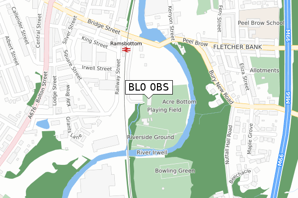
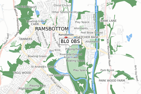
BL0 0BS maps


Source: OS Open Zoomstack (Ordnance Survey)
Licence: Open Government Licence (requires attribution)
Attribution: Contains OS data © Crown copyright and database right 2025
Source: Open Postcode Geo
Licence: Open Government Licence (requires attribution)
Attribution: Contains OS data © Crown copyright and database right 2025; Contains Royal Mail data © Royal Mail copyright and database right 2025; Source: Office for National Statistics licensed under the Open Government Licence v.3.0
Licence: Open Government Licence (requires attribution)
Attribution: Contains OS data © Crown copyright and database right 2025
Source: Open Postcode Geo
Licence: Open Government Licence (requires attribution)
Attribution: Contains OS data © Crown copyright and database right 2025; Contains Royal Mail data © Royal Mail copyright and database right 2025; Source: Office for National Statistics licensed under the Open Government Licence v.3.0
BL0 0BS geodata
| Easting | 379355 |
| Northing | 416573 |
| Latitude | 53.645269 |
| Longitude | -2.313768 |
Where is BL0 0BS?
| Country | England |
| Postcode District | BL0 |
Politics
| Ward | Ramsbottom |
|---|---|
| Constituency | Bury North |
Transport
Nearest bus stops to BL0 0BS
| Bridge St/East Lancs Railway (Bridge St) | Ramsbottom | 291m |
| Peel Brow/Kenyon St (Peel Brow) | Ramsbottom | 292m |
| Peel Brow/Kenyon St (Peel Brow) | Ramsbottom | 307m |
| Bridge St/East Lancs Railway (Bridge St) | Ramsbottom | 331m |
| Eliza St/Bury New Rd (Eliza St) | Ramsbottom | 362m |
Nearest underground/metro/tram to BL0 0BS
| Ramsbottom (East Lancashire Railway) | Ramsbottom | 289m |
Deprivation
25.2% of English postcodes are less deprived than BL0 0BS:Food Standards Agency
Three nearest food hygiene ratings to BL0 0BS (metres)
Scotties Tea Rooms
Empire Works
192m
Tiddlywinks Nursery School

99 Square Street
202m
Aldi Stores Limited

Railway Street
214m
➜ Get more ratings from the Food Standards Agency
Nearest post box to BL0 0BS
| Last Collection | |||
|---|---|---|---|
| Location | Mon-Fri | Sat | Distance |
| Ramsbottom P O | 19:00 | 11:30 | 281m |
| Bridge Street | 18:45 | 11:00 | 349m |
| Eliza Street | 17:10 | 11:20 | 374m |
Environment
| Risk of BL0 0BS flooding from rivers and sea | High |
BL0 0BS ITL and BL0 0BS LAU
The below table lists the International Territorial Level (ITL) codes (formerly Nomenclature of Territorial Units for Statistics (NUTS) codes) and Local Administrative Units (LAU) codes for BL0 0BS:
| ITL 1 Code | Name |
|---|---|
| TLD | North West (England) |
| ITL 2 Code | Name |
| TLD3 | Greater Manchester |
| ITL 3 Code | Name |
| TLD37 | Greater Manchester North East |
| LAU 1 Code | Name |
| E08000002 | Bury |
BL0 0BS census areas
The below table lists the Census Output Area (OA), Lower Layer Super Output Area (LSOA), and Middle Layer Super Output Area (MSOA) for BL0 0BS:
| Code | Name | |
|---|---|---|
| OA | E00025402 | |
| LSOA | E01005017 | Bury 001D |
| MSOA | E02001019 | Bury 001 |
Nearest postcodes to BL0 0BS
| BL0 9AZ | Square Street | 203m |
| BL0 9GB | Cobden Mews | 215m |
| BL0 9DB | Grants Lane | 231m |
| BL0 9ZP | Square Street | 242m |
| BL0 9AY | Kay Brow | 244m |
| BL0 9AX | Barwood Lea | 267m |
| BL0 0AA | Peel Brow | 293m |
| BL0 9NB | Grants Lane | 294m |
| BL0 0BT | Bury New Road | 301m |
| BL0 9HZ | Verna Street | 315m |