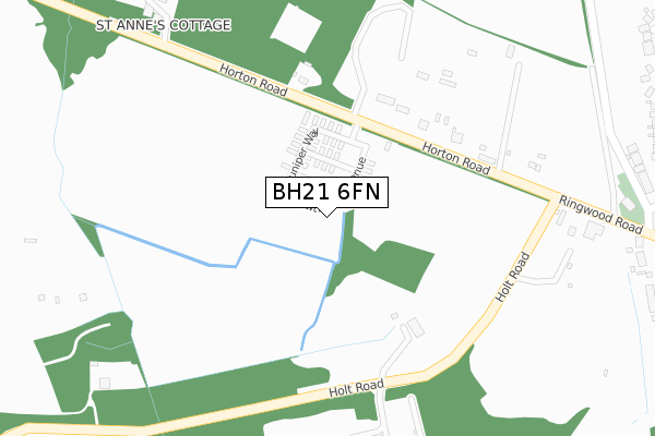
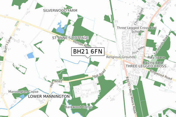
BH21 6FN is located in the Stour & Allen Vale electoral ward, within the unitary authority of Dorset and the English Parliamentary constituency of North Dorset. The Sub Integrated Care Board (ICB) Location is NHS Dorset ICB - 11J and the police force is Dorset. This postcode has been in use since September 2019.


GetTheData
Source: OS Open Zoomstack (Ordnance Survey)
Licence: Open Government Licence (requires attribution)
Attribution: Contains OS data © Crown copyright and database right 2024
Source: Open Postcode Geo
Licence: Open Government Licence (requires attribution)
Attribution: Contains OS data © Crown copyright and database right 2024; Contains Royal Mail data © Royal Mail copyright and database right 2024; Source: Office for National Statistics licensed under the Open Government Licence v.3.0
| Easting | 407472 |
| Northing | 105756 |
| Latitude | 50.851266 |
| Longitude | -1.895218 |
GetTheData
Source: Open Postcode Geo
Licence: Open Government Licence
| Country | England |
| Postcode District | BH21 |
| ➜ BH21 open data dashboard ➜ See where BH21 is on a map ➜ Where is Three Legged Cross? | |
GetTheData
Source: Land Registry Price Paid Data
Licence: Open Government Licence
| Ward | Stour & Allen Vale |
| Constituency | North Dorset |
GetTheData
Source: ONS Postcode Database
Licence: Open Government Licence
| May 2022 | Anti-social behaviour | On or near Holt Road | 319m |
| April 2022 | Violence and sexual offences | On or near Holt Road | 319m |
| April 2022 | Public order | On or near Holt Road | 319m |
| ➜ Get more crime data in our Crime section | |||
GetTheData
Source: data.police.uk
Licence: Open Government Licence
| West Moors Road | Three Legged Cross | 580m |
| West Moors Road | Three Legged Cross | 587m |
| The Woodcutters | Three Legged Cross | 673m |
| Juniper Close (Joys Road) | Three Legged Cross | 678m |
| The Woodcutters | Three Legged Cross | 696m |
GetTheData
Source: NaPTAN
Licence: Open Government Licence
GetTheData
Source: ONS Postcode Database
Licence: Open Government Licence


➜ Get more ratings from the Food Standards Agency
GetTheData
Source: Food Standards Agency
Licence: FSA terms & conditions
| Last Collection | |||
|---|---|---|---|
| Location | Mon-Fri | Sat | Distance |
| Church Road | 16:00 | 10:30 | 704m |
| Three Legged Cross P.o. | 17:00 | 09:30 | 771m |
| Crab Orchard | 11:00 | 09:30 | 1,471m |
GetTheData
Source: Dracos
Licence: Creative Commons Attribution-ShareAlike
| Facility | Distance |
|---|---|
| Three Legged Cross First And Nursery School Church Road, Three Legged Cross, Wimborne Grass Pitches | 765m |
| Three Legged Cross Recreation Ground Verwood Road, Three Legged Cross, Wimborne Grass Pitches | 928m |
| Magpies Sports Ground (Closed) Lower Common Lane, Three Legged Cross, Wimborne Grass Pitches | 1.7km |
GetTheData
Source: Active Places
Licence: Open Government Licence
| School | Phase of Education | Distance |
|---|---|---|
| Three Legged Cross First and Nursery School Church Road, Three Legged Cross, Wimborne, BH21 6RF | Primary | 765m |
| Verwood Church of England First School Howe Lane, Verwood, BH31 6JF | Primary | 2.4km |
| St Mary's CofE First School & Nursery Station Road, West Moors, Ferndown, BH22 0JF | Primary | 2.5km |
GetTheData
Source: Edubase
Licence: Open Government Licence
The below table lists the International Territorial Level (ITL) codes (formerly Nomenclature of Territorial Units for Statistics (NUTS) codes) and Local Administrative Units (LAU) codes for BH21 6FN:
| ITL 1 Code | Name |
|---|---|
| TLK | South West (England) |
| ITL 2 Code | Name |
| TLK2 | Dorset and Somerset |
| ITL 3 Code | Name |
| TLK25 | Dorset |
| LAU 1 Code | Name |
| E06000059 | Dorset |
GetTheData
Source: ONS Postcode Directory
Licence: Open Government Licence
The below table lists the Census Output Area (OA), Lower Layer Super Output Area (LSOA), and Middle Layer Super Output Area (MSOA) for BH21 6FN:
| Code | Name | |
|---|---|---|
| OA | E00103365 | |
| LSOA | E01020398 | East Dorset 005B |
| MSOA | E02004247 | East Dorset 005 |
GetTheData
Source: ONS Postcode Directory
Licence: Open Government Licence
| BH21 6SD | Horton Road | 172m |
| BH21 6SG | Village Hall Lane | 474m |
| BH21 6YU | Fryers Road | 514m |
| BH21 6QP | West Moors Road | 545m |
| BH21 6XX | Greycot Close | 554m |
| BH21 6YT | Fryers Road | 576m |
| BH21 6YZ | West Avenue | 580m |
| BH21 6YX | Albany Drive | 596m |
| BH21 6QA | Hermitage Close | 612m |
| BH21 6YY | Albany Drive | 630m |
GetTheData
Source: Open Postcode Geo; Land Registry Price Paid Data
Licence: Open Government Licence