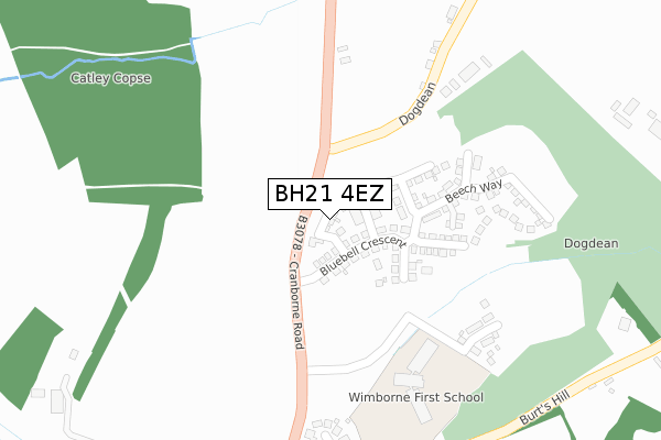
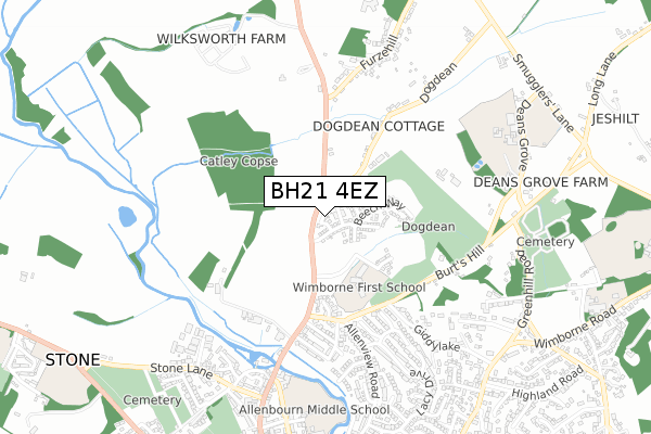
BH21 4EZ is located in the Wimborne Minster electoral ward, within the unitary authority of Dorset and the English Parliamentary constituency of Mid Dorset and North Poole. The Sub Integrated Care Board (ICB) Location is NHS Dorset ICB - 11J and the police force is Dorset. This postcode has been in use since October 2018.


GetTheData
Source: OS Open Zoomstack (Ordnance Survey)
Licence: Open Government Licence (requires attribution)
Attribution: Contains OS data © Crown copyright and database right 2024
Source: Open Postcode Geo
Licence: Open Government Licence (requires attribution)
Attribution: Contains OS data © Crown copyright and database right 2024; Contains Royal Mail data © Royal Mail copyright and database right 2024; Source: Office for National Statistics licensed under the Open Government Licence v.3.0
| Easting | 401126 |
| Northing | 101209 |
| Latitude | 50.810423 |
| Longitude | -1.985379 |
GetTheData
Source: Open Postcode Geo
Licence: Open Government Licence
| Country | England |
| Postcode District | BH21 |
| ➜ BH21 open data dashboard ➜ See where BH21 is on a map ➜ Where is Wimborne Minster? | |
GetTheData
Source: Land Registry Price Paid Data
Licence: Open Government Licence
| Ward | Wimborne Minster |
| Constituency | Mid Dorset And North Poole |
GetTheData
Source: ONS Postcode Database
Licence: Open Government Licence
2023 19 JUL £605,000 |
3, PRIMROSE CLOSE, WIMBORNE MINSTER, WIMBORNE, BH21 4EZ 2018 18 DEC £390,000 |
4, PRIMROSE CLOSE, WIMBORNE MINSTER, WIMBORNE, BH21 4EZ 2018 17 DEC £420,000 |
5, PRIMROSE CLOSE, WIMBORNE MINSTER, WIMBORNE, BH21 4EZ 2018 17 DEC £435,000 |
2018 30 NOV £450,000 |
7, PRIMROSE CLOSE, WIMBORNE MINSTER, WIMBORNE, BH21 4EZ 2018 30 NOV £520,000 |
6, PRIMROSE CLOSE, WIMBORNE MINSTER, WIMBORNE, BH21 4EZ 2018 29 NOV £565,000 |
1, PRIMROSE CLOSE, WIMBORNE MINSTER, WIMBORNE, BH21 4EZ 2018 27 NOV £475,000 |
2, PRIMROSE CLOSE, WIMBORNE MINSTER, WIMBORNE, BH21 4EZ 2018 27 NOV £455,000 |
➜ Wimborne Minster house prices
GetTheData
Source: HM Land Registry Price Paid Data
Licence: Contains HM Land Registry data © Crown copyright and database right 2024. This data is licensed under the Open Government Licence v3.0.
| June 2022 | Violence and sexual offences | On or near Parking Area | 60m |
| June 2022 | Violence and sexual offences | On or near Parking Area | 60m |
| June 2022 | Violence and sexual offences | On or near Parking Area | 60m |
| ➜ Get more crime data in our Crime section | |||
GetTheData
Source: data.police.uk
Licence: Open Government Licence
| Lacy Drive (Allenview Road) | Wimborne Minster | 563m |
| Lacy Drive (Allenview Road) | Wimborne Minster | 565m |
| Knobcrook Road | Wimborne Minster | 755m |
| Allenbourn School | Wimborne Minster | 791m |
| Highland Road (Rowlands Hill) | Wimborne Minster | 900m |
GetTheData
Source: NaPTAN
Licence: Open Government Licence
| Percentage of properties with Next Generation Access | 100.0% |
| Percentage of properties with Superfast Broadband | 100.0% |
| Percentage of properties with Ultrafast Broadband | 100.0% |
| Percentage of properties with Full Fibre Broadband | 100.0% |
Superfast Broadband is between 30Mbps and 300Mbps
Ultrafast Broadband is > 300Mbps
| Percentage of properties unable to receive 2Mbps | 0.0% |
| Percentage of properties unable to receive 5Mbps | 0.0% |
| Percentage of properties unable to receive 10Mbps | 0.0% |
| Percentage of properties unable to receive 30Mbps | 0.0% |
GetTheData
Source: Ofcom
Licence: Ofcom Terms of Use (requires attribution)
GetTheData
Source: ONS Postcode Database
Licence: Open Government Licence


➜ Get more ratings from the Food Standards Agency
GetTheData
Source: Food Standards Agency
Licence: FSA terms & conditions
| Last Collection | |||
|---|---|---|---|
| Location | Mon-Fri | Sat | Distance |
| Walford | 17:00 | 12:00 | 420m |
| Woodleaze | 11:00 | 09:00 | 670m |
| Horns In Colehill | 10:00 | 09:00 | 740m |
GetTheData
Source: Dracos
Licence: Creative Commons Attribution-ShareAlike
| Facility | Distance |
|---|---|
| Wimborne First School Campanula Way, Wimborne Minster, Wimborne Grass Pitches | 308m |
| Dumpton School Wimborne Swimming Pool, Sports Hall, Grass Pitches, Artificial Grass Pitch, Outdoor Tennis Courts | 767m |
| Colehill Sports & Social Club Wimborne Road, Colehill, Wimborne Grass Pitches | 812m |
GetTheData
Source: Active Places
Licence: Open Government Licence
| School | Phase of Education | Distance |
|---|---|---|
| Dumpton School Deans Grove House, Deans Grove, Wimborne, BH21 7AF | Not applicable | 765m |
| Allenbourn Middle School East Borough, Wimborne, BH21 1PL | Middle deemed secondary | 840m |
| Wimborne First School and Nursery Campanula Way, Wimborne, BH21 4FW | Primary | 948m |
GetTheData
Source: Edubase
Licence: Open Government Licence
The below table lists the International Territorial Level (ITL) codes (formerly Nomenclature of Territorial Units for Statistics (NUTS) codes) and Local Administrative Units (LAU) codes for BH21 4EZ:
| ITL 1 Code | Name |
|---|---|
| TLK | South West (England) |
| ITL 2 Code | Name |
| TLK2 | Dorset and Somerset |
| ITL 3 Code | Name |
| TLK25 | Dorset |
| LAU 1 Code | Name |
| E06000059 | Dorset |
GetTheData
Source: ONS Postcode Directory
Licence: Open Government Licence
The below table lists the Census Output Area (OA), Lower Layer Super Output Area (LSOA), and Middle Layer Super Output Area (MSOA) for BH21 4EZ:
| Code | Name | |
|---|---|---|
| OA | E00103269 | |
| LSOA | E01020380 | East Dorset 007C |
| MSOA | E02004249 | East Dorset 007 |
GetTheData
Source: ONS Postcode Directory
Licence: Open Government Licence
| BH21 1PH | Walford Close | 339m |
| BH21 1NS | Burts Hill | 379m |
| BH21 1NP | Wimborne Road | 430m |
| BH21 1NY | Milton Road | 459m |
| BH21 1NR | Wimborne Road | 478m |
| BH21 1NT | Tennyson Road | 480m |
| BH21 1DQ | Venator Place | 486m |
| BH21 1NZ | Shakespeare Road | 495m |
| BH21 1DP | Chaucer Close | 510m |
| BH21 4HA | Dogdean | 510m |
GetTheData
Source: Open Postcode Geo; Land Registry Price Paid Data
Licence: Open Government Licence