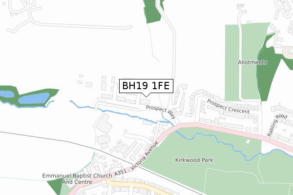
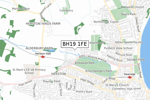
BH19 1FE is located in the Swanage electoral ward, within the unitary authority of Dorset and the English Parliamentary constituency of South Dorset. The Sub Integrated Care Board (ICB) Location is NHS Dorset ICB - 11J and the police force is Dorset. This postcode has been in use since December 2019.


GetTheData
Source: OS Open Zoomstack (Ordnance Survey)
Licence: Open Government Licence (requires attribution)
Attribution: Contains OS data © Crown copyright and database right 2024
Source: Open Postcode Geo
Licence: Open Government Licence (requires attribution)
Attribution: Contains OS data © Crown copyright and database right 2024; Contains Royal Mail data © Royal Mail copyright and database right 2024; Source: Office for National Statistics licensed under the Open Government Licence v.3.0
| Easting | 402007 |
| Northing | 79364 |
| Latitude | 50.613973 |
| Longitude | -1.972987 |
GetTheData
Source: Open Postcode Geo
Licence: Open Government Licence
| Country | England |
| Postcode District | BH19 |
| ➜ BH19 open data dashboard ➜ See where BH19 is on a map ➜ Where is Swanage? | |
GetTheData
Source: Land Registry Price Paid Data
Licence: Open Government Licence
| Ward | Swanage |
| Constituency | South Dorset |
GetTheData
Source: ONS Postcode Database
Licence: Open Government Licence
| October 2023 | Violence and sexual offences | On or near Petrol Station | 283m |
| September 2023 | Anti-social behaviour | On or near Petrol Station | 283m |
| February 2023 | Violence and sexual offences | On or near Petrol Station | 283m |
| ➜ Get more crime data in our Crime section | |||
GetTheData
Source: data.police.uk
Licence: Open Government Licence
| Herston Cross (High Street) | Herston | 431m |
| Steer Road (High Street) | Herston | 437m |
| Herston Cross (High Street) | Herston | 541m |
| Cecil Road (High Street) | Swanage | 550m |
| Howard Road (High Street) | Swanage | 635m |
| Swanage (Swanage Railway) (Station Road) | Swanage | 1,004m |
GetTheData
Source: NaPTAN
Licence: Open Government Licence
GetTheData
Source: ONS Postcode Database
Licence: Open Government Licence


➜ Get more ratings from the Food Standards Agency
GetTheData
Source: Food Standards Agency
Licence: FSA terms & conditions
| Last Collection | |||
|---|---|---|---|
| Location | Mon-Fri | Sat | Distance |
| Kings Road West | 17:15 | 12:00 | 403m |
| Herston P.o. | 17:15 | 12:00 | 405m |
| Victoria Ave | 17:15 | 12:00 | 422m |
GetTheData
Source: Dracos
Licence: Creative Commons Attribution-ShareAlike
| Facility | Distance |
|---|---|
| Forres Field Victoria Avenue, Swanage Grass Pitches | 497m |
| King Georges Field (Swanage) Victoria Avenue, Swanage Grass Pitches | 513m |
| Joe's Gym Kings Road West, Swanage Health and Fitness Gym, Studio | 540m |
GetTheData
Source: Active Places
Licence: Open Government Licence
| School | Phase of Education | Distance |
|---|---|---|
| Swanage St Mark's Church of England Primary School High Street, Swanage, BH19 2PH | Primary | 866m |
| The Swanage School High Street, Swanage, BH19 2PH | Secondary | 866m |
| St Mary's Catholic Primary School, Swanage Northbrook Road, Swanage, BH19 1QE | Primary | 994m |
GetTheData
Source: Edubase
Licence: Open Government Licence
The below table lists the International Territorial Level (ITL) codes (formerly Nomenclature of Territorial Units for Statistics (NUTS) codes) and Local Administrative Units (LAU) codes for BH19 1FE:
| ITL 1 Code | Name |
|---|---|
| TLK | South West (England) |
| ITL 2 Code | Name |
| TLK2 | Dorset and Somerset |
| ITL 3 Code | Name |
| TLK25 | Dorset |
| LAU 1 Code | Name |
| E06000059 | Dorset |
GetTheData
Source: ONS Postcode Directory
Licence: Open Government Licence
The below table lists the Census Output Area (OA), Lower Layer Super Output Area (LSOA), and Middle Layer Super Output Area (MSOA) for BH19 1FE:
| Code | Name | |
|---|---|---|
| OA | E00103820 | |
| LSOA | E01020478 | Purbeck 006A |
| MSOA | E02004268 | Purbeck 006 |
GetTheData
Source: ONS Postcode Directory
Licence: Open Government Licence
| BH19 1AS | Victoria Avenue | 103m |
| BH19 1BE | Prospect Crescent | 259m |
| BH19 1BH | Aigburth Road | 266m |
| BH19 1AX | Victoria Avenue | 268m |
| BH19 1BA | Victoria Avenue | 282m |
| BH19 1BD | Prospect Crescent | 293m |
| BH19 1AR | Victoria Avenue | 298m |
| BH19 1BQ | Ancaster Road | 303m |
| BH19 1HW | Kings Road West | 306m |
| BH19 1AY | Victoria Avenue | 308m |
GetTheData
Source: Open Postcode Geo; Land Registry Price Paid Data
Licence: Open Government Licence