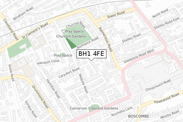
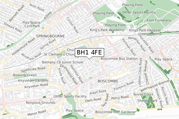
BH1 4FE is located in the Boscombe West electoral ward, within the unitary authority of Bournemouth, Christchurch and Poole and the English Parliamentary constituency of Bournemouth East. The Sub Integrated Care Board (ICB) Location is NHS Dorset ICB - 11J and the police force is Dorset. This postcode has been in use since September 2018.


GetTheData
Source: OS Open Zoomstack (Ordnance Survey)
Licence: Open Government Licence (requires attribution)
Attribution: Contains OS data © Crown copyright and database right 2024
Source: Open Postcode Geo
Licence: Open Government Licence (requires attribution)
Attribution: Contains OS data © Crown copyright and database right 2024; Contains Royal Mail data © Royal Mail copyright and database right 2024; Source: Office for National Statistics licensed under the Open Government Licence v.3.0
| Easting | 411102 |
| Northing | 92046 |
| Latitude | 50.727919 |
| Longitude | -1.844063 |
GetTheData
Source: Open Postcode Geo
Licence: Open Government Licence
| Country | England |
| Postcode District | BH1 |
| ➜ BH1 open data dashboard ➜ See where BH1 is on a map ➜ Where is Bournemouth? | |
GetTheData
Source: Land Registry Price Paid Data
Licence: Open Government Licence
| Ward | Boscombe West |
| Constituency | Bournemouth East |
GetTheData
Source: ONS Postcode Database
Licence: Open Government Licence
| January 2024 | Burglary | On or near Campbell Road | 18m |
| January 2024 | Anti-social behaviour | On or near Parking Area | 364m |
| January 2024 | Anti-social behaviour | On or near Parking Area | 364m |
| ➜ Get more crime data in our Crime section | |||
GetTheData
Source: data.police.uk
Licence: Open Government Licence
| Palmerston Road | Boscombe | 189m |
| Boscombe Crescent (Christchurch Road) | Boscombe | 270m |
| Palmerston Road (Christchurch Road) | Boscombe | 279m |
| Boscombe Crescent (Christchurch Road) | Boscombe | 319m |
| Sovereign Centre (Centenary Way) | Boscombe | 324m |
| Pokesdown Station | 1.4km |
| Bournemouth Station | 1.4km |
| Christchurch Station | 4.4km |
GetTheData
Source: NaPTAN
Licence: Open Government Licence
| Percentage of properties with Next Generation Access | 100.0% |
| Percentage of properties with Superfast Broadband | 100.0% |
| Percentage of properties with Ultrafast Broadband | 100.0% |
| Percentage of properties with Full Fibre Broadband | 0.0% |
Superfast Broadband is between 30Mbps and 300Mbps
Ultrafast Broadband is > 300Mbps
| Percentage of properties unable to receive 2Mbps | 0.0% |
| Percentage of properties unable to receive 5Mbps | 0.0% |
| Percentage of properties unable to receive 10Mbps | 0.0% |
| Percentage of properties unable to receive 30Mbps | 0.0% |
GetTheData
Source: Ofcom
Licence: Ofcom Terms of Use (requires attribution)
GetTheData
Source: ONS Postcode Database
Licence: Open Government Licence


➜ Get more ratings from the Food Standards Agency
GetTheData
Source: Food Standards Agency
Licence: FSA terms & conditions
| Last Collection | |||
|---|---|---|---|
| Location | Mon-Fri | Sat | Distance |
| 79 Palmerstone Road | 17:45 | 11:45 | 144m |
| 9 Carysfoot Road | 17:30 | 11:45 | 191m |
| 543 Christchurch Road | 17:30 | 12:00 | 277m |
GetTheData
Source: Dracos
Licence: Creative Commons Attribution-ShareAlike
| Facility | Distance |
|---|---|
| Majestic Gym Ltd Roumelia Lane, Bournemouth Health and Fitness Gym, Studio | 331m |
| David Lloyd Club (Bournemouth) (Closed) Knole Road, Bournemouth Sports Hall, Studio, Swimming Pool, Health and Fitness Gym, Squash Courts | 519m |
| Healthstyles (Closed) Owls Road, Bournemouth Studio, Health and Fitness Gym, Swimming Pool | 593m |
GetTheData
Source: Active Places
Licence: Open Government Licence
| School | Phase of Education | Distance |
|---|---|---|
| St Clement's and St John's Church of England Infant School St Clement's Road, Boscombe, Bournemouth, BH1 4DZ | Primary | 339m |
| Bethany Church of England Junior School Knole Road, Boscombe, Bournemouth, BH1 4DJ | Primary | 399m |
| King's Park Academy Ashley Road, Bournemouth, BH1 4NB | Primary | 473m |
GetTheData
Source: Edubase
Licence: Open Government Licence
The below table lists the International Territorial Level (ITL) codes (formerly Nomenclature of Territorial Units for Statistics (NUTS) codes) and Local Administrative Units (LAU) codes for BH1 4FE:
| ITL 1 Code | Name |
|---|---|
| TLK | South West (England) |
| ITL 2 Code | Name |
| TLK2 | Dorset and Somerset |
| ITL 3 Code | Name |
| TLK24 | Bournemouth, Christchurch and Poole |
| LAU 1 Code | Name |
| E06000058 | Bournemouth, Christchurch and Poole |
GetTheData
Source: ONS Postcode Directory
Licence: Open Government Licence
The below table lists the Census Output Area (OA), Lower Layer Super Output Area (LSOA), and Middle Layer Super Output Area (MSOA) for BH1 4FE:
| Code | Name | |
|---|---|---|
| OA | E00077234 | |
| LSOA | E01015282 | Bournemouth 019E |
| MSOA | E02003190 | Bournemouth 019 |
GetTheData
Source: ONS Postcode Directory
Licence: Open Government Licence
| BH1 4EP | Campbell Road | 23m |
| BH1 4EL | Carysfort Road | 38m |
| BH1 4JF | Palmerston Mews | 45m |
| BH1 4JE | Palmerston Mews | 64m |
| BH1 4JH | Palmerston Mews | 76m |
| BH1 4HD | Walpole Road | 77m |
| BH1 4ER | Borthwick Road | 86m |
| BH1 4HR | Palmerston Road | 98m |
| BH1 4HW | Palmerston Road | 107m |
| BH1 4JL | Palmerston Mews | 110m |
GetTheData
Source: Open Postcode Geo; Land Registry Price Paid Data
Licence: Open Government Licence