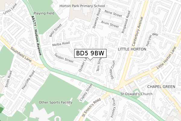
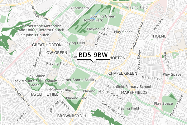
BD5 9BW is located in the Little Horton electoral ward, within the metropolitan district of Bradford and the English Parliamentary constituency of Bradford East. The Sub Integrated Care Board (ICB) Location is NHS West Yorkshire ICB - 36J and the police force is West Yorkshire. This postcode has been in use since November 2017.


GetTheData
Source: OS Open Zoomstack (Ordnance Survey)
Licence: Open Government Licence (requires attribution)
Attribution: Contains OS data © Crown copyright and database right 2024
Source: Open Postcode Geo
Licence: Open Government Licence (requires attribution)
Attribution: Contains OS data © Crown copyright and database right 2024; Contains Royal Mail data © Royal Mail copyright and database right 2024; Source: Office for National Statistics licensed under the Open Government Licence v.3.0
| Easting | 414957 |
| Northing | 431256 |
| Latitude | 53.777440 |
| Longitude | -1.774520 |
GetTheData
Source: Open Postcode Geo
Licence: Open Government Licence
| Country | England |
| Postcode District | BD5 |
| ➜ BD5 open data dashboard ➜ See where BD5 is on a map ➜ Where is Bradford? | |
GetTheData
Source: Land Registry Price Paid Data
Licence: Open Government Licence
| Ward | Little Horton |
| Constituency | Bradford East |
GetTheData
Source: ONS Postcode Database
Licence: Open Government Licence
| June 2022 | Drugs | On or near Tern Street | 49m |
| June 2022 | Possession of weapons | On or near Tern Street | 49m |
| June 2022 | Violence and sexual offences | On or near Floyd Street | 120m |
| ➜ Get more crime data in our Crime section | |||
GetTheData
Source: data.police.uk
Licence: Open Government Licence
| Southfield Lane Hillam St (Southfield Lane) | Little Horton | 110m |
| Southfield Lane Methodist Ch (Southfield Lane) | Little Horton | 169m |
| Canterbury Ave Little Horton Lane (Canterbury Avenue) | Little Horton | 209m |
| St Enochs Road Lemon St (St Enoch's Road) | Little Horton | 216m |
| St Enochs Road Lemon St (St Enoch's Road) | Little Horton | 233m |
| Bradford Interchange Station | 2.2km |
| Bradford Forster Square Station | 2.6km |
| Low Moor Station | 3.4km |
GetTheData
Source: NaPTAN
Licence: Open Government Licence
➜ Broadband speed and availability dashboard for BD5 9BW
| Percentage of properties with Next Generation Access | 100.0% |
| Percentage of properties with Superfast Broadband | 100.0% |
| Percentage of properties with Ultrafast Broadband | 100.0% |
| Percentage of properties with Full Fibre Broadband | 0.0% |
Superfast Broadband is between 30Mbps and 300Mbps
Ultrafast Broadband is > 300Mbps
| Median download speed | 50.0Mbps |
| Average download speed | 84.9Mbps |
| Maximum download speed | 200.00Mbps |
| Median upload speed | 9.8Mbps |
| Average upload speed | 7.7Mbps |
| Maximum upload speed | 10.00Mbps |
| Percentage of properties unable to receive 2Mbps | 0.0% |
| Percentage of properties unable to receive 5Mbps | 0.0% |
| Percentage of properties unable to receive 10Mbps | 0.0% |
| Percentage of properties unable to receive 30Mbps | 0.0% |
➜ Broadband speed and availability dashboard for BD5 9BW
GetTheData
Source: Ofcom
Licence: Ofcom Terms of Use (requires attribution)
GetTheData
Source: ONS Postcode Database
Licence: Open Government Licence


➜ Get more ratings from the Food Standards Agency
GetTheData
Source: Food Standards Agency
Licence: FSA terms & conditions
| Last Collection | |||
|---|---|---|---|
| Location | Mon-Fri | Sat | Distance |
| Southfield Lane P.o. Box | 17:00 | 12:15 | 178m |
| 560 Little Horton Lane | 17:30 | 12:30 | 495m |
| 455 Great Horton Road | 17:45 | 12:45 | 998m |
GetTheData
Source: Dracos
Licence: Creative Commons Attribution-ShareAlike
| Facility | Distance |
|---|---|
| Grange Sports Centre (Bradford) (Closed) Haycliffe Lane, Bradford Sports Hall, Health and Fitness Gym, Grass Pitches, Studio, Squash Courts | 350m |
| Grange Sports Centre Haycliffe Lane, Bradford Swimming Pool, Sports Hall, Studio, Health and Fitness Gym, Artificial Grass Pitch, Grass Pitches | 358m |
| Hudson Avenue Recreation Ground Hudson Avenue, Bradford Grass Pitches | 408m |
GetTheData
Source: Active Places
Licence: Open Government Licence
| School | Phase of Education | Distance |
|---|---|---|
| Canterbury Nursery School and Centre for Children and Families Basil Street, Canterbury, Bradford, BD5 9HL | Nursery | 242m |
| Horton Park Primary School Dawnay Road, Bradford, BD5 9LQ | Primary | 292m |
| Eternal Light Christopher Street, Off Little Horton Lane, Bradford, BD5 9DH | Not applicable | 332m |
GetTheData
Source: Edubase
Licence: Open Government Licence
The below table lists the International Territorial Level (ITL) codes (formerly Nomenclature of Territorial Units for Statistics (NUTS) codes) and Local Administrative Units (LAU) codes for BD5 9BW:
| ITL 1 Code | Name |
|---|---|
| TLE | Yorkshire and The Humber |
| ITL 2 Code | Name |
| TLE4 | West Yorkshire |
| ITL 3 Code | Name |
| TLE41 | Bradford |
| LAU 1 Code | Name |
| E08000032 | Bradford |
GetTheData
Source: ONS Postcode Directory
Licence: Open Government Licence
The below table lists the Census Output Area (OA), Lower Layer Super Output Area (LSOA), and Middle Layer Super Output Area (MSOA) for BD5 9BW:
| Code | Name | |
|---|---|---|
| OA | E00054147 | |
| LSOA | E01010739 | Bradford 051C |
| MSOA | E02002233 | Bradford 051 |
GetTheData
Source: ONS Postcode Directory
Licence: Open Government Licence
| BD5 9JS | Tern Street | 44m |
| BD5 9JL | Quaker Lane | 62m |
| BD5 9JP | Ringwood Road | 78m |
| BD5 9JR | Ringwood Road | 86m |
| BD5 9HR | Floyd Street | 109m |
| BD5 9JT | Tees Street | 113m |
| BD5 9HS | Southfield Lane | 123m |
| BD5 9HH | Seldon Street | 143m |
| BD5 9HT | Hillam Street | 144m |
| BD5 9HU | Southfield Lane | 155m |
GetTheData
Source: Open Postcode Geo; Land Registry Price Paid Data
Licence: Open Government Licence