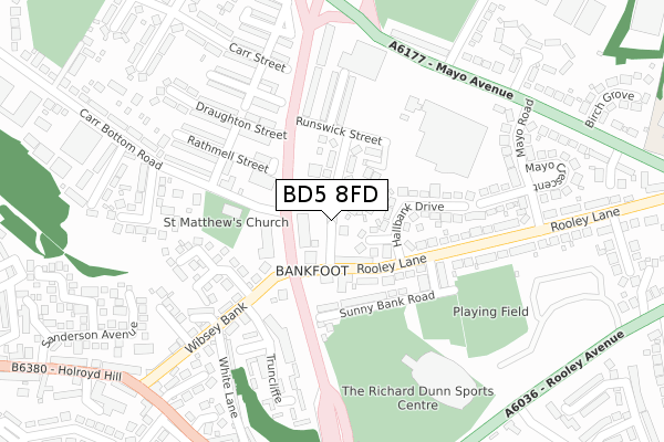
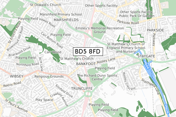
BD5 8FD is located in the Wibsey electoral ward, within the metropolitan district of Bradford and the English Parliamentary constituency of Bradford South. The Sub Integrated Care Board (ICB) Location is NHS West Yorkshire ICB - 36J and the police force is West Yorkshire. This postcode has been in use since July 2018.


GetTheData
Source: OS Open Zoomstack (Ordnance Survey)
Licence: Open Government Licence (requires attribution)
Attribution: Contains OS data © Crown copyright and database right 2024
Source: Open Postcode Geo
Licence: Open Government Licence (requires attribution)
Attribution: Contains OS data © Crown copyright and database right 2024; Contains Royal Mail data © Royal Mail copyright and database right 2024; Source: Office for National Statistics licensed under the Open Government Licence v.3.0
| Easting | 415830 |
| Northing | 430289 |
| Latitude | 53.768723 |
| Longitude | -1.761322 |
GetTheData
Source: Open Postcode Geo
Licence: Open Government Licence
| Country | England |
| Postcode District | BD5 |
| ➜ BD5 open data dashboard ➜ See where BD5 is on a map ➜ Where is Bradford? | |
GetTheData
Source: Land Registry Price Paid Data
Licence: Open Government Licence
| Ward | Wibsey |
| Constituency | Bradford South |
GetTheData
Source: ONS Postcode Database
Licence: Open Government Licence
| January 2024 | Violence and sexual offences | On or near Rathmell Street | 213m |
| January 2024 | Violence and sexual offences | On or near Rathmell Street | 213m |
| January 2024 | Anti-social behaviour | On or near Rathmell Street | 213m |
| ➜ Get more crime data in our Crime section | |||
GetTheData
Source: data.police.uk
Licence: Open Government Licence
| Manchester Rd Carr Bottom Road (Manchester Road) | Bankfoot | 95m |
| Manchester Rd Carr Bottom Road (Manchester Road) | Bankfoot | 99m |
| Manchester Rd Carr Bottom Road (Manchester Road) | Bankfoot | 114m |
| Manchester Rd Rooley Lane (Manchester Road) | Bankfoot | 122m |
| Morrisons Car Park (Morrisons Superstore Car Park (Mayo Avenue)) | Bankfoot | 211m |
| Low Moor Station | 2.2km |
| Bradford Interchange Station | 2.6km |
| Bradford Forster Square Station | 3.2km |
GetTheData
Source: NaPTAN
Licence: Open Government Licence
GetTheData
Source: ONS Postcode Database
Licence: Open Government Licence


➜ Get more ratings from the Food Standards Agency
GetTheData
Source: Food Standards Agency
Licence: FSA terms & conditions
| Last Collection | |||
|---|---|---|---|
| Location | Mon-Fri | Sat | Distance |
| 120 Mayo Avenue | 18:00 | 12:15 | 332m |
| Woodroyd Works | 17:30 | 12:00 | 678m |
| 100 Parkway | 17:30 | 12:00 | 929m |
GetTheData
Source: Dracos
Licence: Creative Commons Attribution-ShareAlike
| Facility | Distance |
|---|---|
| Snap Fitness (Bradford) Manchester Road, Manchester Road, Bradford Health and Fitness Gym | 114m |
| The Hub Gym (Closed) Manchester Road, Bradford Health and Fitness Gym | 145m |
| Muff Field Cricket Club Sunny Bank Road, Bradford Grass Pitches | 223m |
GetTheData
Source: Active Places
Licence: Open Government Licence
| School | Phase of Education | Distance |
|---|---|---|
| Bankfoot Primary School Bolingbroke Street, Bankfoot, Bradford, BD5 9NR | Primary | 460m |
| St Matthew's CofE Primary School and Nursery Ivy House Road, Bradford, BD5 8FG | Primary | 560m |
| Marshfield Primary Thornton Lane, Little Horton, Bradford, BD5 9DS | Primary | 783m |
GetTheData
Source: Edubase
Licence: Open Government Licence
The below table lists the International Territorial Level (ITL) codes (formerly Nomenclature of Territorial Units for Statistics (NUTS) codes) and Local Administrative Units (LAU) codes for BD5 8FD:
| ITL 1 Code | Name |
|---|---|
| TLE | Yorkshire and The Humber |
| ITL 2 Code | Name |
| TLE4 | West Yorkshire |
| ITL 3 Code | Name |
| TLE41 | Bradford |
| LAU 1 Code | Name |
| E08000032 | Bradford |
GetTheData
Source: ONS Postcode Directory
Licence: Open Government Licence
The below table lists the Census Output Area (OA), Lower Layer Super Output Area (LSOA), and Middle Layer Super Output Area (MSOA) for BD5 8FD:
| Code | Name | |
|---|---|---|
| OA | E00054226 | |
| LSOA | E01010747 | Bradford 056B |
| MSOA | E02002238 | Bradford 056 |
GetTheData
Source: ONS Postcode Directory
Licence: Open Government Licence
| BD5 8JQ | Hallbank Close | 35m |
| BD5 8LU | Rooley Lane | 50m |
| BD5 8LT | Manchester Road | 71m |
| BD5 8LS | Runswick Grove | 77m |
| BD5 8LX | Rooley Lane | 85m |
| BD5 8NB | Sunny Bank Road | 107m |
| BD5 8JE | Hallbank Drive | 124m |
| BD5 8LP | Runswick Street | 127m |
| BD5 8NA | Sunny Bank Avenue | 165m |
| BD6 1AN | Wibsey Bank | 208m |
GetTheData
Source: Open Postcode Geo; Land Registry Price Paid Data
Licence: Open Government Licence