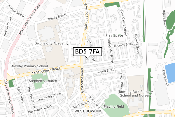
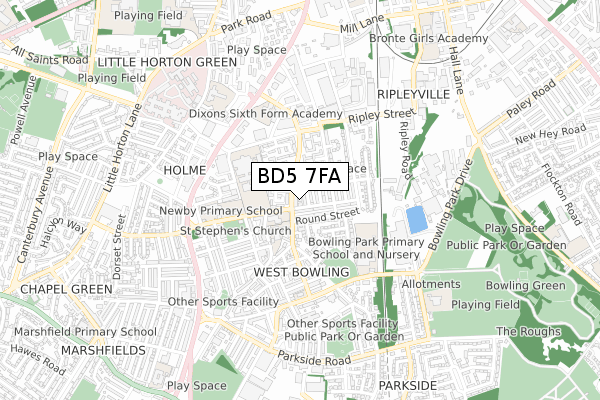
BD5 7FA is located in the Little Horton electoral ward, within the metropolitan district of Bradford and the English Parliamentary constituency of Bradford East. The Sub Integrated Care Board (ICB) Location is NHS West Yorkshire ICB - 36J and the police force is West Yorkshire. This postcode has been in use since February 2018.


GetTheData
Source: OS Open Zoomstack (Ordnance Survey)
Licence: Open Government Licence (requires attribution)
Attribution: Contains OS data © Crown copyright and database right 2024
Source: Open Postcode Geo
Licence: Open Government Licence (requires attribution)
Attribution: Contains OS data © Crown copyright and database right 2024; Contains Royal Mail data © Royal Mail copyright and database right 2024; Source: Office for National Statistics licensed under the Open Government Licence v.3.0
| Easting | 416323 |
| Northing | 431483 |
| Latitude | 53.779440 |
| Longitude | -1.753781 |
GetTheData
Source: Open Postcode Geo
Licence: Open Government Licence
| Country | England |
| Postcode District | BD5 |
| ➜ BD5 open data dashboard ➜ See where BD5 is on a map ➜ Where is Bradford? | |
GetTheData
Source: Land Registry Price Paid Data
Licence: Open Government Licence
| Ward | Little Horton |
| Constituency | Bradford East |
GetTheData
Source: ONS Postcode Database
Licence: Open Government Licence
| June 2022 | Other theft | On or near Bowbridge Road | 40m |
| June 2022 | Public order | On or near Bowbridge Road | 40m |
| June 2022 | Robbery | On or near Bowbridge Road | 40m |
| ➜ Get more crime data in our Crime section | |||
GetTheData
Source: data.police.uk
Licence: Open Government Licence
| Spring Mill St St Stephens Road (Spring Mill Street) | West Bowling | 141m |
| Spring Mill St St Stephens Road (Spring Mill Street) | West Bowling | 149m |
| Spring Mill Street Baird St (Spring Mill Street) | West Bowling | 150m |
| Gaythorne Rd Round Street (Gaythorne Road) | West Bowling | 161m |
| St Stephens Rd Bowling Old Lane (St Stephen's Road) | West Bowling | 163m |
| Bradford Interchange Station | 1.3km |
| Bradford Forster Square Station | 1.9km |
| Low Moor Station | 3.3km |
GetTheData
Source: NaPTAN
Licence: Open Government Licence
GetTheData
Source: ONS Postcode Database
Licence: Open Government Licence


➜ Get more ratings from the Food Standards Agency
GetTheData
Source: Food Standards Agency
Licence: FSA terms & conditions
| Last Collection | |||
|---|---|---|---|
| Location | Mon-Fri | Sat | Distance |
| 9 - 11 Gaythorne Road | 17:30 | 11:45 | 47m |
| West Bowling P.o. Box | 17:15 | 11:45 | 206m |
| Chapel Green | 17:30 | 12:30 | 389m |
GetTheData
Source: Dracos
Licence: Creative Commons Attribution-ShareAlike
| Facility | Distance |
|---|---|
| Dixons City Academy Ripley Street, Bradford Health and Fitness Gym, Sports Hall, Artificial Grass Pitch, Studio | 259m |
| Bowling Old Lane Cricket Club Birch Lane, Bradford Grass Pitches | 294m |
| Dixons Sixth Form Academy Bowling Old Lane, Bowling Old Lane, Bradford Sports Hall | 369m |
GetTheData
Source: Active Places
Licence: Open Government Licence
| School | Phase of Education | Distance |
|---|---|---|
| St Stephen's CofE Primary School Gaythorne Road, West Bowling, Bradford, BD5 7HU | Primary | 162m |
| Dixons City Academy Ripley Street, Bradford, BD5 7RR | Secondary | 259m |
| Bowling Park Primary School New Cross Street, West Bowling, Bradford, BD5 8BT | Primary | 365m |
GetTheData
Source: Edubase
Licence: Open Government Licence
The below table lists the International Territorial Level (ITL) codes (formerly Nomenclature of Territorial Units for Statistics (NUTS) codes) and Local Administrative Units (LAU) codes for BD5 7FA:
| ITL 1 Code | Name |
|---|---|
| TLE | Yorkshire and The Humber |
| ITL 2 Code | Name |
| TLE4 | West Yorkshire |
| ITL 3 Code | Name |
| TLE41 | Bradford |
| LAU 1 Code | Name |
| E08000032 | Bradford |
GetTheData
Source: ONS Postcode Directory
Licence: Open Government Licence
The below table lists the Census Output Area (OA), Lower Layer Super Output Area (LSOA), and Middle Layer Super Output Area (MSOA) for BD5 7FA:
| Code | Name | |
|---|---|---|
| OA | E00054140 | |
| LSOA | E01010736 | Bradford 048D |
| MSOA | E02002230 | Bradford 048 |
GetTheData
Source: ONS Postcode Directory
Licence: Open Government Licence
| BD5 7EZ | Ackworth Street | 21m |
| BD5 7ES | Gaythorne Road | 29m |
| BD5 7EX | St Stephens Road | 46m |
| BD5 7HA | Ackworth Street | 75m |
| BD5 7EP | Baird Street | 88m |
| BD5 7HS | Round Street | 93m |
| BD5 7HD | Pembroke Street | 97m |
| BD5 7EY | St Stephens Road | 105m |
| BD5 7HB | Pembroke Street | 117m |
| BD5 7EU | Gaythorne Road | 125m |
GetTheData
Source: Open Postcode Geo; Land Registry Price Paid Data
Licence: Open Government Licence