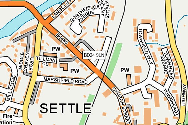
BD24 9LN is located in the Settle & Penyghent electoral ward, within the unitary authority of North Yorkshire and the English Parliamentary constituency of Skipton and Ripon. The Sub Integrated Care Board (ICB) Location is NHS West Yorkshire ICB - 36J and the police force is North Yorkshire. This postcode has been in use since June 2017.


GetTheData
Source: OS OpenMap – Local (Ordnance Survey)
Source: OS VectorMap District (Ordnance Survey)
Licence: Open Government Licence (requires attribution)
| Easting | 381842 |
| Northing | 463930 |
| Latitude | 54.070992 |
| Longitude | -2.278972 |
GetTheData
Source: Open Postcode Geo
Licence: Open Government Licence
| Country | England |
| Postcode District | BD24 |
| ➜ BD24 open data dashboard ➜ See where BD24 is on a map ➜ Where is Settle? | |
GetTheData
Source: Land Registry Price Paid Data
Licence: Open Government Licence
| Ward | Settle & Penyghent |
| Constituency | Skipton And Ripon |
GetTheData
Source: ONS Postcode Database
Licence: Open Government Licence
| January 2024 | Violence and sexual offences | On or near Parking Area | 461m |
| January 2024 | Violence and sexual offences | On or near Parking Area | 461m |
| November 2023 | Criminal damage and arson | On or near Kings Mill Lane | 410m |
| ➜ Get more crime data in our Crime section | |||
GetTheData
Source: data.police.uk
Licence: Open Government Licence
| Bridge End (Church Street) | Settle | 115m |
| Penyghent View (B6480) | Settle | 120m |
| Market Place (Kirkgate) | Settle | 274m |
| Market Place (Church Street) | Settle | 281m |
| Watershed Mill (Langcliffe Road) | Settle | 390m |
| Settle Station | 0.5km |
| Giggleswick Station | 1.9km |
GetTheData
Source: NaPTAN
Licence: Open Government Licence
| Percentage of properties with Next Generation Access | 100.0% |
| Percentage of properties with Superfast Broadband | 100.0% |
| Percentage of properties with Ultrafast Broadband | 0.0% |
| Percentage of properties with Full Fibre Broadband | 0.0% |
Superfast Broadband is between 30Mbps and 300Mbps
Ultrafast Broadband is > 300Mbps
| Percentage of properties unable to receive 2Mbps | 0.0% |
| Percentage of properties unable to receive 5Mbps | 0.0% |
| Percentage of properties unable to receive 10Mbps | 0.0% |
| Percentage of properties unable to receive 30Mbps | 0.0% |
GetTheData
Source: Ofcom
Licence: Ofcom Terms of Use (requires attribution)
GetTheData
Source: ONS Postcode Database
Licence: Open Government Licence


➜ Get more ratings from the Food Standards Agency
GetTheData
Source: Food Standards Agency
Licence: FSA terms & conditions
| Last Collection | |||
|---|---|---|---|
| Location | Mon-Fri | Sat | Distance |
| Bridge End | 17:30 | 11:45 | 155m |
| Townhead Court | 17:30 | 11:45 | 248m |
| Market Place | 17:30 | 12:00 | 281m |
GetTheData
Source: Dracos
Licence: Creative Commons Attribution-ShareAlike
| Facility | Distance |
|---|---|
| Settle Cricket Club (Marshfield Ground) Marshfield Road, Settle Grass Pitches | 150m |
| Bridge End Ground Staircase Cave To Settle Bridge, Giggleswick, Settle Grass Pitches | 335m |
| Settle College Playing Fields Staircase Cave To Settle Bridge, Staircase Cave To Settle Bridge, Giggleswick, Settle Grass Pitches | 385m |
GetTheData
Source: Active Places
Licence: Open Government Licence
| School | Phase of Education | Distance |
|---|---|---|
| Settle Church of England Voluntary Controlled Primary School Bond Lane, Settle, BD24 9BW | Primary | 410m |
| Settle College Giggleswick, Settle, BD24 0AU | Secondary | 428m |
| Giggleswick School Giggleswick, Settle, BD24 0DE | Not applicable | 800m |
GetTheData
Source: Edubase
Licence: Open Government Licence
The below table lists the International Territorial Level (ITL) codes (formerly Nomenclature of Territorial Units for Statistics (NUTS) codes) and Local Administrative Units (LAU) codes for BD24 9LN:
| ITL 1 Code | Name |
|---|---|
| TLE | Yorkshire and The Humber |
| ITL 2 Code | Name |
| TLE2 | North Yorkshire |
| ITL 3 Code | Name |
| TLE22 | North Yorkshire CC |
| LAU 1 Code | Name |
| E07000163 | Craven |
GetTheData
Source: ONS Postcode Directory
Licence: Open Government Licence
The below table lists the Census Output Area (OA), Lower Layer Super Output Area (LSOA), and Middle Layer Super Output Area (MSOA) for BD24 9LN:
| Code | Name | |
|---|---|---|
| OA | E00140361 | |
| LSOA | E01027572 | Craven 003C |
| MSOA | E02005744 | Craven 003 |
GetTheData
Source: ONS Postcode Directory
Licence: Open Government Licence
| BD24 9JG | Church Street | 19m |
| BD24 9JQ | Mayville Terrace | 50m |
| BD24 9JF | Mains View | 53m |
| BD24 9JH | Church Street | 55m |
| BD24 9DA | Marshfield Road | 129m |
| BD24 9JR | Northfields Avenue | 135m |
| BD24 9JJ | Penyghent View | 137m |
| BD24 9JP | Northfields Crescent | 141m |
| BD24 9RL | Tillman Terrace | 167m |
| BD24 9DD | Kirkgate | 179m |
GetTheData
Source: Open Postcode Geo; Land Registry Price Paid Data
Licence: Open Government Licence